
History of Cleburne County Arkansas
Cleburne County was created in 1883 from White, Van Buren & Independence
Counties. It is nestled in the foothills of the Ozarks where the meandering Little
Red River becomes a beautiful lake. 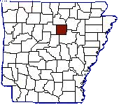
Cleburne is Arkansas' youngest county. It was created by act of the General Assembly as the state's 75th county, and the act was signed into law on February 20, 1883. The new county was formed from the eastern part of Van Buren County and smaller portions of land taken from the western edge of Whit County and the southwest corner of Independence County. Most of what is now Cleburne County was in Pulaski County from 1819 until the formation of the counties of Independence (1820), Van Buren (1833), and White (1835).
The bill not only created the county and defined its boundaries, but also provided for orderly transfer of the business of the county from its surrounding parent counties. The act designated the town of Sugar Loaf (to become Heber Springs) as the temporary county and directed the Van Buren County sheriff to conduct an election to select the permanent county seat and elect officers for the new county.
The first county officials were William George Ward of Quitman, county judge; Thomas Jefferson Andrews, Heber, circuit clerk; Stephen Julon Morton, Heber, sheriff; Thomas Jefferson Majors, Shiloh, county treasurer; Calvin Sales, Waco, surveyor; James Arnettt, coroner; and Jesse W. Witt, Quitman, assessor. Witt died in September of that year and James Calvin Barnes was appointed assessor.
The post office at Heber had been established in 1882, and the town of Sugar Loaf was incorporated later the same year. It was not until 1910 that Heber Post Office was changed to Heber Springs Post Office and the town of Sugar Loaf was officially changed to Heber Springs.
[Excerpts from Time and the River, by Evelena Berry, Rose Publishing Co, Little Rock AR 1983]
Cleburne County is an interior county with a generally rugged terrain. Elevations range from 270 feet above sea level in the river bottom land of the southeast part of the county to 1400 feet in the northwest section. In the valleys are some alluvial lands of good fertility. In the mountains are traces of lead, coal, and possibly other minerals. Little Red River, Greer's Ferry Lake and countless smaller streams and springs furnish an abundant water supply. The land area is 595 square miles, which makes it among the smallest counties in the state.
In addition to farming, during the early 1900's timber cutting and logging was the main industry. Cotton was the money crop in the south half of the county and subsistence farming was practiced throughout. Construction of the Greer's Ferry Dam on Little Red River near Tumbling Shoals beginning in 1959 caused expansion in business as well as in population. Land developers opened up the area to new home owners and vacationers. Population grew from 2,265 in 1960 to 5,000 in 1980. Tourism and the recreation industry thrived in the hospitable climate, and the Greer's Ferry Lake area in Cleburne County has become one of the three most popular areas in Arkansas for visitors.
Townships
In the 1900 census Cleburne County Arkansas was divided into the following
districts:
District 10 Big Creek township, and Grassy township.
District 11 Cadron township, incl. Quitman town.
District 12 Center Post township, and Morgan township, and Saline township.
District 13 California township, and Poff township.
District 14 Clayton township, and Valley township.
District 15 Francis township, and Giles township, incl. Shiloh town.
District 16 Healing Springs township, and Peters Creek township.
District 17 Mountain township, and Piney township.
District 18 Sugarloaf township, and Pine township.
District 19 South Sugarloaf township, incl. Sugarloaf town.
County Seat is Heber Springs.
Submitted by former County Coordinator Tom Martin
With thanks to our previous County Coordinators: Tom Martin and Brian Massey.