LOUISIANA PURCHASE
HISTORIC STATE PARK

African American
Biographies
Cemeteries
Census Records
Civil
War Links
Guest Book
History
History USGenWeb
Land
Records
Lookup
Volunteers
Maps
Marriages
Newspapers
Obituaries
Pictures
Populated
Places
Post a Query
View Your Post
Queries
Researchers A-L
Researchers M-Z
Surnames A-K
Surnames
L-Z
Picture taken by John Ward - April 17, 2002 |
||||
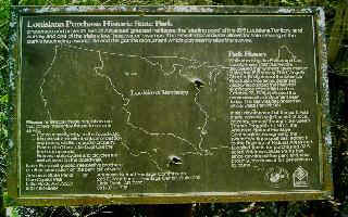
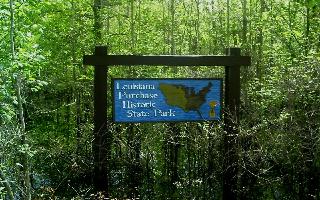
Louisiana Purchase Historic State Park |
||||
The historic point from which all of the Louisiana Purchase was surveyed is on the eastern boundary of Monroe County and is one of the many National Register Properties in Monroe county. A large granite monument marks the original site where the initial survey of lands began in 1815. The park consists of 37.5 acres within a tract of headwater swamp that represents a fast disappearing ecological setting in eastern Arkansas. A 950-ft boardwalk provides access to the monument in the swamp's interior which marks the Survey's initial point. |
||||
|
The county has rich farm lands, an abundance of hardwood timber and is a haven for
sportsmen. The county embraces a part of the
White River National Wildlife Refuge. White
River catfish is a much sought-after delicacy. Monroe County, which has retained the
resources that first attracted the pioneers, is rich with history and abounding in
southern hospitality. |
||||
(Contributed by Jo Claire English)
|