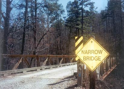
Driving around Montgomery County, Arkansas
you will notice many
barns and
a few wells and low water bridges.
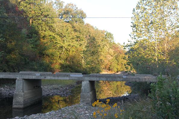
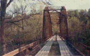
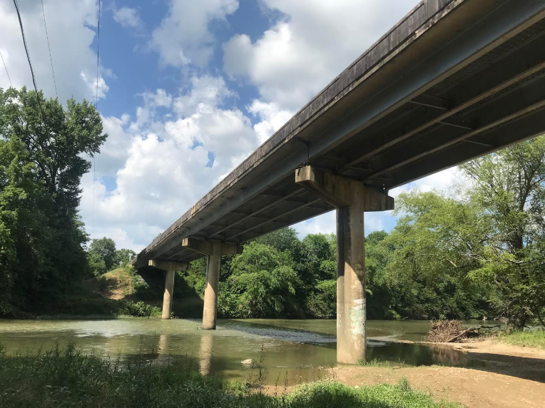
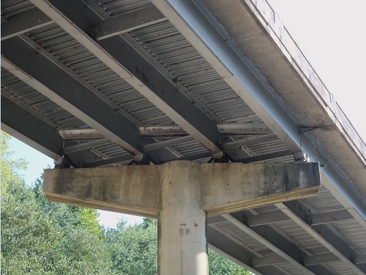
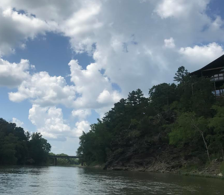
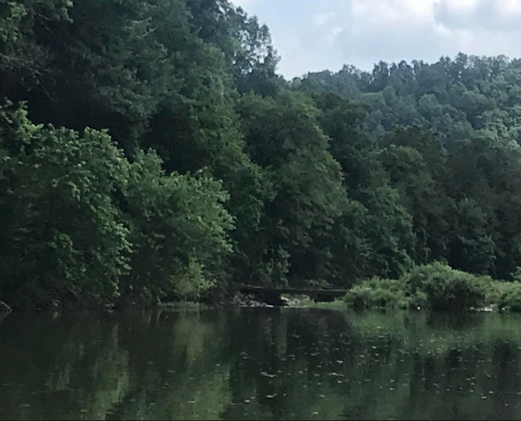
This is a solid old bridge at Big Brushy Recreational area just
off Hwy 270. This ONF gravel road, across the bridge is a short cut to Oden,
six miles, avoiding Blowout
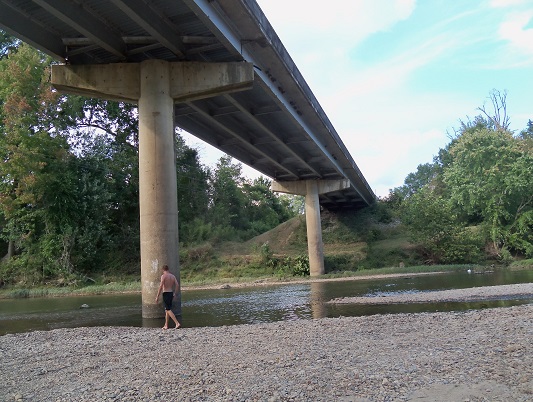
Mountain. Take the first left crossing the ford below then across the next bridge (3rd
photo). A bike route for the family. Very little traffic.
photos
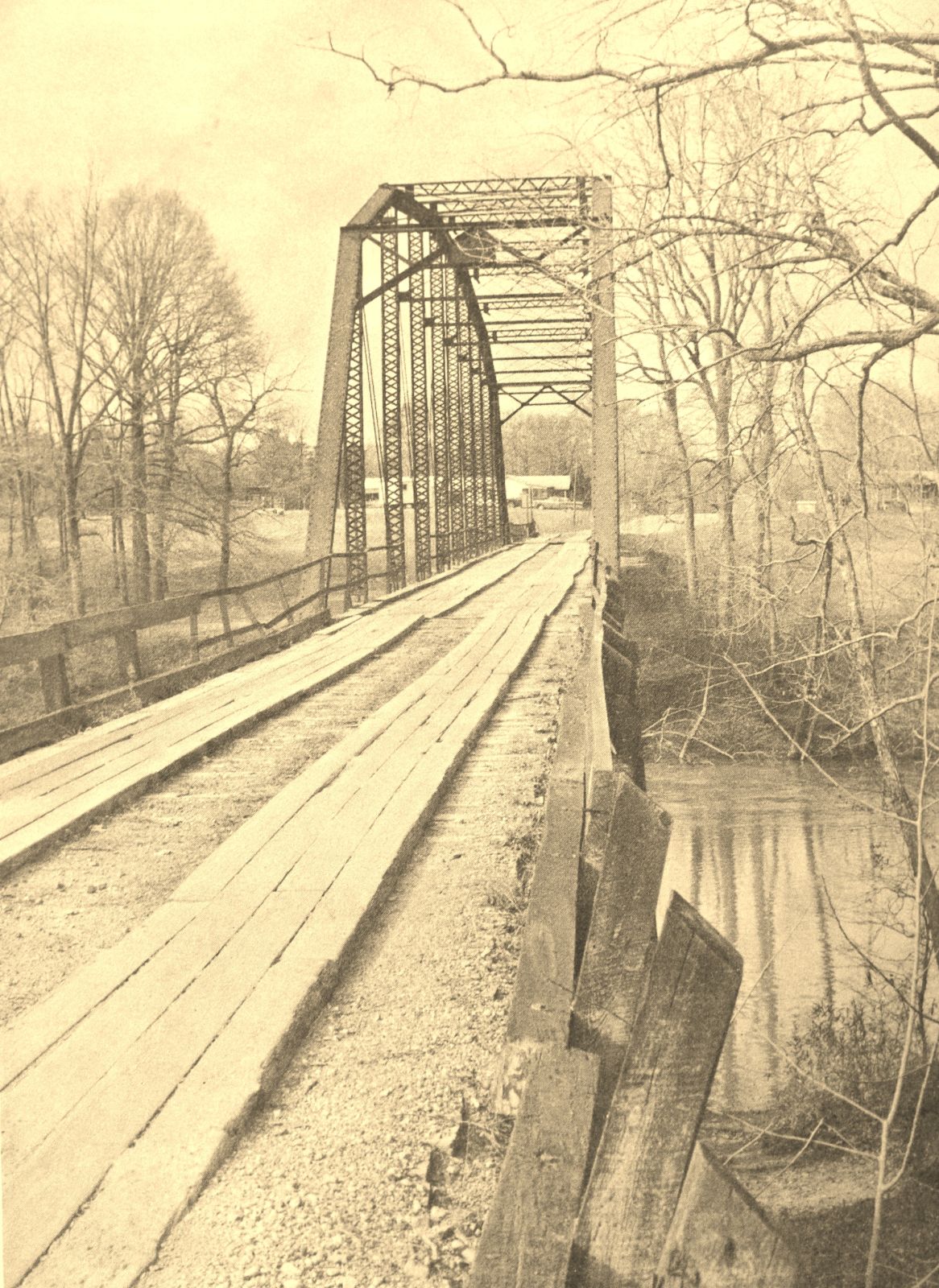
BRUSHY CREEK BRIDGE Commerce Business Daily Issue
No. PSA-1849 20 May 1997
U.S.D.A., Forest Service, Procurement Office, P. O. Box 1270, Hot Springs, AR
71902 ZIP CODE: 71902 BRUSHY CREEK BRIDGE: Replace treated timber deck and curbs
on Brushy Creek Bridge at mile post 0.3, Old Six Road No.6, Ouachita National
Forest, Oden Ranger District, Montgomery County, Arkansas. Work includes removal
and disposal of the existing 115.5 foot long and 13.2 foot wide, creosote
treated, wooden deck and timber curbs and replacement with a new nail laminated
treated wooden deck and treated timber curbing. Contract time for completion is
25 calendar days after receipt of Notice to Proceed. Estimated price range is
$25,000 to $35,000
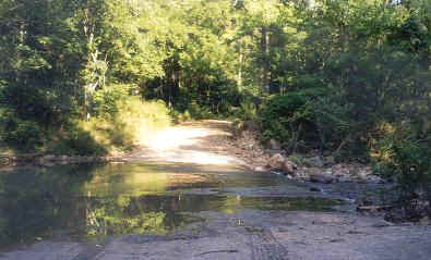
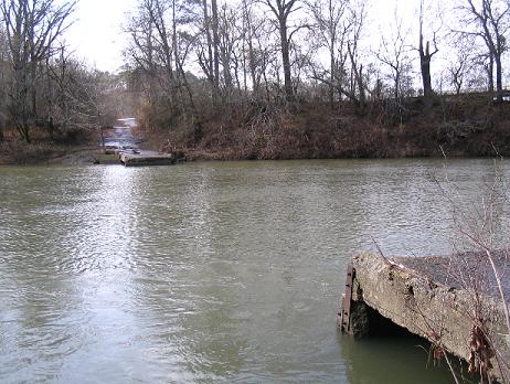
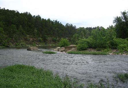
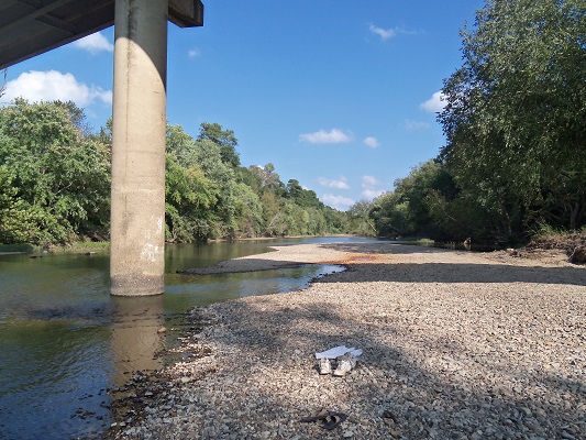
Big Brushy Creek and the ford. The gravel
road leads back, across the creek, to the Brushy Church and on to Oden and forward to
Big
Brushy Recreational Area. August 1998. The creek is canoe able after four
inches rain. A great trip, two miles whitewater, class 2, put in at the ford
(above) and take out at the bridge (below). The creek drops fifty feet
over two miles.
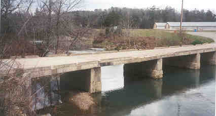
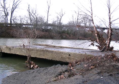
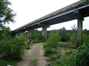
Brushy Bridge with chicken houses in the background.
There use to be an old wooden bridge here. Photo January 2001 after the ice
storm.
Swinging bridges were scattered throughout
the county. There is still one at
Caddo Gap as you cross the
Caddo River River on to
the
Manferd Rd, look north. It is a bit run down. There was another at
Norman, the South Fork in Mt. Ida, across the Ouachita River near Pine Ridge
and across Kate's Creek. Once there was a swing bridge across Brushy Creek.
Clara Goss said this was the only way for some to get to their little one
room schoolhouse and missing a day of school was just not tolerated in her
family.
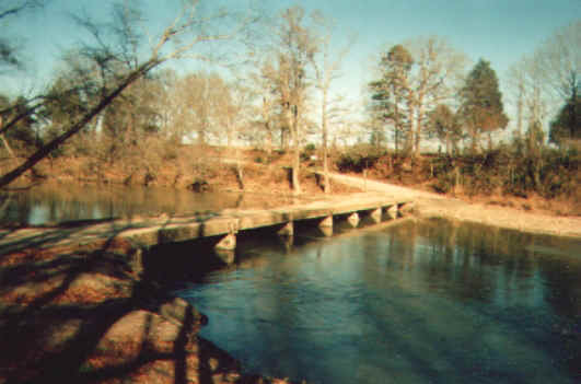
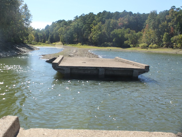
Photo courtesy of Doug Anderson of the old Sims low water
bridge crossing the Ouachita taken not long before it was removed. The
picture was taken in the early 1990s. There was a WPA bridge across Fiddler's Creek.
What is left of the old Sims low water bridge, Dec. 2007.
The new Sims Bridge in the background.

The new Sims bridge across the Ouachita River taken from the old low water
bridge with a river birch in the foreground. Dec. 2007.
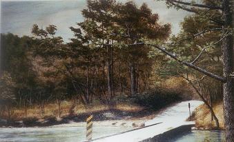
This painting, by Sam Walters, is hanging in the hallway at the courthouse in
Mt. Ida. Sam Waters was a local artist who lived on Hwy 298 east of Story. Mr.
Walters worked at the Story Post Office. There are painting by Sam of this
bridge at different seasons and from the opposite angle. He also did one of a
boy at the old bridge at Sims with a cane pole. Sam also did a painting of the
Buck Knob tower.
Centennial History of Arkansas
By
Dallas Tabor Herndon pg29
The Ouachita (sometimes written Washita) River rises in the northwestern part of
Polk County. It flows eastwardly, by a sinuous course, to the central part of
Garland County, where it turns toward the southeast. Near Malvern it is
deflected to the southwest and continues in that direction to a point on the
line between Hot Spring and Clark counties about six or seven miles north of
Arkadelphia. From that point it follows a southeasterly course until it enters
Louisiana as the boundary line between Ashley and Union counties. The Ouachita's
largest tributary from the west is the Little Missouri River, which rises near
the line between Polk and Montgomery counties. Its general course is eastwardly,
uniting with the Ouachita at the southeast corner of Clark County.
Pine Ridge
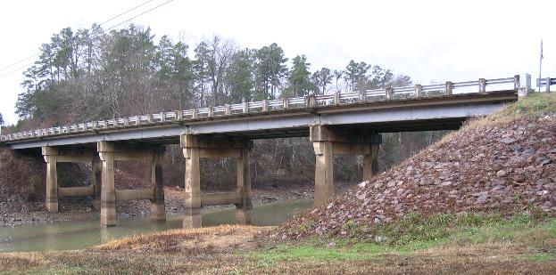
The Ouachita. The old bridge just down stream of the new bridge
at Pine Ridge, below.
May 2005. The bridge across the Ouachita just east of Pine Ridge towards Little
Hope Church. This is the third bridge at this site. The concrete remains of the
lo water bridge are still visible, see above photo. A canoe access site for the
Ouachita River. It took us two hours 15 minutes in May to canoe down to Shirley
Creek Recreational area, a distance of four miles. Water level was a bit low,
dragging on some shoals.
Oden Bridge

A car with "For Hire" on the windscreen was taken across the
Ouachita river, Oden, about 1915 by the ferry, hand pulled by two men.
Oden Bridge, dismantled in 1977 was a Parker through
truss design. B/w photo looking from the south side towards Oden.
Known as the Hog Jaw Bridge. Calvin Lawrence's house on the left. The house on
the right was Luther ____, a custodian at Oden schools.
The old rickety one lane bridge at Oden
crossing the Ouachita no longer exists. Dismantled in 1977. Such bridges come functionally obsolete
because they are not wide or tall enough, they tend to be sturdy because most were
"overbuilt" to handle heavier loads than they would ever hold. Riveted
steel trusses used to be common. They were the No. 1 choice from about 1920 to
WWII and
where found everywhere, they stopped building them and they started being replaced with a
concrete bridge that often block river views. The runners going length
wise helped preserve the life of the bridge and made the ride across
smoother and take a heavier load.
Oden Bridge 3rd July 2020.
Oct. 2014 photo. This is a canoe takeout or put in. Barn swallows nests attached
to the underside of the bridge.

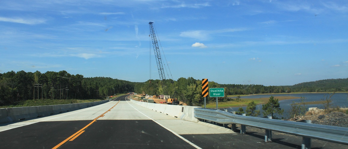
The bridge on Hwy 27 at Washita. Photo taken Dec. 2007 looking south west. In
May 2015 on going
construction -building a new bridge. Bridge removed Oct. 2015. Photo of new
bridge just opened below looking north.
The old Hwy270 bridge at Tompkins Bed. Oct. 2015.

The Mt. Ida bridge over the South Fork River near True Value, Hwy 270, Oct.
2015, river birch trees changing colour.
Hwy 27
Montgomery County
ARGenWeb Project
OUACHITA RIVER FLOAT CAMPS
The Arkansas Democrat Gazette 29 June 2006
With a succession of float camps strung along its course, the upper Ouachita is
a float fisher's dream. From Shirley Creek Float Camp to River Bluff Float Camp,
the camps are spaced in 7- to 10-mile intervals, perfect for a day's fishing.
Formerly operated by the National Forest Service, the camps now are maintained
by the Montgomery County Parks Department and never have looked better. The
grounds are much cleaner than they used to be and are well-maintained.
Despite the county's best efforts, people still leave liquor bottles, beer cans
and soiled diapers around the camps. In the past, such messes accumulated. Now
the county minimizes the damage. Basically, the camps are just open spots on
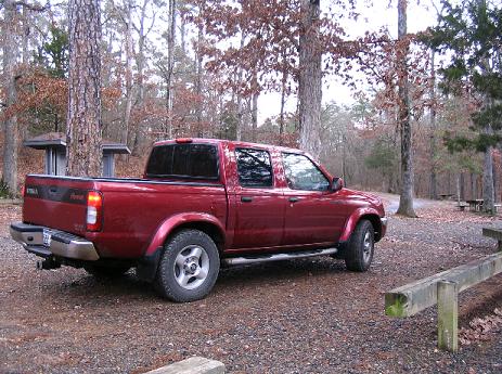
high banks overlooking the river. Each site contains a tent pad, fire
ring/grill, lantern post and table. Shirley Creek Float Camp, near Oden, is the
first in the series. About 10 miles downstream is Rocky Shoals. It is adjacent
to U.S. 270. It's also the most popular launch site for the river's canoe
outfitters. It is noisy, and since it is on a hillside level spots are scarce.
About 7 miles downstream is Fulton Branch Float Camp. From there, it's about 4
miles to Dragover Float Camp and then 2 miles to River Bluff Float Camp. All are
accessible by road.
Dragover Float Camp near Sims- access to the Ouachita River.
A nice clean isolated campground with tent sites and toilets.
Boys Camp Bridge on HWY 270 with the Ouachita River flowing 3 feet high on 3rd
July 2020,
discharge 350cubic feet per second, perect. Put in at Oden and canoed to
Rocky Shoals in 3 hours, 10 miles, passing 21 canoe and kayaks, 75% kayaks and
one paddle board and saw at least five different family and kids on shingle
beaches enjoying an afternoon at the river. Saw two fisherman in a Old Town
canoe with seats with a back rest, fishing, looked comfortable. Saw one fly
fisherman. One red Discovery canoe, from Riverview Cabins, just after the
second long pool from the Oden bridge and before the dairy farm on the right was
wrapped around a rock and a rescue canoe had just arrived to rescue the couple
to take them downstream to the take out at Pencil Bluff.
Low water bridge above the Boys Camp -Ouachita River.
Old bridge plans
Hwy 27 (broken
link)
Swing Bridge
Caddo Gap
wayback
Low water Bridge Caddo Gap
Bridgehunter Montgomery Co.
AR.
Ouachita River
Crossings
Hopping
down the Ouachita - fishing from a canoe.
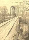
Old RR bridge
over Collier Creek
Without maintenance an end to life
is certain and the bridge is going to be in the drain.
Iron reverts back to oxide - corrosion. Corrosive connection points freeze
up and cannot absorb stress.
Waikato Times,
22 May 1886, Page 1
THE OLD CANOE.
Where rocks are gray and the shore is steep,
And the waters below look dark and deep,
Where the rugged pine, in its lonely pride,
Leans gloomily over the murky tide.
Where the reeds and rushes are long and rank,
And the weeds grow thick on the winding bank;
Where the shadow is heavy the whole day through,
Lies at its mooring the old canoe.
The useless paddles are idly dropped
Like a sea-bird's wings that the storm has lopped.
And crossed on the railing one o'er one,
Like the folded hands when the work is done;
While busily back and forth between
The spider weaves his silvery screen ;
And the solemn owl, with his dull "too-hoo,"
Settles down on the side of the old canoe.
The stern half sunk in the slimy wave
Rots slow away in its living grave,
And the green moss creeps o'er its dull decay,
Hiding the mouldering dust away,
Like the hand that plants o'er the tomb a flower,
Or the ivy that mantles the falling tower,
While many a blossom of liveliest hue,
Springs up o'er the stern of the old canoe.
The currentless waters are dead and still,
But the light winds play with the boat at will,
And lazily in and out again
It floats the length of it's rusty chain,
Like the weary march of the hands of time,
That meet and part in the noontide chime ;
And the shore is kissed at each turn anew
By the dripping bow of the old canoe.
General Albert Pike.
[other versions on the www
slightly differ and have two more verses]
While the authorship of this beautiful poem has been
credited to Gen. Pike, it has also been denied that he wrote it, and he himself
is said to have stated that the honor did not belong to him but to a young lady,
whose name has never been mentioned, to the knowledge of the editor of this
volume. The verses were republished in the Gazette a few years ago with
this reference: "We do not know from what paper or magazine they were taken, but
the editor of one, while crediting Gen. Pike with its authorship, makes this
note: 'Long before the war the appended simple but charming verses appeared,
without signature or address, in a short lived paper at Little Rock, but it was
generally understood that the author was Gen. Albert Pike."
Harper's cyclopedia of British and American poetry By Epes
Sargent 1881
Miss Emily R. Page (1838 -1860) was a native of Bradford, Vt. She was a
toll-gather's daughter, and her poem of "The Old Canoe," written when she was
eighteen years of age, is a pen-picture of an actual scene near the old bridge
just back of her home.
Albert Pike was born in Boston on December 29, 1809, but his boyhood was passed
at Newburyport. He entered Harvard College, but left before graduating. After
teaching school for awhile, he went South, and settled in Little Rock, Arkansas,
where he practised law and published a newspaper. He fought in the Mexican War
against the Mexicans, and in the Civil War on the side of the Confederates as a
Brigadier-General. He published in 1834 "Prose Sketches and Poems;" and in 1854,
"Nngse, a Collection of Poems." His "Hymns to the Gods," in the style of Keats,
show a kindred poetical gift.
Mountain Legend of Albert Pike's Two Years in the Ouachitas
I knew by the smoke
That so gracefully curled
Above the green elms
That a cottage was near
And I said "If there's peace
To be found in the world
A heart that was humble
Might hope for it here"
It is a well known fact that Albert Pike, the great Mason, spent thirty three
years of his life in Arkansas, but the fact that is not so well known is that he
spent two years of that time in the Ouachita Mountains in Montgomery County of
Southwestern Arkansas. The Albert Pike home was on the Little Missouri River.
Over several miles of a little used four wheeler trail that once was the main
thoroughfare between Dallas and Hot Springs, Arkansas. This old trail is the
route used by the James Gang to escape from a posse after the second Malvern to
Hot Springs stage robbery in 1874. A rough trail provides access to some KGC
(Knights of the Golden Circle) carved symbols.
Historic Bridges in Arkansas
facebook
Dirt Roads in AR FB
Bridges
-survey
