CCC site - Crystal Recreational Area,
Montgomery County, Arkansas
Demolished by falling tree, 2016.
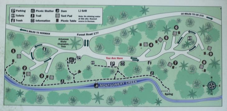
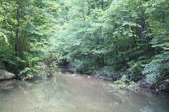
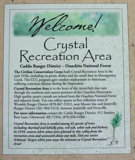
Crystal Recreational Area, one mile north of Norman and three miles east along the gravel road 177, a small Ouachita National Forest Recreational area created by the CCC in 1939 by damming Montgomery Creek and building a solid picnic pavilion. There are 42 species of trees including the shortleaf and loblolly pine, red oak, white oak and hickory. Eastern white pines were planted in this valley from the recreation area and westward one mile. There is a new outhouse there.
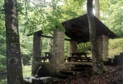
The log and fieldstone picnic shelter at Crystal.
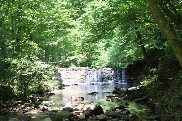
The dam.
Above the dam
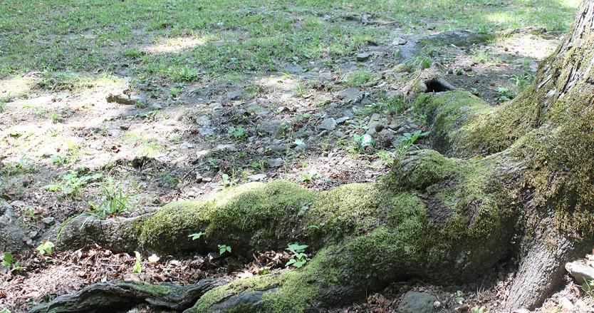
Just a root from an old tree.
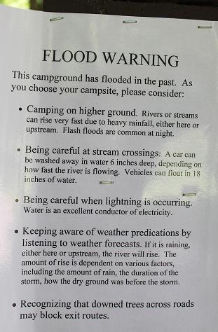
Looks like a new sign in 2010. Probably posted after the
the devastating flood on June 11th 2009 at Albert Pike Campground, a
ONF campground with 20 deaths. No one local.
28th Dec. 2021. Drove from Norman to Logan Gap Rd, and came out just behind the
airport on 270. There were four families camping at Crystal Springs, well
socially distanced. A beautiful spot. Passed two pickup trucks and two cars on
the road. The water was crystal clear. We continued further west and stopped at
Collier Springs Shelter. Looking up I saw it was built by the CCC 307. The water
flowing as fast as ever, even though we have had a very dry summer, and now
leaking and overflowing down the steps. Tthat was not happening in 2010.
 \
\
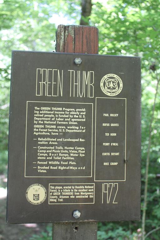
Green thumb trail workers 1972: Paul Hulsey, Rufus Graves, Ted Horn, Perry
O'Neal, Curtis Bryant, Rhee Crump. There are is a ½
mile
trail starting at the at the campground created by the Green Thumb workers.
There was also one near Oden, named Buck Nob and one across the road near Big Brushy Recreational Area. A CCC worker who had worked at Buck Nob said there I first worked at a sawmill stacking lumber, than I was transferred to work at the top of a tower at a Ranger station. My duty was to keep in touch with other tower people in checking on fires and if we located a fire we were to notify the camp that was close by. Passes were issued on Saturday afternoon. Not everyone got passes so many had to stay in camp in case of fire. If we did not get a pass this week-end then it is possible you might get one the next weekend if everything worked out OK. Photo No. 371347, Sam Horne in the fire dispatch office, Ouachita National Forest, August 1938.
The CCC program gave employment to Americans in economic distress during the depression. it was a federal works program and the enrollees, many young men, built numerous recreational areas, replanted forest, fought fires and made roads. Projects included:
Collier Springs Shelter, ca. 1939, on Forest Service Rd 177, NE of Norman
Crystal Springs Camp Shelter, ca. 1939, Forest Service Rd 177, E. of Hwy. 27.
Crystal Springs Dam, ca. 1939, near Norman
Charlton Bathhouse, ca. 1938, near Alf, way between Mt Ida and Hot Springs
Charlton Spillway/Dam, ca. 1938, half way between Mt Ida and Hot Springs.
Norman Square
Shady Lake Recreation Area, located on a scenic 25-acre lake formed by a Civilian Conservation Corps dam constructed in the 1930s.
At Shady Lake consider hiking to the the Tall Peak Trail which accesses the Tall Peak Fire Tower, built by the Civilian Conservation Corps in the 1930s. On a small lake created by a dam and at least three spring fed creeks, this place was created by the CCC during the depression. Today it is a ACE site.
Womble District Administrative Site House No. 1, ca. 1940, just east of Mount Ida. N. of Hwy. 270 e. of Mt. Ida c. 1940 frame structure.
From Hwy 270 E take Logan Gap Rd (just west of the Mt Ida Airport) south, turn right on to Forest Road 177 along Twin Creek and follow the signs. At the intersection of 177 and 2237 take the windy and hilly 177 Forest Rd one mile. The roads are gravel and best traveled when dry. In the late 1930s the CCC built a picnic pavilion that enclosed the spring. There is an outhouse across the road and up a shade steep slope. Just upstream there is a tiny waterfall. Collier Creek starts three miles upstream on Bear Mt., [1660'], and drops 300' before reaching Collier Spring is at 1,300 feet. The creek continues to drop another 500' before it flows under Hwy 8 and into the Caddo River, about a mile north of Caddo Gap.
Collier Springs Shelter.
Water still gushes here. In 1940 it was gushing at a rate of 3,000 gallons per hour.