In search of Crooked Creek Falls lead us to the Little Missouri Falls Recreational Area, a picnic area in the Ouachita National Forest, in southern, Montgomery County, Arkansas on the Little Missouri River. The Little Missouri River flows 29 miles from Big Fork to Lake Greeson. Designated as a National Wild and Scenic River. Best way to get to the falls is from Norman, Arkansas, through Black Springs, AR and on Highway 8 West. Be prepared for a three mile drive on a rough gravel road, a slow drive, on FR# 43, watch for stop sign, Crooked Creek Rd.
The Crooked Creek Road follows Wehunt Creek and where it crosses under the road at 3.3 miles is Crooked Creek Falls on your left. Crooked Creek Falls, N34 25.620, W93 53.135, Caddo Gap, AR 71935. There is no signage, just watch for the large culvert and a dark rock formation at creek level, it is easy to miss. If you miss it look for it on the way back. Park on the side of the road. Make sure you take a map or mark it on a phone before you loose cell phone signal.
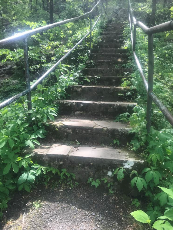
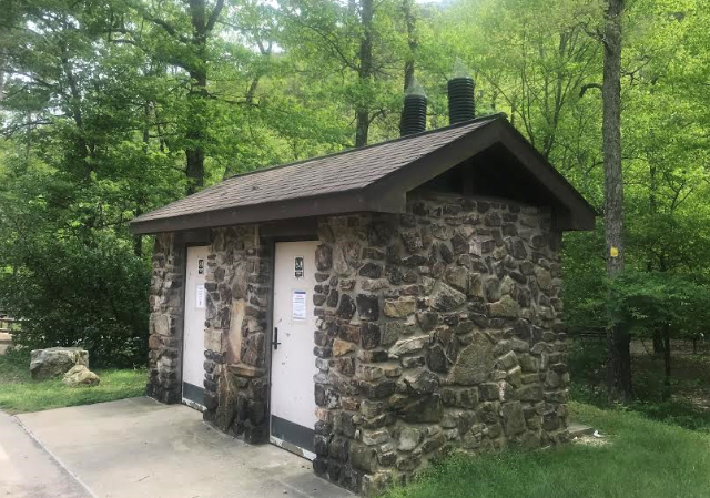
To get to Little Missouri Falls from here, continue another 1.4 miles and turn right onto FSR#25, then turn left after 0.7 miles at the signage. The Little Missouri Falls picnic area has a toilet block, vault toilets, and six picnic tablets with BBQ grills and a trail to the falls across a good bridge across the Little Missouri River. A few were swimming in the river in 29 April 2020, even though the area was closed, and it was a Wednesday and everyone was socially isolating. The water was clear and cool. It is an easy walk to the Little Missouri Falls overlook but a fall risk for the elderly as there are steps. Early in the spring the water level is higher.
Looks like a survey tree in the back, I will have a look at the sign next time.
These toilets were locked in April 2020 as the recreational area was closed.
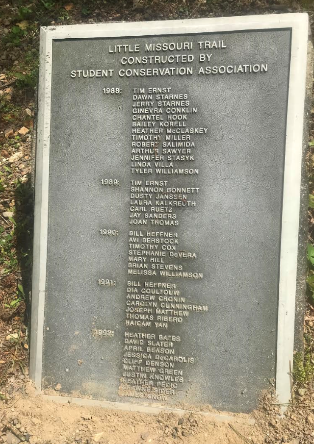
The Little Missouri Trail is a 6.3 mile walking trail between the falls and the Albert Pike Recreational Area, day use only, in the Caney Creek Wilderness Area. The trail marking is white rectangles. Remember the ERL trail and the Little Missouri Trail starts at the overflow parking area not the trail to the falls.
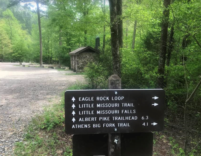
Here is a trailhead to the Eagle Rock Loop (ERL) trail a 26.8 miles, 2 to 3 day backpack hike, a combination of three trails with five trail heads. This trail was developed along a 100 year old postal route and old wagon roads in partnership with the Forest Service, the Student Conservation Association, Bayou Chapter of the Ozark Society and the Little Missouri Council. Check the weather and water level of the Little Missouri as there is numerous river crossings. Water gauge height 1st May 2020 4ft.
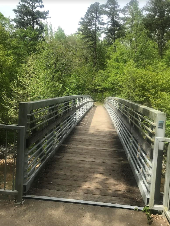
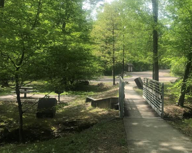
The 2nd bridge crosses the Little Missouri River.
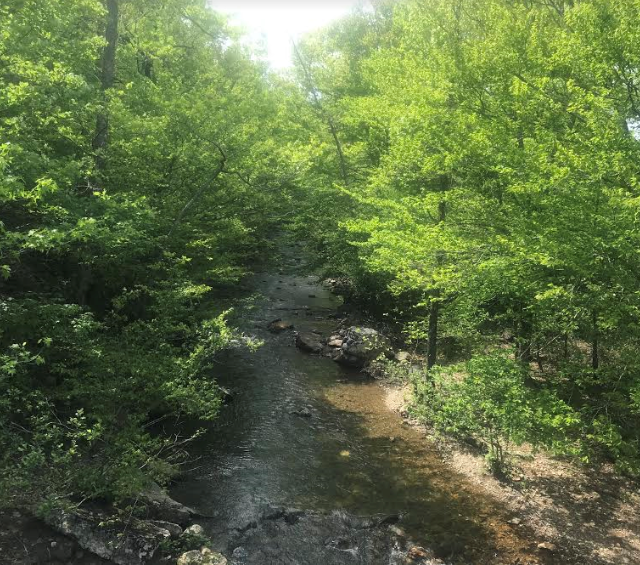
Little Missouri River.
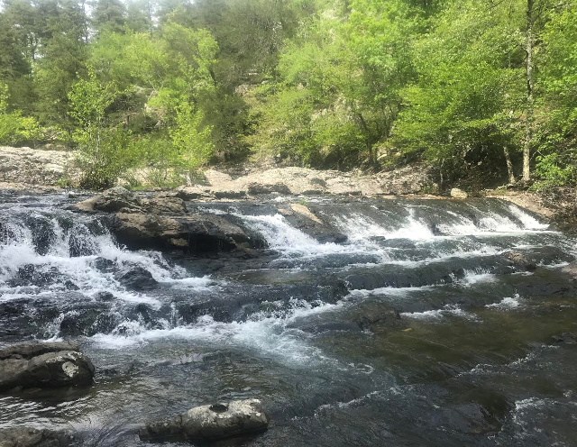
Little Missouri Falls.
Did you know?
Information from sign in recreational area. A place with a past. At Little Missouri Falls archeologists discovered a 7000 year old campsite of prehistoric hunter- gathers. The artifacts left behind reveal that the group stayed only a short time, long enough to roast game animals and gather and process novaculite. This stone resource, important for the production of tools and weapons, can only be seen at the surface only in the south Ouachita Mountains. With the use of hammers, novaculite was pried from formations. Evidence of this activity can be seen on boulders or outcrops in this area. The campsite found at Little Missouri Falls is from the Archaic era. People from this era depended on forest animals and aquatic species such as fish, nuts and acorns and seeds, fruit and roots. They lived in communities with a permanent base camp surrounded by temporary sites for seasonal activities such as foraging, quarrying and wood harvesting. Artifacts from this group would include distinct style of dart points, pebbles for fishnet weights, woven bags containing acorns, bones of owls, and manufactured clothing from deer skins. Archeologist estimate the approximate age of spear points by shape and design. The larger novaculite spear points were attached to a short handled spear before the time of the bow and arrow. People in the river valleys along the Caddo and Ouachita find spare points frequently today, some are lucky enough to have bucket full of these spear points and arrow heads.
Wildflowers
Information from sign in recreational area. Wildflowers fill the landscape spring through fall. Photograph them but don't pick and watch out for poison ivy. Fishing and hunting within the national forest is regulated by state law. Know the regulations and when deer and turkey season it. Wear orange vests during the fall hunting season, helps prevent accidents. There is now a trend to ride UTVs , side by side four wheelers instead of ATVs, especially for the aging with hip problems. Stay safe and don't drive fast and stay on the trails to prevent damage to the forest environment. Black bears are present in some areas. Store food out of reach of bears. Keep pets under control. Pack out what you bring in. Keep your campsite clean. Be careful crossing the river. Rocks can be slippery and water currents strong.
Scarlet red springtime bloom. Catchfly: Fire Pink, Scarlet Catchfly
Silene virginica. (Native) Family: Caryophyllaceae - Pink family
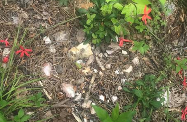
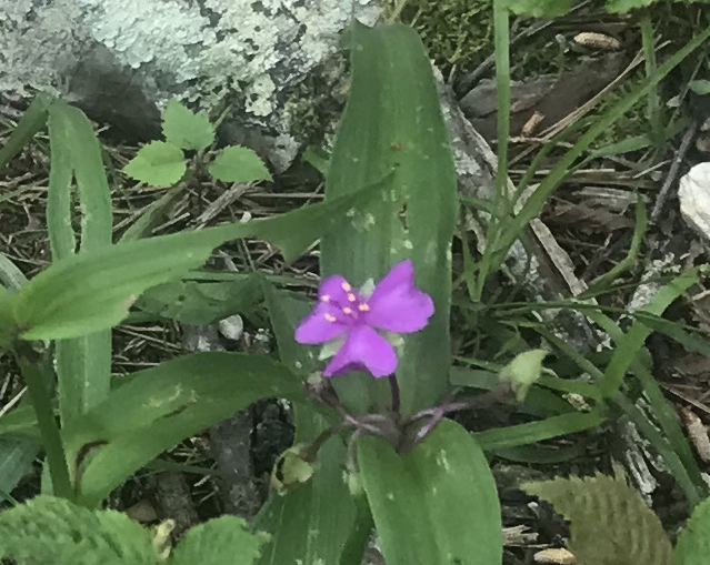
The stones look like a piece of novaculite on the left under the purple flower
and a good size piece of slate.
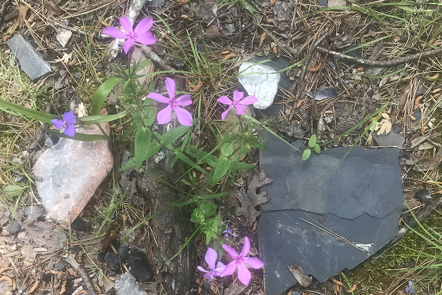
The pink flower is a Downy Phlox. Dry areas, thin soils, rocky or shade out
croppinggs, openings in wood. Statewide. Flowers April-July.

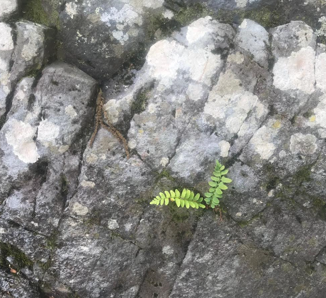
A socially distanced fern.
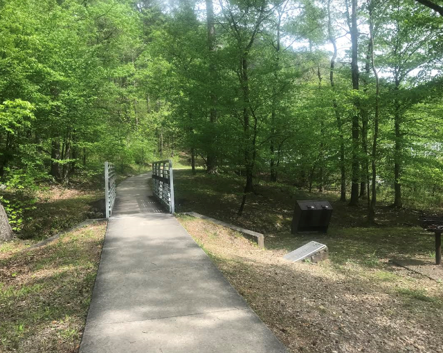
The 1st bridge.
Why are the Red oaks dying?
Information from sign in recreational area. You may have noticed some of the oak trees dying in the
forest. Some red oak and white oak are suffering from oak decline. Oak decline
is a complex phenomenon with no single cause. It is multi-factorial. Conditions
predisposing trees to decline are
(1) old age
(2) Shallow, rocky soils on ridge top and upper slope locations
(3) Droughts.
Secondary insects and diseases further stressing and damaging trees are
(1) Red oak borer
(2) Two-lined chestnut borers
(3) Armillaria root rot
(4) Defoliating insects like walking sticks
(5) Hypoxylon canker.
Healthy and vigorously growing trees normally fight off insect attacks such as
red borer. Recent droughts stressed the red oak and white oak trees, making them
vulnerable.
Mortality of northern red, black and southern red oaks in the
Ozark and Ouachita National Forests became very noticeable in 1999 following two
years of drought. White oaks, hickories and other species were also affected to
a lesser degree. The red oak borer population peaked during these years to
further weaken the trees. They cause damage to wood products by boring tunnels
up to half inch in diameter into the tree trunks. Woodpeckers, the natural
predator of the red oak borers, were unable to keep up with the rapidly growing
insect population. Forestry practices that maintain tree vigor include cutting
weak or damaged trees and thinning to remove some trees from overpopulated
stands can help prevent or minimize infestation. Reference: Information board at
the LMFs Recreational area.
We didn't find Crooked Creek Falls.