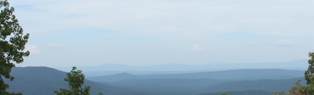
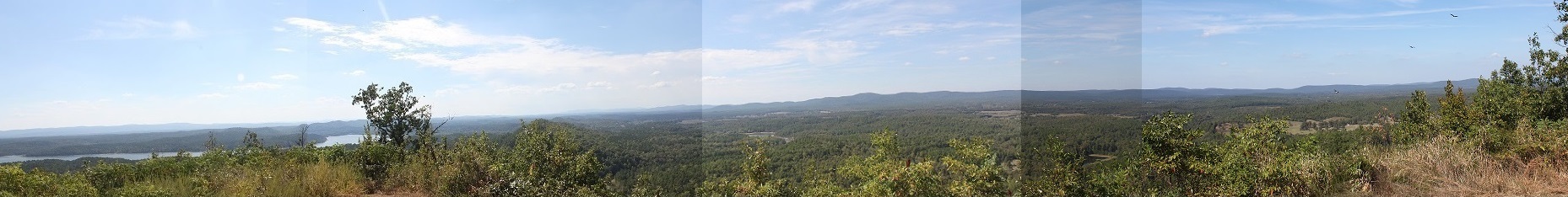
Looking east from the Talimena National Scenic Byway in October 2015
Looking east from the Talimena National Scenic Byway in
October 2015
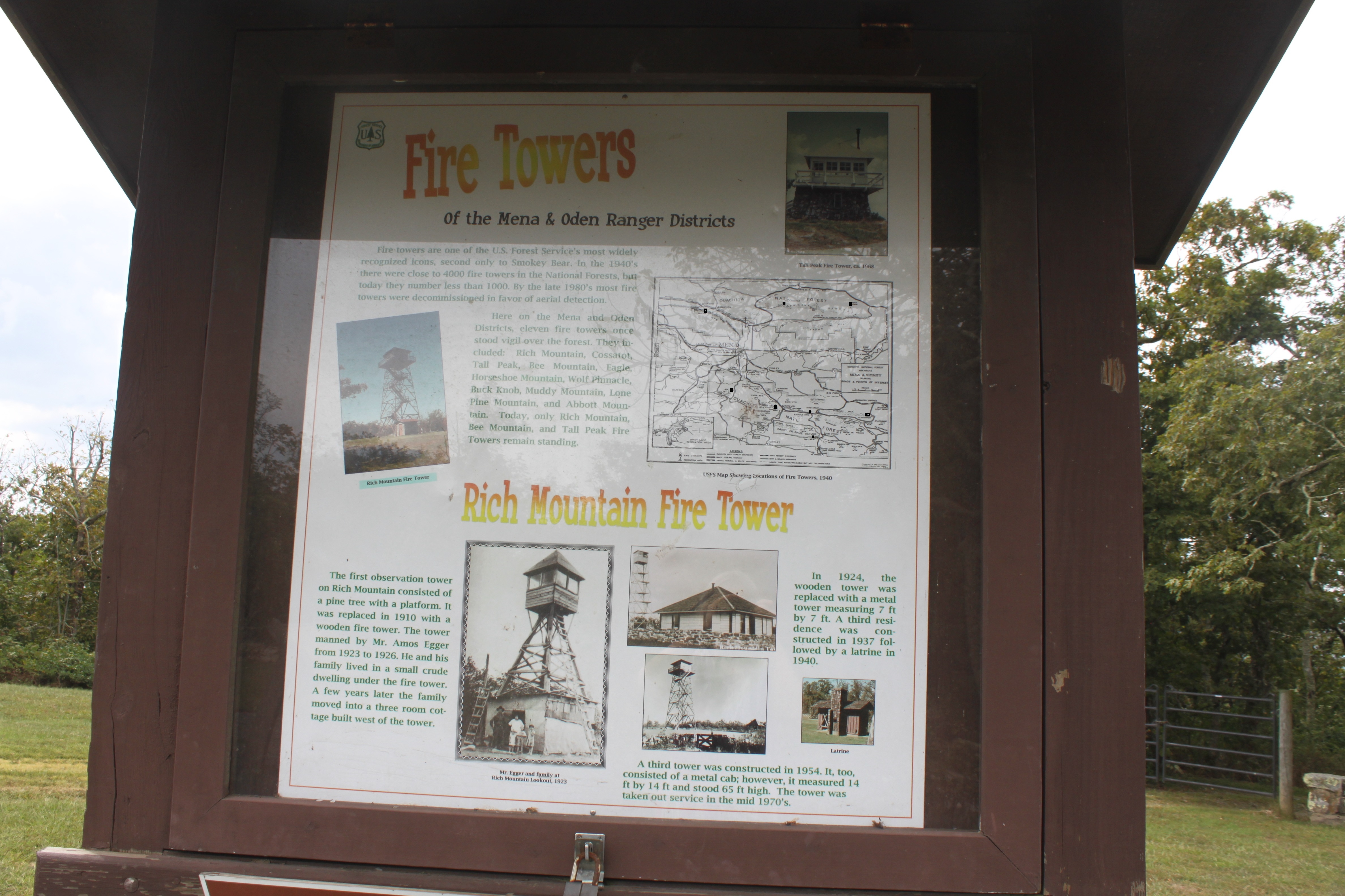
Fire towers are one of the U.S. Forest Service's most widely recognized icons, second only to Smokey Bear. In the 1940s there were close to 4000 fire towers in the National Forests, but today they number less than 1000. By the late 1980s most fire towers were decommissioned in favor of aerial detection. Once there were 43 lookouts on the Ouachita National Forest in Arkansas, and today only six remain. Here in the Mena and Oden Districts, eleven fire towers once stood vigil over the forest. They included: Rich Mountain (still standing), Cossatot, Tall Peak, still standing, (Polk County, Bee Mountain, Wolf Pinnacle, Buck Knob, Lone Pine Mountain and Abbot Mountain. In Montgomery County there was Muddy Mountain (another photo), Gaston Mountain, High Peak (signal tower), Slatington Mountain and Vanderslice Mountain is south of the Union Hill Church East of Story (34°38'59.63"N 93°30'25.47"W), you can still drive up there and find the old concrete footers. Today, only Rich Mountain, Bee Mountain and Tall Peak Fire Towers remain standing. map map The land was deemed not suitable for agriculture but useful for timber. Approx. 75% of Montgomery County is national forest and is one fifth of the Ouachita National Forest, which was established to protect the streams and rivers and to ensure a supply of timber in the future. Over the years the US Forest Services policies changed regarding public access, clear-cutting and waster management. The fire lookout tower at Pigeon Roost Mountain was built in 1929.
Gaston Mtn 9 miles west of Mt. Ida and about 6 miles sw of pencil Bluff. it is a 4-legged steel structure with a 45' cabin on top, and is 70 feet in height, removed.
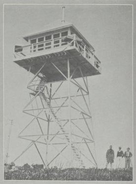
Buck Knob Tower, Scott County, from 1933-1934 Arkansas Civilian Conservation Corps Pictorial
Review.
Color photo ONF archived 1959.
Removed.
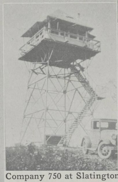
Slatington Fire Tower built by the CCC in 1933
Arkansas
Lookouts
High peaks in Montgomery
Co.
Benchmarks in Montgomery Co.
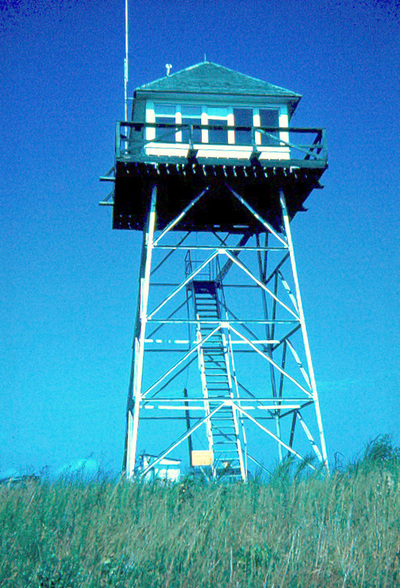
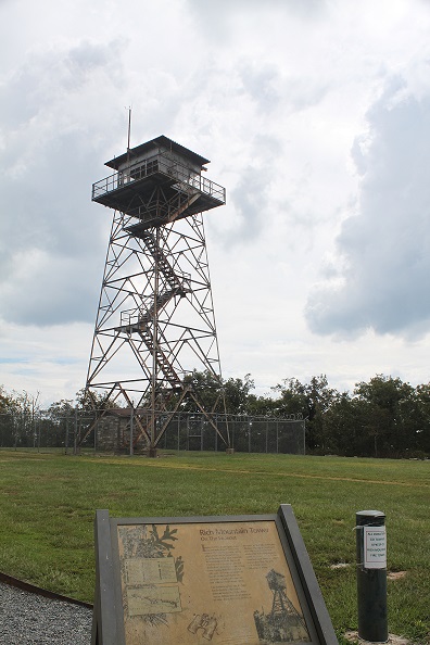
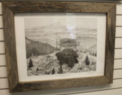
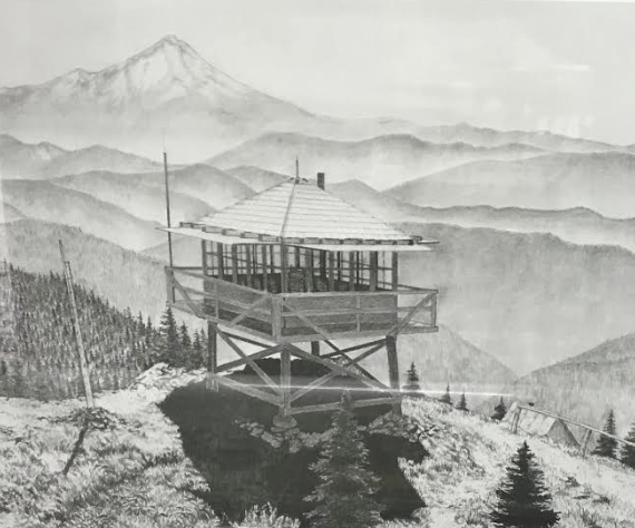
Rich Mountain Tower on The Lookout
Imagine it's 1923. Amos Egger, his wife
Grace, and their three children are at home in Rich Mountain Tower. Amos, a fire
lookout for the Forest Service scans the horizon for forest fires while his wife
single-handedly digs a well. Until the well is completed, she and her husband
hand water in canvas bags from a spring more than a quarter mile away. And when
groceries run low, the family heads down the mountain on foot ; a two and one
half mile, to the nearest store.
Like lookout nationwide, the Egger family played a critical role in detecting
forest fires. When Amos was out fighting a fire or attending to his other
duties, Grace would fill in at the watch, all the while tending her children.
The Egger's stayed warm with only a camp stove for heat; comfortably weathering
sudden and severe storms. In fact, Amos kept an ax inside the cabin to chip ice
away from the door so it could be opened following the storms. Amos died in
1968. Grace died in 1980.
The first observation tower on Rich Mountain consisted of a
pine tree with a platform. It was replaced in 1910 with a wooden fire tower. The
tower manned by Mr. Amos Egger from 1923 to 1926. He and his family lived in a
small crude dwelling under the fire tower. A few years later the family moved
into a three room cottage built west of the tower.
In 1924, the wooden tower was replaced with a metal tower
measuring 7ft by 7ft. A third residence was constructed in 1937 followed by a
latrine in 1940. The latrine was still standing when I was there in October
2015.
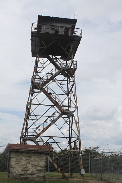
A third tower was constructed in 1954. It, too, consisted of
a metal cab; however, it measured 14ft by 14ft and stood 65ft high. The tower
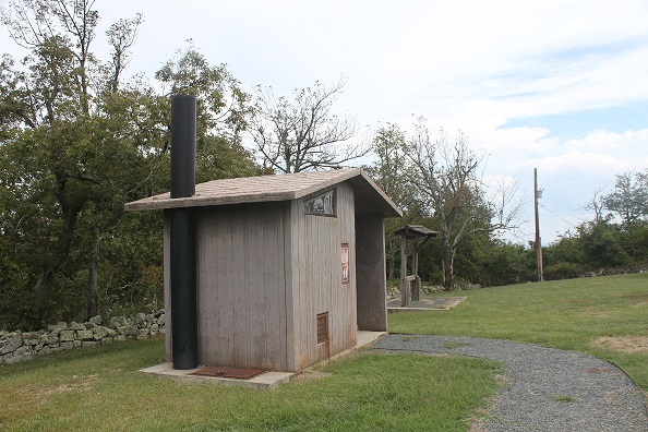
was taken out of service in the mid 1970s. The fire tower is open on weekend
afternoons from Memorial Day in May through Veterans Day in November. Volunteer
staff give you a tour. A restroom and picnic tables are available for visitor
use. An interpretive sign discusses the history of the tower.
Elevation: 2681 feet.
Second highest peak in Arkansas.
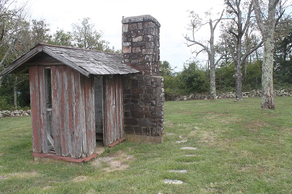
They call it The Latrine.
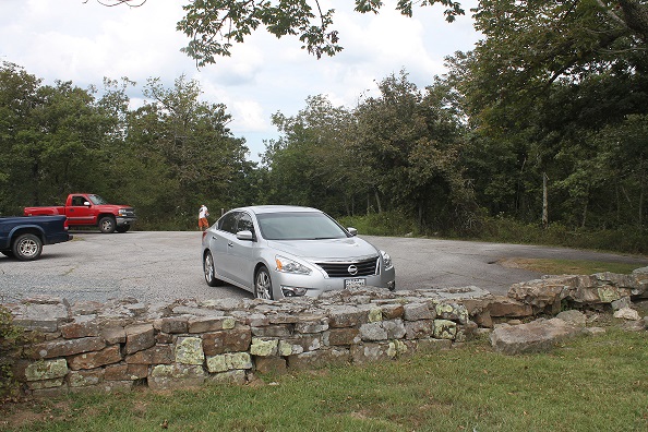
Parking lot at the Rich Mountain Lookout Tower. The rock wall looks like CCC
work.
58 feet tower.
The Hickorynut Mountain fire tower no longer exists
The Hickory Nut Mountain vista /picnic area off Hwy 270, 13 miles east of Mt. Ida or 23 miles west of Hot Springs. Look for the turn to Hickory Nut Mountain Rd, approx. 1.3 miles west of the Garland/Montgomery county line, in Montgomery Co. The road ends at 4.2 miles at the vista overlook. The road climbs up the hill and take the left fork at 1.0 mile. At 3.5 miles is a sign on your left for the picnic area. Note of the sign pointing to the Old Fire Tower spur. After only a .15 miles or 10 minute hike on the spur you will arrive at the old Forest Service fire tower site, which includes the concrete anchors of the tower, the foundation to the fire tower watcher’s cabin, a water cistern, and the two National Geological Survey medallions installed in 1953. Altitude: 1416ft. Just a little further up the road from the picnic area is the Hickory Mountain Vista Overlook with views of Lake Ouachita. Especially beautiful during autumn! Map. pano. video. Lake Ouachita is at an elevation of 578ft and has more than 200 islands and covers 40,000 acres.
Near Story, east,
map, 360° views of lake and the Ouachita
Mountains from an elevation of 1075ft asl. At the west end of a east-west ridge.
Lake Ouachita from the north side of the lake Oct. 2015. Muddy Creek
in centre of photo, runs into Lake Ouachita. The new bridge across the Hwy 27 at
Washita at the start of the lake just to the left of the tall shrub was visible
from the vista here. Turkey vultures soaring, use thermals, rarely flap their
wings. They are very common in Montgomery Co. often seen in groups cleaning up
dead kills: raccoons and opossums. They use to be seen roosting at night on the
old cedar fence posts, one to a post, but now farmers tend to use the
t-posts so
the vultures now roost in trees in flocks.
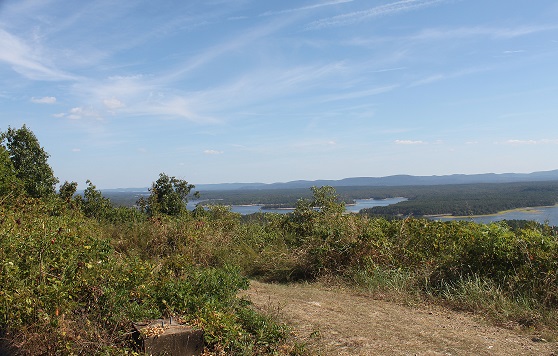
Photo of SW footing. The lookout consisted of a lookout
house about 15 feet square supported by four steel legs and rose to a height of
about 47.5ft. The only thing left of the forest
service lookout tower is the forestry road in and the four concrete footings.
Two National Geological Survey medallions installed in 1956. I didn't find the
survey markers, it is in the centre.
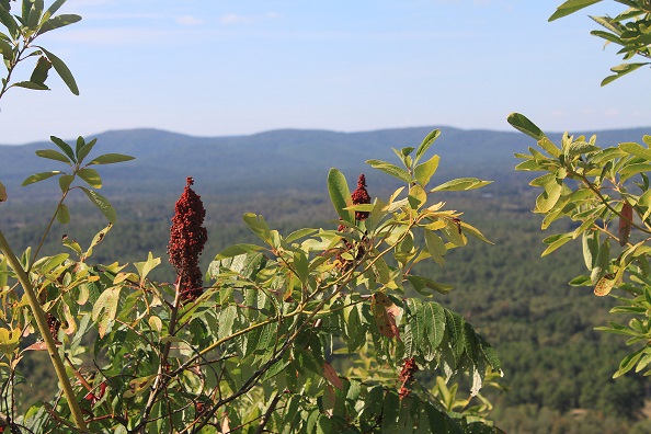
Smooth Sumac, common, occurs in all 48 states. Browsed by
deer. The leaves turn a variety of orange, red and yellows in the autumn. Often
seen in open or shaded areas along roadsides.
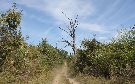
Lightning strikes are a common danger when at highest point.
Three trees by the track have recently hit by lightning and are dying. Explains why
there isn't any trees on top only shrubs.
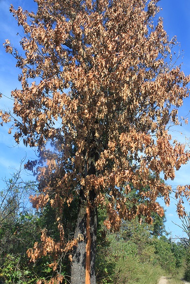
The most likely area for a lightning strike is toward higher elevations and tall
objects. Where lightning has struck a tree in the past, it will likely hit
again. A long vertical scar running down the trunk of the tree and pieces of
bark scattered around the ground are both common signs the tree has been struck
by lightning.
Arkansas Fire Lookouts
Buck Knob -
not standing. Photos of Buck Knob Tower taken in 1959 and 1966 show a square
cap.
Gaston
Lookout Tower -long gone. 419m asl. Latitude: 34°34'8.36" Longitude:
-93°47'1.73"
High Peak
Tower - long gone. 5 miles north of Caddo Gap and 5 miles south of Mt. Ida and 4
miles NE of Norman. The tower was a 4 legged structure with a square,
metal/glass enclosed, lookout house on top. The height of the structure was
70ft. to the eaves with the gable being 3 ft making an overall height of 73ft. N
34° 28.367 W 093° 36.334. The footings still remain. Has a terrific veiw.
Slatington 1933, CCC not standing, metal frame use
discontinued in early 1960s
Tall Peak Fire Tower: Elevation: 2292'. 1930s, CCC, standing,
stone base, wooden, inactive, restored, access from Shady Lake via the 6 hour, 5
mile, strenuous,
Tall Peak Trail.
The Bull was built at its current location in 1942. It was staffed every year until 1964, then staffed by volunteers intermittently until the 1980s. “If you were assigned to ‘The Bull,’ you hiked 16 miles from the end of the road to the lookout,” wrote Bud Unruh, who staffed the lookout in the 1940s. “After the packer unloaded your personal items and a month’s supply of grub, he was gone and there you were, alone for at least two months of the fire season. “You would probably see one more person, the packer about August 1st with more grub supplies, and then again in early September to move you out.” You come out of the forest at The Bull and all of a sudden you can see every major Cascade Peak. Lightning is a major cause of forest fires.
The US Forest Service Caddo/Womble District Office on the east side of Mt Ida
has a sketch hanging on the wall "Bull of the Woods Lookout" Mt. Hood
National Forest.
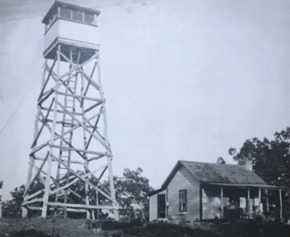
Photo from the Heritage House Museum in Mt. Ida.
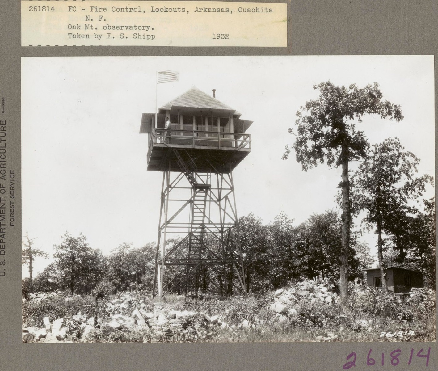
Oak Mountain Observatory, Ouachita National Forest, Saline County. No longer in existence. From Hot Springs take State
Hwy 7 north for 37 miles. turn east on Forest Rd 132 and continue 6.8 miles.
Bench mark : a mark on a permanent object indicating elevation and serving as a reference in topographic surveys.
Jerry Shields writes articles "Hittin' the Trails..." for the Montgomery County
News, sometimes, of local interest. In January and February 2019 he covered the
history of Hickory Nut Mountain. The summit is 1,416ft. The 100ft steel tower
was built in 1939, inside steel stairwell and a 7x7ft observation room atop the
tower. The tower was dismantled in 1979.
About eighty years ago a team of USFS personnel pushed a rough road up the east
slope of Hickory Nut Mountain through huge boulders, hardwoods and rugged
terrain to construct one of the Watcher's Towers later known as fire towers, and
a small cabin for the watcher to live in while on duty. The site was used for
nearly fifty years and abandoned in the 1950s as planes and then satellites
replaced the manned fire towers. During the construction of the LOVIT the
Traildogs found several of the concrete piers used to anchor the fire tower near
the bottom of the south slope and found the old road to the tower completely
covered in brambles, vines, and new growth trees. They cleared and dug a spur
800ft trail up to the tower site (a 10minute hike). Jerry wrote" At the fire
tower site we began clearing brambles, bushes and downed trees while hopefully
herding a vast collection of ticks and chiggers over the backside of the
mountain." While clearing at the old tower site they found two tower anchors,
the stone 8x12 foundation for the watcher's cabin, and the US Coast & Geodetic
Survey medallion from 1956 near the site of the old cabin and an old apple tree.
They aslo discovered a 3'x3" native stone in-the-wild stove / oven rock with an
iron sheet as a cook-top, which Ellen, in Idaho, daughter of an old Watcher
there, wrote that that her father had built a safe distance from the wooden
cabin. Ellen shared her parents spent their honeymoon on the mountain. They
utilized a small spring for their water supply. Her uncle and cousin would
deliver supplies to the tower in an old pickup truck that bounced up the roughed
track in axle high ruts to deliver the supplies in good or bad weather.
Bill and Wynemia, of Mt Ida, were visiting the Vista when Jerry was there and
Bill said he helped with the construction of the Vista and following its
completion was assigned as one of the tower watchers before transferring to the
timber management team during a long career with the Forest Service. [I see
there is a Bill Cobb and wife Wynemia of Mount Ida]
The Vista offers a panoramic unobstructed views of Lake Oucahita and one of the
finest sites to star gaze or watch eagles or turkey buzzards. The road is pretty
rough, and many would like to see it paved. Jerry wrote the Vista was
constructed over fifty years ago by the Forest Service. The final mile of the
4.2 mile road USFS RD 50 from US Highway 270 required significant applications
of dynamite to breach the rocky ridge atop the mountain. The old sand filled
walls of the old explosive storage building sits almost unnoticed just off the
east side of the road. The USFS team created a broad parking area at the Vista
site surrounded with beautiful sandstone walls and a covered observation deck
complete with restrooms for public use. As time past funds for the upkeep of the
vista and road dwindled making the trip to the vista by car more an adventure.
Then thirty years ago a traveling band of homeless vagrants set up camp on the
vista and decided the wood roofed observation deck would make good firewood. The
band was banished but the damage was done. Within the next year the vandalized
restrooms were closed. Graffiti became a problem and vandals were ripping stones
from the wall. Over the next several years the USFS periodically repaired the
walls replacing the stones that had been tossed over the walls and cleaned off
the graffiti. They also annually graded the gravel road. The small campground to
the left before you get to the vista was decommissioned and left open as a day
use picnic area. The LOVIT trail began in 2005 and reached the summit of Hickory
Nut Mountain in 2007.
Photos taken early Oct. 2015 by OW.
Ouachita
Pinnacle -Garland Co.