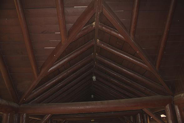
The CCC sure knew how to build them. Here you can get away from it all.
The CCC sure knew how to build them. Here you can get away from it all.
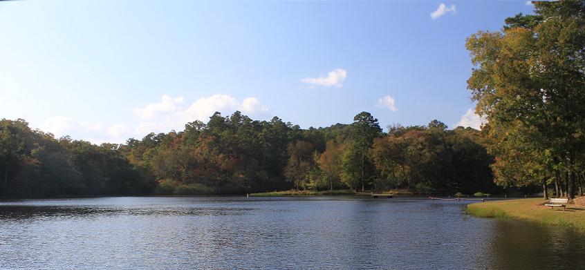
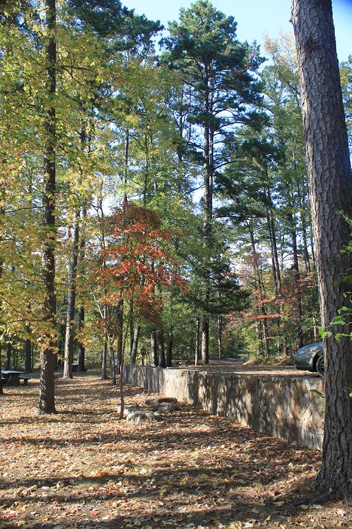
Shady Lake, 25 acre lake with a grassy beach, lies on the
extreme southern edge of the Ouachita National Forest,
18 miles SE of Mena, Arkansas offers camping, fishing, swimming, boating,
amphitheater, group picnic area, playground and
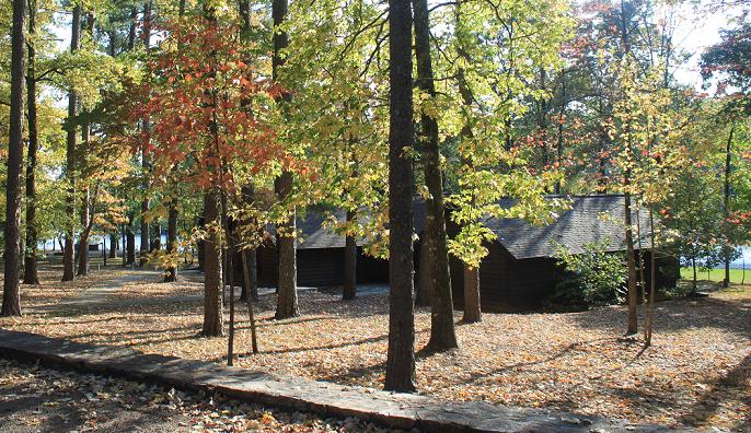
hiking at the 66 unit campground, 21 with water and electricity, surrounded by a forest of large pines and
hardwoods. The recreational area was developed in 1938 by
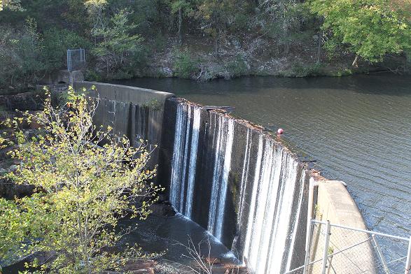
the CCC men at Camp Shady. The men built the dam across the Saline River, the
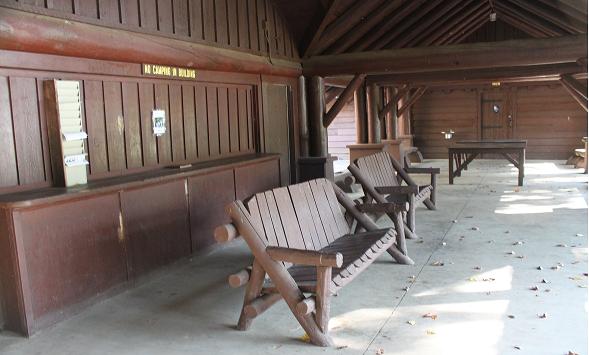
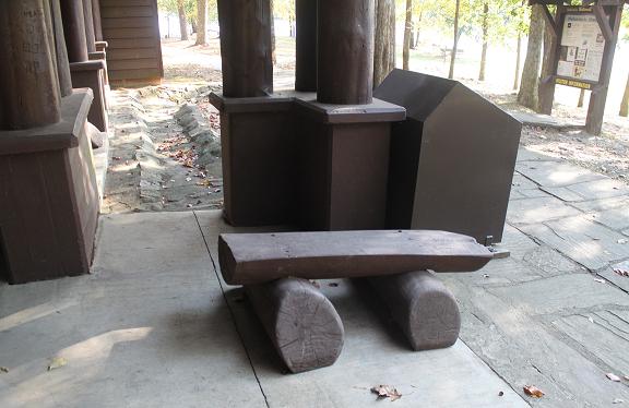
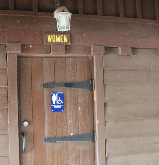
picnic pavilion complete with benches,
ping pong table, concession store and modern warm water showers and bathrooms, two
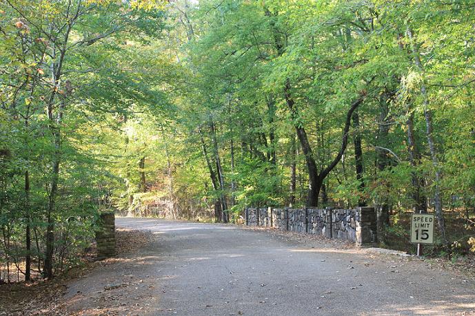
beautiful stone
bridges, the caretaker's house, the Tall Peak
Lookout Tower
on FS Rd 38A,
turn left when you get to the top, and two vista pullovers, Buckeye and
Sugar Creek, on Forest Service Road 38 heading towards Dallas, AR. The beautiful
lake is stocked with largemouth bass, catfish and sunfish and boat with electric motors or row boats
are allowed. There is a
fishing pier, swim area, an interpretive trail (.5 miles) and the Tall Peak Trail. We approached Shady Lake from the south, about- a
two miles west of
Athens, on the 246 West, start looking for the gravel Shady Lake Road sign and
the small brown ONF directional signs, easy to miss, near the chicken houses and
silo. If you cross the Saline River you have missed the turned on the right if
heading west. Don't be surprised if you are the only ones there as it is
isolated. The campground is open from March 1st until December 1st.
Memories
Photos
Directions: Five miles southwest of Glenwood on U.S. 70; west 23 miles on Hwy.
84 to Athens, then 2.2 miles west on Hwy. 246. Then north at sign for 3.7 miles
on the gravel Forest Road 38.
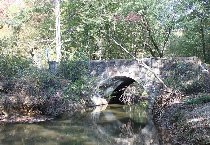
Shady Lake CCC Bridge #1,
Forest Service Road 38 over the South Fork of the Saline River, Athens
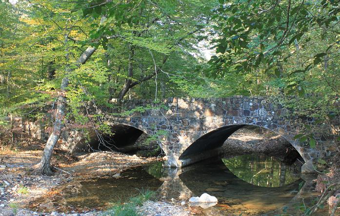
Shady Lake CCC Bridge #2,
Shady Lake Campground loop road over the East Fork of the Saline River, Athens
![]()
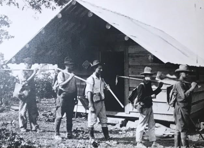
CCC - March 31, 1933 to June 30, 1942
During the depression of the 1930s, the Civilian Conservation Corps (CCC) battled woods fires, reforested the area with pine seedlings, erected buildings, and constructed all-weather roads in the National Forest and five state parks. Most CCC projects were built in national forests or on state-owned property. Other CCC jobs for these men included stringing phone lines, building fire towers and ranger stations and develop public access areas. The basic pay was $30 per month but $25 was mailed home to each enrollee’s relatives. Classroom education was compulsory for those who could not read or write.
On the road north of Shady Lake towards Mena.
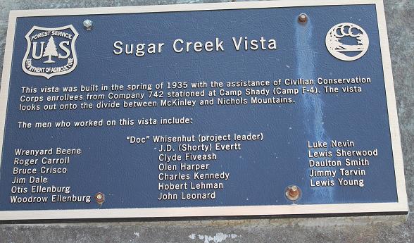
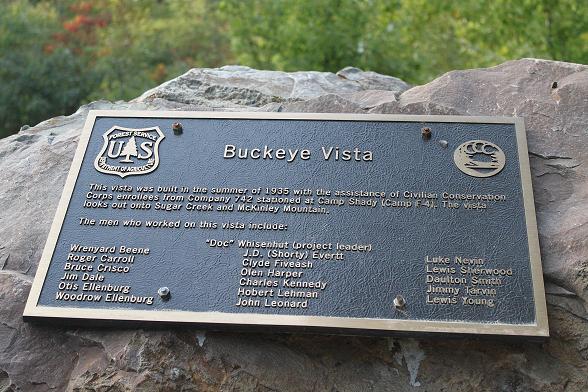
This vista was built in the summer of 1935 with the assistance of Civilian
Conservation Corps enrollees from Company 742 stationed at Camp Shady (Camp
F-4). The vista looks out onto Sugar Creek and McKinley Mountain.
The men who worked on this vista include:
| Wrenyard Beene Roger Carroll Bruce Crisco Jim Dale Otis Ellenburg Woodrow Ellenburg |
J.D. (Shorty) Evertt Clyde Fiveash Olen Harper Charles Kennedy Hobert Lehman John Leonard |
Luke Nevin Leis Sherwood Daulton Smith Jimmy Tarvin Lewis Young |
This vista was built in the summer of 1935 with the assistance of Civilian
Conservation Corps enrollees from Company 742 stationed at Camp Shady (Camp
F-4) 9F or NF National Forest ).
The vista looks out onto Sugar Creek and McKinley Mountain.

Bard Springs Picnic Shelter, Bathhouse, Dams 1 and 2, ca. 1936, near Athens is three miles east of Shady Lake recreational area on Forest Service Road 106, was a CCC campground project or 7.7 miles from the Shady Lake Rd, Athens, State Rt. 246 west road turn off. Bard Springs Primitive campground with 13 tent sites is located southeast of Mena Located on a small scenic stream swimming and hiking are available from the campground. Facilities at the campground include a picnic shelter, drinking water, and flush toilets. No fishing.
The Caney Creek Wilderness area,
14,460 acres, north of the Shady Lake area, has numerous
hiking trails. In 1935
8,300 acres of what is now Caney Creek Wilderness was designated as a Game
Refuge. On January 3, 1975 this area became part of the National
Wilderness Preservation System. The trails are not marked or signed and Mtn.
bikes and motorized equipment are prohibited in the Wilderness.
Shay Lake Trail (3.1 miles)
Tall Peak Trail (3.2 miles hiking) or 5 miles by road, you can drive up to
the tower
on a dirt road.
Buckeye Trail (4.7 miles)
Caney Creek Trail (17.5 miles) (all distances one way).
Poteau Mountain Road, Ouachita National Forest, was built in the 1930s by the Civilian Conservation Corps (CCC). The CCC built this road and many others throughout the national forest so that firefighters could reach wildfires. The concrete culverts used on this road were made by the crews from Shady Lake CCC camp south of Mena. The CCC camps were set up to consist of approximately 200 men each usually from the surrounding counties. CCC camps
Montgomery County ArkansasGenWeb Project
All these photos above were take by me, Olwyn, on a beautiful autumn day, 13 Oct. 2010. We saw one beautiful white tailed buck on the road just before Shady.

Montgomery Co. Polk Twp 1940 census enumerated April 21 1940
by Buenos Sikes.
CCC Camp F-13
McKee, Calvin C- head, 18, born Ohio, residence, Trenton, Lawrence Co. Ohio, on
a farm, laborer, road contractor. Highest grade completed at school H2
Carmichael, Joseph Rix Jr officer 24, born Utah, residence Seattle, King, Co.
Washington State. Officer CCC. Highest grade completed at school C5