|
|
Welcome to
| 
|
|
|
Welcome to
|
|
The material in this index remains the property of the author, Jerry McKelvy. Nevada County, AR, Rural Churches
Reproduction for your research is permitted, but no republishing is allowed without the written consent of the author.
Jerry McKelvy has generously posted this list of Nevada County churches. He does not have pictures of churches inside the city limits of Prescott and Emmet, so he called it Rural Churches of Nevada County.
Photos will be added as quickly as possible.
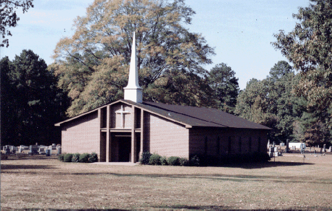
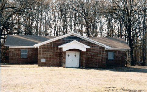
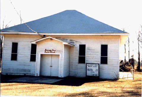
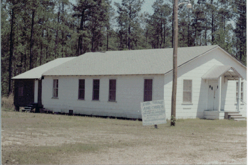
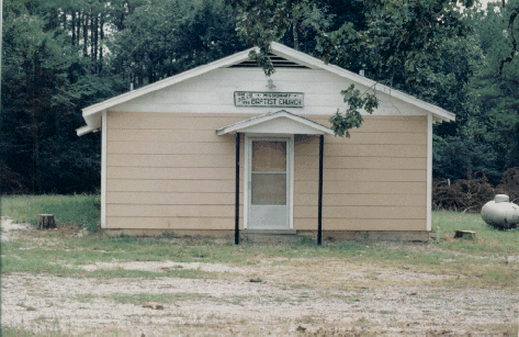
ANTIOCH MISSIONARY BAPTIST CHURCH
Located west of Laneburg and about 1.6 miles west of Hwy. 53. Photo taken in November, 1993.
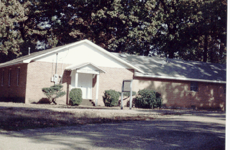
BLUFF CITY MISSIONARY BAPTIST CHURCH
Located on south side of Hwy. 24 about 1/4 mile east of center of town. Land sold to church by W. B. and Margaret Howard in 1861 with more land later from John and S.E. J.Nichols and E. W. and M. M. Barlow. Photo taken May, 1993.
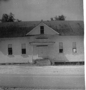
BLUFF CITY CHURCH OF CHRIST-OLD BUILDING
Was located about 1/8 mile west of center of town on south side of Hwy. 24. Building does not exist today. Land for church donated by John and E. J. Bradley in 1884. Known then as Christian Church. Photo date sometime before 1952
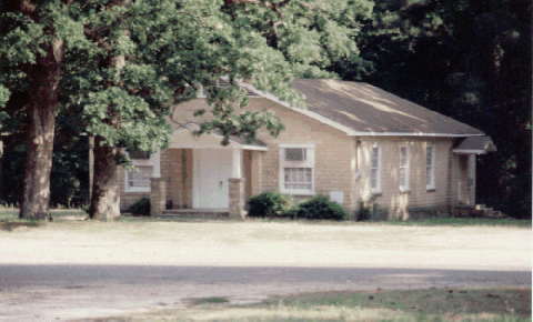
BLUFF CITY CHURCH OF CHRIST-NEW BUILDING
Located 1/4 mile east of center of town on north side of Hwy. 24. Building was formerly Bluff City School. Used as church since 1952. Bluff City Cemetery is visible from building. Photo May, 1993
BLUFF SPRINGS BAPTIST CHURCH
Located on Rd. 29 about two miles north of Hwy. 278. Bluff Springs Cemetery is about one half mile north of church. Previous church destroyed by fire. Photo taken December, 1996.
BODCAW BAPTIST CHURCH
Located in downtown Bodcaw on east side of Hwy. 53. Photo taken November, 1993.
BODCAW NO. 1 BAPTIST CHURCH
Located on Rd. 13 just north of Hwy. 32 about three miles west of Bodcaw. Cemetery is across road in front of church. Photo taken November, 1993.
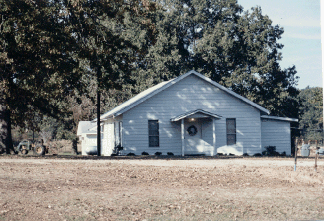
BOUGHTON BAPTIST CHURCH
Located on Rd. 35 in Boughton. Photo taken September, 1996.
CANA A. M. E. CHURCH
Located on Rd. 47 about three miles north of Hwy. 278. Photo taken in June, 1996
CAROLINA UNITED METHODIST CHURCH
Located in remote area about 1.5 miles north of Hwy. 278 and 1/2 mile east of Rd. 47. One of the oldest churches in Nevada County. Building was restored in 1977. The old wooden church pews made from very wide boards have been removed and building has had no maintenance since 1977. Church is located on the old road from Camden to Washington, Arkansas. Photo taken in April, 1993.
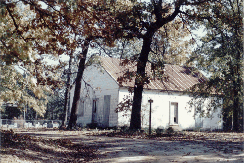
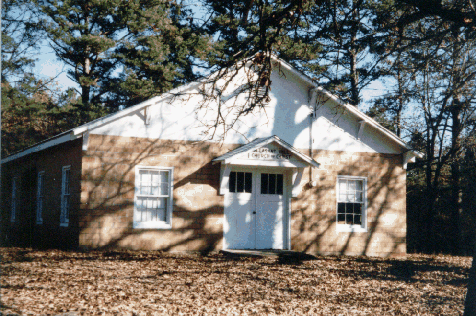
CLEVET SPRINGS BAPTIST CHURCH
Located just south of Hwy. 355 one mile east of Falcon. Clevet Springs Cemetery is just east of building. Photo taken November, 1993.
CORINTH BAPTIST CHURCH
Located on Hwy. 32 one mile east of Hwy. 53. Photo taken November, 1993.
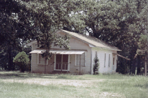
DAVIDSON CHURCH
Located at intersection of Rd. 8 and 166 southeast of Willisville. Cemetery next to church. Building still stands, but is not used. Photo taken July, 1993.
EDWARD'S CHAPEL CHURCH OF GOD IN CHRIST
Located about 1/2 mile south of Tick Hill Cemetery on Rd. 19. Building is gone now. Photo taken July, 1993.
EBENEZER UNITED METHODIST CHURCH
Was located on Hwy. 299 about 4.5 miles southwest of Bluff City. Building no longer exists. A school once existed across the highway. Ebenezer Cemetery is at this location. Photo not available.
EPHESUS CHURCH
Located about 1/2 half mile north of Emmet on Hwy. 67. Ephesus Cemetery is just north of building. Photo taken in December, 1997.
FAIRVIEW UNITED METHODIST CHURCH
Located 1.5 miles north of Hwy. 19 at intersection of Rd. 42 and Rd. 22. Photo taken in December, 1997.
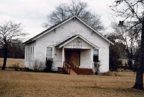
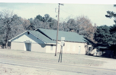
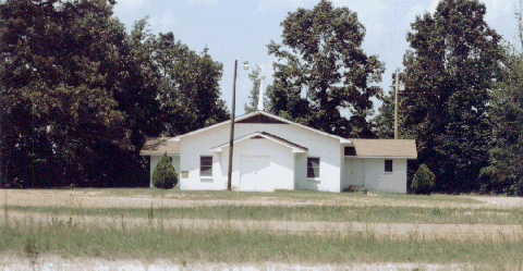
FALCON CHURCH OF CHRIST
Located at intersection of Hwy. 53 and Hwy. 355 in Falcon. Photo taken November, 1993.
FOREST HILL BAPTISH CHURCH
Located on Rd. 271 about 1/2 mile north of Hwy. 278 near Hempstead County line. Cemetery behind church. Photo taken November, 1993.
FRIENDSHIP BAPTIST CHURCH
Located just off Hwy. 200 about half way between Cale and Morris. Church is not being used at this time (1999). Friendship Cemetery is located on east side of building. Photo taken in November, 1993
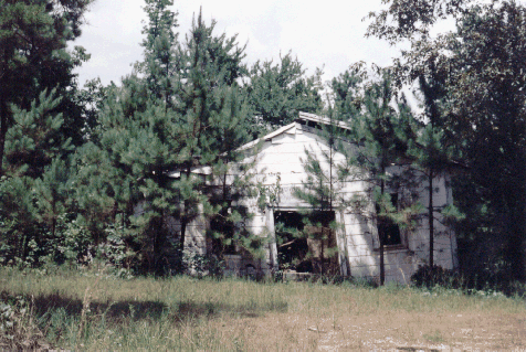
GUM GROVE CHURCH OF CHRIST
Was located at intersection of Rds. 290 and 403 about four miles southwest of Bluff City. This site was called Lone Grove in 1865 and was the location of the Gum Grove School until 1929. The church no longer exists and the building has been moved. Photo date unknown.
HARMONY METHODIST CHURCH
Located on Hwy. 73 about one mile west of Hwy. 53. Established in 1849. Cemetery is behind church. Prior structure destroyed by fire. Photo taken November, 1993.
HARRISON CHAPEL BAPTIST CHURCH
Located on Hwy. 76 about 2.5 miles east of Waterloo. Cemetery next to church. Photo taken July, 1993.
KENDRICK'S CHAPEL BAPTIST CHURCH
Located on Rd. 6 about 1.5 miles east of Hwy. 371. Cemetery across road from church. Photo taken July, 1993.
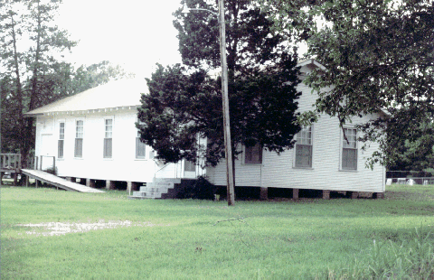
LANEBURG BAPTIST CHURCH
Located on Hwy. 371 in Laneburg. Cemetery next to church. Photo taken September, 1993.
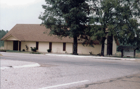
LANEBURG UNITED PENTECOSTAL CHURCH
Located west of Hwy. 53 at intersection with Hwy. 299. Photo taken September, 1993
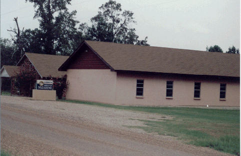
LIBERTY CHURCH OF THE NAZARENE
Located in Redland community across Rd. 35 from Liberty Cemetery. Photo taken September, 1993.
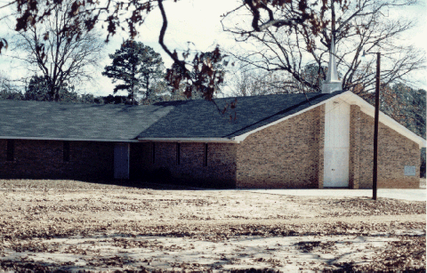
MACEDONIA BAPTIST CHURCH
Located on Rd. 220 and 237 between Hwy. 67 and I-30. Photo taken September, 1996.
MASONIC LODGE
Located about three miles north of Hwy. 278 on Rd. 47. Abandoned. Across road from Cana A. M. E. church. Photo taken June, 1996.
MIDWAY METHODIST CHURCH
Located on Hwy. 371 about four miles west of Prescott. Cemetery next to church. Photo taken December, 1997.
MISSIONARY GROVE BAPTIST CHURCH
Located on Rd. 37 about five or six miles north of Prescott. Cemetery next to church. Also known as Nubbin Hill. Photo taken December, 1997.
MT. CANA BAPTIST CHURCH
Located on Rd. 41 about 1.5 miles east of Rd. 23 (Cale Rd.) Photo taken September, 1993.
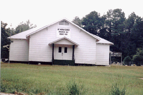
MT. MORIAH CHURCH
Located on Hwy. 371 about half way between Laneburg and Rosston. Church was organized in 1857 and was rebuilt in 1928. This was once county seat of Nevada County. Cemetery is located next to church. Photo taken September, 1993
MT. OLIVE MISSIONARY BAPTIST CHURCH
Located on Hwy. 76 about one mile east of Hwy. 371. Cemetery behind church. Photo taken July, 1993.
MT. VERNON CHURCH
Located on Rd. 6 about four miles south of Hwy. 76. Cemetery is next to church. Photo taken July, 1993.
MT. ZION MISSIONARY BAPTIST CHURCH
Located in Cale at old school location. Photo taken November, 1993.
MORRIS BAPTIST CHURCH
Located at intersection of Hwy. 299, Hwy. 200 and Rd. 23. Caney Cemetery behind church. Photo taken November, 1993.
MORRIS NAZARENE CHURCH
Located at intersection of Hwy. 299 and Hwy. 200. Does not exist today. Was used in scene in Boxcar Bertha movie. Photo not available.
MOSCOW UNITED METHODIST CHURCH
Located at intersection of Cale Rd. (No. 23) and Rd. 257. Cemetery next to church. Not in use at this time (1999). Site of Civil War skirmish.
NEW BETHEL A. M. E. CHURCH
Located on Hwy. 200 in Oak Grove. Photo taken November, 1993.
NEW LIBERTY MISSIONARY BAPTISH CHURCH
Located about six miles west of Laneburg and three miles south of Emmet near intersection of Rd. 275 and 14. Photo taken November, 1993.
NEW HOPE BAPTIST CHURCH NO. 2
Located in Sanders community about four miles northeast of Falcon on Rd. 4. Cemetery west of building. Photo taken November, 1993.
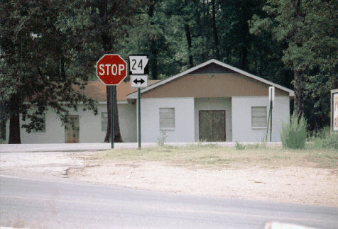
NEW HOPE COMMUNITY CHURCH
Located at Jct. of Hwy. 24 and 53 in Terrapin Neck community. Photo taken September, 1993.
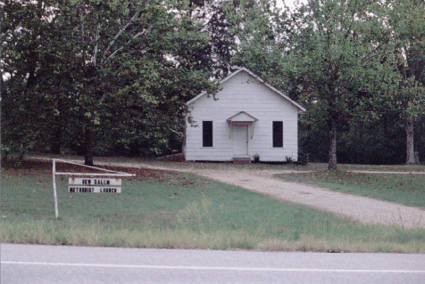
NEW SALEM METHODIST CHURCH
Located on Hwy. 371 about 1.5 miles south of Laneburg. Cemetery behind church. Photo taken September, 1993.
NEW SALEM A. M. E. CHURCH
Located on Hwy. 278 about five miles east of Rosston. Cemetery is behind church. Date of 1941 on building. Photo taken April, 1993.
OAK GROVE BAPTIST CHURCH
Located on Hwy. 200 in Oak Grove. Photo taken November, 1993.
PINE GROVE A. M. E. CHURCH
Located on Rd. 25 about two miles from Hwy. 76. Cemetery is 1/2 mile south of church. Photo taken April, 1993.
PLEASANT GROVE BAPTIST CHURCH (OLD BUILDING)
Located on Rd. 8 about two miles east of Willisville. New building has been built as same location. Photo taken July, 1993.
PLEASANT GROVE BAPTIST CHURCH (NEW BUILDING)
Located on Rd. 8 about two miles east of Willisville. Photo taken July, 1993.
PLEASANT HILL CHURCH OF CHRIST
Located on Hwy. 19 about five miles north of Prescott. Cemetery is next to church. Photo taken December, 1997.
PLEASANT HILL BAPTIST CHURCH
Located on Rd. 6 about 1/2 mile east of Hwy. 371. Cemetery is behind church. Photo taken July, 1993.
PLEASANT HILL MISSIONARY BAPTIST CHURCH NO. 1
No longer exists. Was located on Rd. 47 about two miles south of Hwy. 299. Was organized in 1891 and dissolved in 1911. Handwritten church records were recently discovered. No photo available.
PLEASANT RIDGE METHODIST CHURCH
Located on Rd. 266 off Hwy. 371 about five miles south of Prescott. Organized 1888. Cemetery across road from church. Photo taken September, 1996.
ROCKY HILL METHODIST CHURCH
Located about four miles southwest of Bluff City at intersection of Rds. 40 and 404. Building still stands, but has not been used in many years. Land for church donated by Alexander Fletcher and Elizabeth Ann McKelvy in 1907. This community was also called Gooseankle by local residents.
ROSSTON BAPTIST CHURCH
Located on Hwy. 371 in center of Rosston. Photo taken November, 1993.
ROSSTON RD. CHURCH OF CHRIST
Located on Hwy. 278 about one mile from Ouachita County line. Photo taken April, 1993.
SALEM MISSIONARY BAPTIST CHURCH
Located about 1/4 mile west of Hwy. 371 on Rd. 51 about two miles south of Prescott. Dates on sign appear to be 1890 to 1859. Photo taken September, 1993.
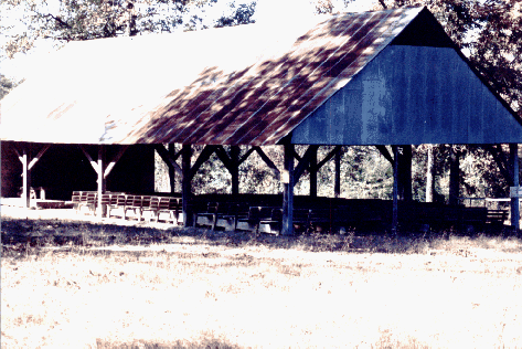
SEREPTA SPRING CAMPSHED
Located on Hwy. 372 about 1/2 mile south of Hwy. 299. Small cemetery at this location. Well known spring here and one of oldest landmarks of Nevada County. Photo taken November, 1993.
SHADY GROVE BAPTIST CHURCH
Located at intersection of Rds 18 and 250 about five miles east of Prescott. Small cemetery behind church. Photo taken September, 1993.
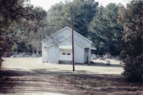
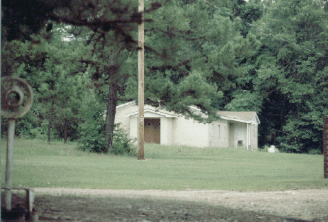
SHILOH COMMUNITY CHURCH
Located about three miles northwest of Falcon on Rd. 5. Cemetery located in front of church. Photo taken November 22, 1993.
SOUTHSIDE BAPTIST CHURCH
Located east of Hwy. 371 on south side of Prescott. Photo taken September, 1993
ST. JOHN'S BAPTIST CHURCH
Located on Hwy. 299 about two miles from Bluff City. Photo taken May, 1993.
ST. MARK BAPTIST CHURCH
Located north of Hwy. 24 on Rd. 18 about 1/2 mile west of Terre Rouge Creek. Photo taken September, 1993.
SWEET HOME BAPTIST CHURCH
Located in Upchurch community at intersection of Rd. 290 and Rd. 41. Organized in 1911. Rebuilt in 1976. Cemetery is half mile west of church. Photo taken September, 1993.
SWEET HOME CHURCH OF GOD IN CHRIST
Located on Hwy. 24 in Upchurch community. Photo taken September, 1993.
TROY CHURCH OF CHRIST
Located on Rd. 25 near Ouachita County line. Cemetery next to church. Building is not used today. Photo taken April, 1993.
UNION BAPTIST CHURCH
Located about two miles north of Bodcaw on Hwy. 53 at Rd. 9. Cemetery is on Rd. 9 about 1/4 mile from church. Photo taken November, 1993.
UNION GROVE BAPTIST CHURCH
Located about half way between Bluff City and Reader on Rd. 27. Cemetery is behind church. Photo taken August, 1993.
WHITE'S CHAPEL BAPTIST CHURCH
Located 1.5 miles north of Hwy. 32 at intersection of Rd. 7 and 120. Photo taken November, 1993.
WILLISVILLE CHURCH OF CHRIST
Located on Hwy. 371 on south side of Willisville. Photo taken July, 1993.
WILLISVILLE UNITED METHODIST CHURCH
Located on Rd. 8 in Willisville. Cemetery is behind church. Photo taken July, 1993.
August 7, 1999