
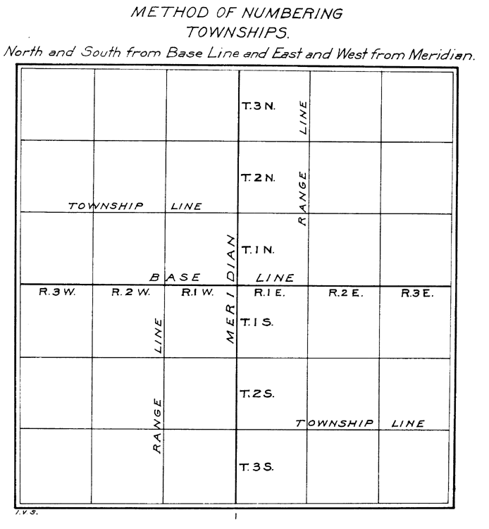
The Township identifies a major subdivision of the public lands under the rectangular system of surveys. Most Townships measure approximately 6 miles on each side and contain approximately 23,040 acres. A Township is identified by its relationship to a base line and a principal meridian.
For example, "Township 5 South, Range 12 West, 5th Principal Meridian" identifies a particular township that is 5 tiers south from the base line of the 5th Principal Meridian.
The Range used in conjunction with the Township data field identifies a row or tier of townships lying east or west of the principal meridian and numbered successively to the east or west from the principal meridian. In the example "Township 5 South, Range 12 West," the number 12 represents the Range Number that is used to identify the township that is 12 tiers to the west of the principal meridian.
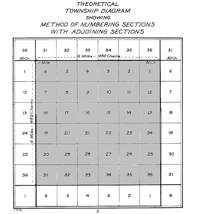
The Section Number identifies a tract of land, usually 1 mile square, within a township. Most townships contain 36 sections. Standard sections contain 640 acres. A section number identifies each section within a township.
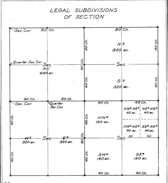
Using the rectangular system of survey, lands were divided into Townships containing 6 square miles. Each Township was subdivided into 36 Sections, each containing approximately 640 acres. Each Section was further subdivided into halves and quarters, repeatedly, until the parcel of land was accurately described. Without the use of Fractional Sections, Blocks, or Lots (in the case of uneven parcels of land), Aliquot Parts were used to represent the exact subdivision of the section of land. Halves of a Section (or subdivision thereof) are represented as N, S, E, and W (such as "the north half of section 5"). Quarters of a Section (or subdivision thereof) are represented as NW, SW, NE, and SE (such as "the northwest quarter of section 5"). Sometimes, several Aliquot Parts are required to accurately describe a parcel of land. For example, "ESW" denotes the east half of the southwest quarter containing 80 acres and "SWNENE" denotes the southwest quarter of the northeast quarter of the northeast quarter containing 10 acres. It is important to remember that the Aliquots shown in the data base (e.g., "SWNENE") usually translates into words found on the land document.
In General: