
Index for Quadrant Maps
These historical topographical maps are Courtesy of the University of Texas at Austin. These map are from different years and are of different series but still exciting historically. Originally from the USGS, they are done by quadrant. WARNING, these are huge both in file size and in your browser; click on the maps and they will enlarge. You cannot see the entire map on your screen, you will have to scroll around.
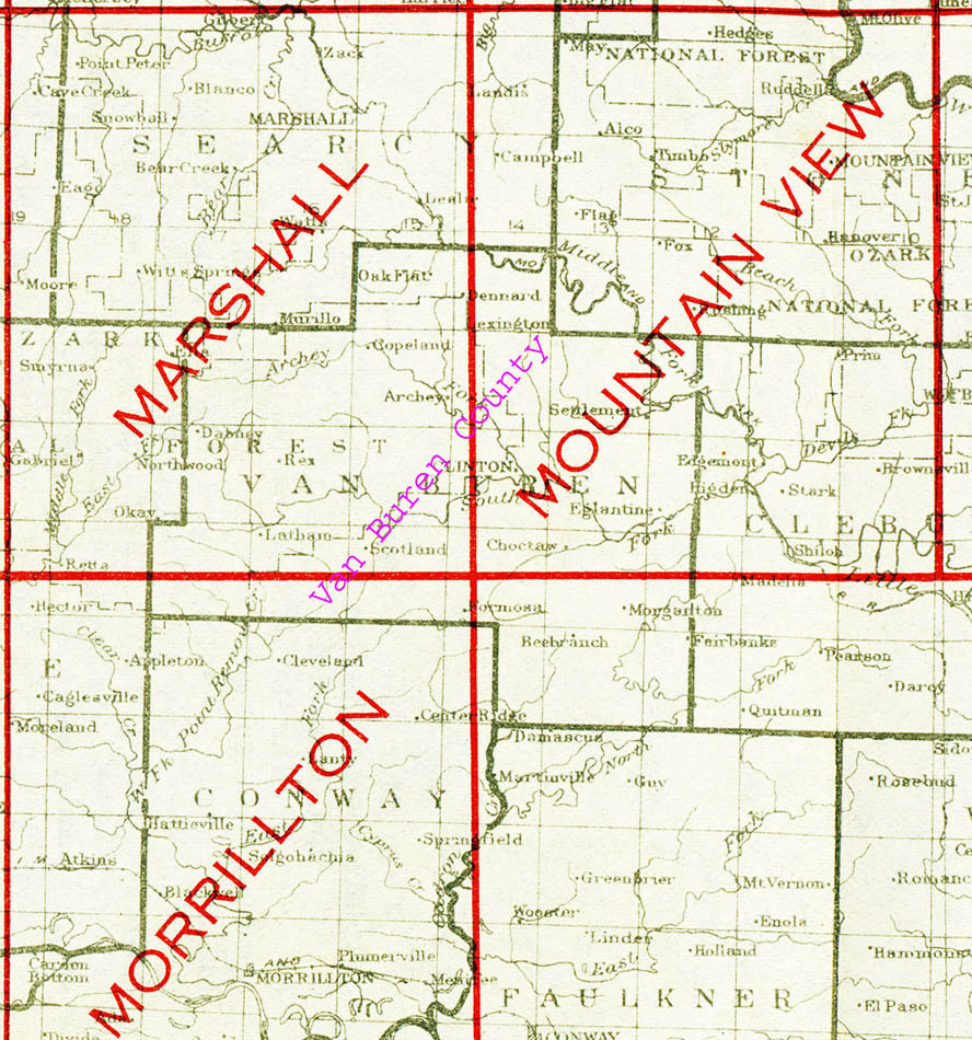
Marshall Quadrant, 1889
Morrillton Quadrant, 1943
Mountain View Quadrant, 1894
Sorry, there is no map for the extreme South East area of Van Buren County.
Arkansas, 1839
Van Buren County before and after Cleburne County, 1888
Historical Maps, 1936
State Map with County Seats, 1990
Courtesy of University of Texas Library
Cemetery Map
Modern Road Map