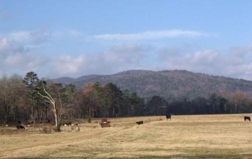
Grapevine Mtn. Looking west towards Pine Ridge.
Grapevine Mtn. Looking west towards Pine Ridge.
![]()
Goodspeed's Biographies for Montgomery County Arkansas
"The Goodspeed Biographical and Historical Memoirs of Western Arkansas." Published by Southern Publishing Company 1891. Chicago and Nashville. Comprising: A condensed history of the state, a number of biographies of distinguished citizens of the same, a brief descriptive history of each of the counties mentioned, and numerous biographical sketches of the citizens of the such counties and descriptions of villages.
County officials 1844 - 1890
Schools
Circuit Courts
The settlement of the territory now composing Montgomery County began early in the decade of the thirties, but on account of its being far from river communication in the early days, and far from railroad facilities in the latter, the settlement has always been slow and gradual, and as yet only a small percentage–as has been stated–has been settled and cleared. The settlements are confined mostly to the lines of the streams where the best lands are located. Prominent among the early settlers were Granville Whittington, Andrew Boles, Henry Brewer, John Boggs, Samuel Cunningham, James Hutson, James Gaston, David Mayberry, Robert McConnell, Jesse Ollier, George Pointer, Benjamin Polk, Frederick Salyers, George Fisher, and J. I. McClendon, all of whom settled in the original municipal township of Sulphur Springs, embracing the north-central and north western part of the county. Mr. Granville Whittington came from Boston and settled in 1835. Ira Bowlin, Dennis Carroll, Lewis Carroll, J. W. Embry, James Fair, Benedict Harroll, John H. Jeffrey, James May, Taylor Polk, Charles Smith, Elisha Tweedle, and John Shipp, were the prominent early settlers of Caddo Cove municipal township, which embraced the southern portion of the county. T. H. Bledsoe, Cornelius Cane, Solomon Kerby, Joseph Lamb, Ira K., and G. K. Robinson, Isaac Shipman and Jefferson Cunning were among the leading pioneers of Mountain Township, which embraced the eastern part of the county, including also that portion since set off to Garland County.
The pioneer settlers came mostly from the southern States bordering on the Atlantic and the Gulf, Kentucky, Tennessee, and some from Missouri. Jefferson Collier and George P. McKinney, two very old citizens, were among the first persons born in what is now Montgomery County. A few of the early settlers brought slaves with them, and others procured slaves after coming. In 1845, as shown by what appears to be the first tax book of the county, there were fifty-four slaves therein. Of these fifteen were owned by Lewis Carroll, and seven by Taylor Polk, both of Caddo Cove Township. There were twenty-one persons then in the county owning slaves–several having only one each. The pioneer settlers all wore homespun clothing, and many of the citizens still continue to manufacture much of their wearing apparel. The hum of the spinning wheel and the clatter of the shuttle in the loom is still heard in many a household.
The tax book of 1889 shows that of the total acreage of the county, which is about 590,000, only 108,051 was owned by individuals and subject to taxation. Of the residue, however, a considerable amount is owned by homesteaders who have not as yet “proved up” and received their titles. Perhaps two-thirds or more of the whole area of the county is public land subject to entry. Much of this, however, is in the hills and mountains, and not suitable for cultivation. There is also a large amount of fairly good land yet subject to entry by homesteaders.
The tax book of the county for the year 1845, consisted of ten sheets of paper the size of “foolscap,” sewed together. The whole number of taxpayers was 205, and the amount of taxes charged for State purposes was $59.72, and for county purposes $369.76 making a total of $429.48. The number of taxable polls was 190, and the amount of taxable property was $42,869. In 1889 the real estate of the county subject to taxation was assessed at $231,457 and the personal property at $329,804, making a total of $561,261 as the taxable wealth of the county. There were also 1,521 taxable polls.
Montgomery County was organized under the provisions of an act of the General Assembly of the State approved December 9, 1842, out of territory taken from Hot Springs County. It seems, however, that the county was not fully and actually organized until some time in 1844. No record of the county court has been preserved prior to July, 1845, and only a part of the record of the July term of that year is preserved. At this term the commissioners previously appointed to select a site for the county seat, made their report, having selected the site where Mount Ida now stands. The report was accepted and approved so far as it related to the location of the site, but rejected as to the matter it contained about laying out the site into town lots. Robert McConnell was then appointed commissioner to let the contract and superintend the erection of a “log building” to “temporarily accommodate the holding of courts.” The original name given to the county seat was Montgomery, and the tract of land on which it was located was entered at the land office at Washington in Hempstead County, for the county, by Robert McConnell, who was paid $10 for going to Washington for that purpose. The names of the commissioners who located the county seat, were William C. Hall, Charles Maddox, Robert McConnell and J. J. McLendon, and each was paid the sum of $3 for his services.
Soon thereafter the town of Montgomery was surveyed and laid out into lots and streets by the county surveyor, in obedience to orders from the county court. A sale of town lots was ordered to be made in 1847, and subsequently the commissioner of public buildings was authorized to sell the remaining unsold lots, from time to time, under prescribed stipulations. The county seat continued to be called Montgomery until July, 1850, when the county court changed the name to Salem, and in October of the same year the court changed the name to Mount Ida, which it now bears.
Among the first duties of the county court, after its organization, was the subdivision of the county into municipal townships and road districts. Accordingly the county was subdivided into the following named municipal townships: Sulphur Springs, Caddo Cove and Mountain. Each township was subdivided into road districts. Some changes in the boundary lines of the county have been made since its organization, and a considerable portion of the original county was set off to Garland, when that county was organized, in 1873. The following is a correct description of the boundary lines of the county, as now located:
Commencing on the township line at the corner of Sections 4 and 5, in Township 1, north of the base line, and Range 22, west of the fifth principal meridian; thence west on the township line to the line dividing Ranges 22 and 23 west; thence south on the range line to the corner between Sections 12 and 13, in Township 1, north, Range 23 west; thence west on section lines to the dividing ridge of the Ouachita Hills or Mountains; thence following the dividing ridge of these mountains in a southwesterly direction until it intersects the base line in Range 27 west; thence west on the base line to the line dividing Ranges 27 and 28 west; thence south on the range line to the line dividing Townships 4 and 5 south; thence east on the township line to the line dividing Ranges 22 and 23 west; thence north on the range line to the line dividing Townships 2 and 3 south; thence east on the township line to the corner between Sections 33 and 34, in Township 2 south, Range 21 west; thence north on section lines to the corner of Sections 9, 10, 15 and 16, in Township 1 south, Range 21 west; thence west on the section line to the corner of Sections 8, 9, 16 and 17, in Township 1 south, Range 22 west; thence north on section lines to the place of beginning.
The formation of municipal townships has undergone many changes since the organization of the county, it being now subdivided into townships or precincts named as follows: South Fork, Washita, Polk, Big Fork, Caddo, Missouri, Parks, Gap, Caney, Mazern, Crystal, Bear, Mountain, Leverney, Sulphur Springs and Center. The county buildings consist of only a small–though sufficiently large–two-story frame court-house, with a hall and county offices on the first floor, and the court-room on the second. When it was erected, which was several years ago, the old one-story court-house, which had been used for many years, was moved south of the public square, where it has since been used as a school-house and church. Its use for church purposes has been discontinued since the erection of the new Methodist Church.
The population of Montgomery County at the end of the several census decades since its organization has been as follows: 1850, 1,958; 1860, 3,633; 1870, 2,984; 1880, 5,729. These figures show that from 1850 to 1860 the population nearly doubled, and from 1860 to 1870 it materially decreased, while from 1870 to 1880 it nearly doubled again. The population of 1890, under the new census, will soon be published, and will show a material increase since 1880, though probably not so great as from 1870 to 1880, for the reason that in 1880 there was a considerable mining population in the county that has since moved out. It will be interesting, however, to compare the figures of the new and forthcoming census report with the foregoing. The colored population of the county in 1860 was 92, in 1870, 120, and in 1880 it was 258. The 92 colored people in the county in 1860 were slaves, who, in consequence of the emancipation proclamation and subsequent legislation obtained their freedom.
The writer of the article heretofore referred to as published recently in the Montgomery County Herald, descriptive of the county, etc., gives the following truthful description of the “principal towns and mining camps” in the county:
Bear City is situated near the eastern border of the county, and about sixteen miles from Hot Springs. The population is composed mainly of miners and others interested in the reduction of the gold and silver ores so generously distributed by nature in the hills and mountains surrounding the town, which, however, have proved to be of a refractory nature, besides being condemned by the State geologist as non-paying, the effect of which has been disastrous in the extreme to the growth and prosperity of the camp until very recently.
Bear contains numerous hotels, prominent among which are the Grand Central, W. H. Triggerson proprietor, and the Golden Wonder and Ozark, of which Mr. Joseph Bartenschlaeger and Col. C. F. Britsch are the respective hosts. The last two named are now doing a good and steadily increasing business, consequent upon the large influx of visitors since the testing of the ores by the new process began at the plant recently erected. Bear's “Model Garden” is located on a part of the grounds of the Ozark Hotel, and Col. Britsch, its owner and designer, has reason to be proud of the many flattering compliments that visitors pay his fine vegetables and plants, who, by reason of its fame, never fail to make a tour of the garden.
Harley & Ward, dealers in dry goods, groceries, etc., and John Q. Carter (old Sin-Duda), dealer in drugs, medicines and fancy goods, are the principal merchants. A chair factory and saw and planingmill are also located in Bear. The following is a partial list of the “Old Guard,” who have stood by the camp in all its trials and tribulations: John Tillman, D. J. Dannelley, Capt. A. L. Hunt, J. O. Bartenschlaeger, H. Moscowitz, N. H. Harley, W. H. Price, Lew Mallaby, W. P. Wilson, Col. C. F. Britsch, J. Q. Carter, Gen. S. B. Sherer, C. C. Woods, Col. E. P. Snow, Orson Hager, Eddie Beam, A. M. Beam, Samuel Aughey, I. E. Arnold, Frank Wise, W. C. King, J. B. Jewell, C. C. Chapin, E. J. Adams, Eldredge & Warner and C. G. Grove.
The surrounding country is reasonably fertile, and yields good returns in crops of corn, wheat, oats, cotton, Irish and sweet potatoes and vegetables of all kinds. Small fruits of every variety common to the temperate zone, as grapes, pears, plums, apricots, persimmons, etc., grow wild and in abundance in the woods about the town, and are in many instances equal in flavor to the cultivated fruits of the North. The adjoining forests are filled with many varieties of wood valuable for building purposes, the manufacture of furniture, etc.
Prof. A. M. Beam and Samuel Aughey, old pioneers of the camp, whose implicit faith in the existence there of gold and silver in paying quantities has never wavered or faltered, have toiled on and labored earnestly for the last two years under the most trying circumstances, endeavoring to obtain a solution of the problem of how to save the values in sufficient quantities to invite the attention and investment of capital in the development of the vast mineral resources of Bear Mountain District, and their efforts seem about to be crowned with success in the discovery of what is known as the “Beam Electric Process.” A plant has been erected at what was formerly known as the Smith smelter, and continued runs for the last month, on the various ores of the district, in quantities ranging from 200 to 1,000 pounds have been made, and our information from reliable sources up to the hour of writing this article, is that they have been entirely satisfactory to all interested.
The mineral deposits of this vicinity are new to this age and generation, and when the attention of capitalists is called to them, as it will be if it is once clearly and plainly demonstrated that profits can be secured from the ores by the electric process, the future of the country will no longer be in doubt, and Bear City will become the emporium of the great mining regions of Arkansas.
Crystal Springs lie at the foot of Crystal Mountain, and are equi-distant between Hot Springs and Mount Ida, and some four miles from Bear. A more attractive spot for a home can not be imagined, and the pure, health-giving waters that abound here have already acquired a fame equal to those, if not superior, of noted and frequented watering places.
P. W. Williamson, dealer in dry goods, groceries, etc., is the leading representative of the mercantile interests, and is largely interested in some of the best mining properties of this mineral region.
This is also a mining district, and immense bodies of ore are found here, of which the sandrock predominates. Here is located Moffett's smelter, erected at an outlay of $30,000, and in the event of its being finally demonstrated that paying values can be obtained from these ores, Oliver Moffett, son of Col. Moffett, and a mining man of large experience at Joplin, Mo., who is now on the ground, will at once erect a large plant.
Crystal has a fine school, and also church-house, and its people are noted for their generous hospitality to visitors. Among its prominent citizens may be mentioned Sheriff Peden, Col. E. R. Moffett, W. H. Thorp, E. Spiva, G. L. Avarett and Col. C. H. Jacobs, all largely interested in mining property in the district. Many fine farms are located in this vicinity.
A few miles from Crystal Springs is the famous Crystal Mountain, from whose summit the scene presented to the vision of the tourist is beautiful and grand beyond description. In this region are found crystals of the purest water, without fault or blemish, that are said, by old crystal diggers, to rival those of the crystal fields of the West.
Silver City is eight and one-half miles from Mount Ida and thirty-two miles from Hot Springs, and ten years ago was a mining camp of considerable magnitude, but owing to misdirected efforts and bad management has of late been practically abandoned. The ores of this district consist of galena, gray copper, chlorides, etc., and assay up in the thousands. Old miners assert that all the indications point to the fact of rich mineral being deposited in and around Silver City, and the mining that has been done would seem to confirm this. The following are some of the mines it is claimed can be made producers, by the assistance of capital: The Waterloo, Silver King, Montezuma (patented), Mammoth, Walnut, Diamond Jo, and several other properties whose names we have not at hand. State Geologist Branner, in his report upon this mineral district, pronounces it meritorious and worthy of development. About one mile from Silver City is situated Elnora City, where the famous Elnora mine is located. This mine needs only the assistance of capital, to a limited extent, to put it on a paying basis, and it is believed that the coming fall will see the Elnora resume operations. Dr. J. C. Bates, the physician and surgeon located here, Capt. Frank Pease, Judge J. J. Hayes and J. H. Fisher, of the Diamond Jo Hotel, are largely interested in mining property in Mount Ida Mining District, and capitalists seeking investment or desiring information concerning the camp, should address them at Silver City. This is also a good farming country, and many of Montgomery County's substantial farmers reside in this neighborhood.
Mount Ida is about equi-distant from Hot Springs on the east and Dallas on the west, Waldron on the north and Arkadelphia on the south. Situated as Prof. Branner says: “Upon the gravel terrace of an ancient river or lake, apparently at the mouth or in the course of a tributary stream from the south,” it is, nevertheless, high, level and dry; and overlooking, as it does, the beautiful valley of the South Fork of the Ouachita River, and in sight of splendid farms and beautiful mountain scenery, it is instinctively decided to be a healthful and delightful hamlet. Within the last two years it has doubled its population and business, and today is evincing greater signs of progress than at any time in the past. Being the county site—centrally situated in the county—in the very heart of the mining belt, with the Ouachita River (South Fork), Twin Creeks and Williams' Creek, all with their rich fields and valleys close by, we do not exaggerate when we claim that the next few years will very greatly augment its population. Watkins Bros., and Mrs. G. W. Golden, dealers in dry goods, groceries, etc., and C. A. Abernathy, dealer in lumber, lath and shingles, and also in flour, represent the mercantile interests; Watkins & Witt, attorneys at law, and R. C. Roberts, physician and surgeon, the professional; and N. B. Riffe, general blacksmith and wood-worker, the mechanical. The Mount Ids High School takes rank as a first-class educational institution, under the able direction of Prof. W. G. Fail and his accomplished daughter, Miss Annie. A commodious and elegant church building, erected by the Methodist Episcopal Church South, used alike by the several Christian denominations composing the population of the village and adjacent country, adorns and beautifies the southwestern part of the town.
We venture the assertion there is no town or village in the United States of the same age that can say as much for the health of its citizens. We are told that none of its citizens or business men, while living here, except Sheriff Golden, have shuffled off this mortal coil, although it has been a small town for about fifty years, and many of its citizens have resided here for a long time. The Montgomery County Herald is published here, and has a large and steadily increasing circulation. It is now in its first volume, is a five-column folio, neatly printed and well edited, and is the only newspaper in the county. Col. William Cochran is the editor, and G. Witt, business manager.
Caddo Gap is eighteen miles from Mount Ida and thirty-five miles from Hot Springs and one-quarter of a mile below the famous Gap, west of the river. Splendid farms are to be seen in all directions, the soil and climate being admirably adapted for cereals and cotton. Fruits of all kinds yield prolifically in the Caddo Valley. Above the noted Gap is situated the Caddo Cove, and the picturesque and romantic scenery that is presented to the vision at this point is entrancing; it embraces an area of six miles north and one to three miles east and west, and is said to be one of the most fertile spots in the county. The Caddo is a favorite resort for disciples of Izaak Walton, the choicest varieties of the finny tribe inhabiting its waters. The following are some of the substantial farmers of this vicinity: W. A. Hopper, John Welch, J. F. Hopper, W. S. Duling, Mart Holden, Vaught Brothers, Bob Peel, J. N. Wasson, W. S. Autrey, Jeff Collier, W. O. Diffie, Judge Vaught and Judge West; J. F. Hopper and S. M. Collier represent the mercantile interest, and Dr. A. S. Logan the professional.
Black Springs is nine miles southwest of Mount Ida on the Hot Springs and Dallas road and near the Caddo River, near the center of the valley of the Caddo, noted for its fertility and heretofore described. The population is about 250 and the surrounding country is well settled up. It is near the survey of the Fort Smith & Gurdon Railway, and bids fair to become a commercial center of some note if the road is built. F. Gross carries one of the largest stocks of general merchandise in the county, and the Rowton Bros. are also wide-awake and enterprising merchants, doing a good business. Its altitude is about 1,000 feet above the sea level, is high, dry and healthy, with good schools and good society. It is about six miles from the State House Mountain, supposed to be rich in manganese.
Buckville is a flourishing little town eighteen miles east of Mount Ida, and twenty two miles northwest of Hot Springs. Many of the solid farmers of the county reside in this locality. Cotton and corn are the principal products. The population is estimated at about 100. In the event of the electric process becoming an assured success this region will become a great mining district, as there are inexhaustible mineral deposits here, sand rock predominating. J. W. Freeman represents the mercantile interest, also having a large cattle ranch; J. W. Martin is the mill man.
Cedar Glades has a population of 250, is twenty-two miles east of Mount Ida and twenty miles northwest of Hot Springs, and is surrounded by a good farming country. There is a good school-house here. Speer Brothers, A. J. Cotnam and William Ray represent the mercantile interest, and R. J. Housely is the mill man, and B. F. Carrollton the cabinet workman; Sharp & Boone, general black-smiths and wood workers.
Chapmondville is a flourishing village in Sulphur Township, situated ten miles from Mount Ida and forty miles from Hot Springs, on the Danville and Mount Ida road. This is a splendid farming country—the Ouachita River running through the township. The principal products are cotton and corn. Considerable live-stock, principally cattle, is raised here. Several churches, of almost every denomination, and also a flourishing Sunday-school, are in this vicinity. There are also several good public schools. Thomas L. Chapmond is the general merchant at Chapmondville. G. W. Maddox has a cotton-gin, saw and grist-mill, and Dr. A. J. Poole, physician and surgeon, is located here.
Hickory Station is thirty-three miles from Hot Springs and twenty-two from Mount Ida. In this locality will be found some of the finest upland in Montgomery County. There is an abundance of fine water, and the country is well timbered. The population of this vicinity is about 500. Good school facilities exist here. G. A. Tackett is the general merchant and mill man, and Assessor George B. Willis resides here. Lucky is a little hamlet of about fifty souls; has a steam saw and grist-mill with cotton-gin attached, owned by Short & Montgomery; has also a post-office and “pin-book” store. It is situated twenty-five miles southwest of Mount Ida, twenty-five miles west of Hot Springs, and is peopled and surrounded by an industrious people. A correspondent writes us that this would be a good location for a general merchandise business. Oden is located some twelve miles west of Mount Ida, and has a population of about 150. The mercantile interests here are represented by H. S. Goodner, Philpot & Sims and James Allen. The latter carries a large stock of general merchandise. This village is situated on the survey of the Fort Smith & Gurdon Railroad.