Montgomery County, Arkansas
Goodspeed
Population was 7,841 in 1990; housing
units was 4,269 in 1990;
land area is 780.98 square miles (499,828 acres); water area is
19.37 square miles (12,395 acres)
Population of Arkansas April 1 2020
3,011,524.
Montgomery County, Arkansas: Census April 1 2020 population 8,484. Census April
1 2010 population 9,487. Population change 2010 to 2020 census -10.6%
Population per square mile, 2010 12.2 (average in US 87.4). Land area in square
miles 779.88. Housing units July 1, 2019 5,877. Veterans 749.
Rainfall at Oden in 2022 just above 60 " and rainfall at Oden in 2023 59.5
inches.
2020 Mount Ida city population 996. Housing units 516. 2016 population 1,004
2020 Black Springs town 96. Housing units 38. 2016 population 92
2020 Caddo Gap CDP population 39. Housing units 25
2020 Norman town CDP population 303. Housing units 174. Norman population 2016
361
2020 Oden population180. Housing units 91. 2016 CDP population 216
Pencil Bluff CDP (a census-designated place) (the statistical counterpart of an
incorporated place) population 72. Housing units 41.
"Montgomery County is a large county, but a small community." said JD.
Your land, my land, God's land!
And a place where eagles fly.
Mount Ida, AR
Longitude: -93.6341, Latitude: 34.5568
Zip Codes:
71935 - Caddo Gap, AR
71957 - Mount Ida, AR
71960 - Norman, AR
71961 - Oden, AR
71965 - Pencil Bluff, AR
71969 - Sims, AR
71970 - Story, AR
Towns (trading centers) naturally sprang up at
river fords or ferries, crossroads and mill sites where travel was broken or where
settlers had their grain ground. In 1890 there were fifty-nine common schools, open three
months of the year. The nearest railroad point in 1890 was Hot Springs. Reference: A Pictorial History of Arkansas by Fay Hempstead.
| 1851
U.S. Post Offices
|
Postmaster |
| Akin's
Store |
a post office of Montgomery
Co., Arkansas |
| Big Fork |
a post office of
Montgomery Co., Arkansas |
| Caddo Cove |
Wm D. Rowton |
| Harold |
Gibson K. Robinson |
| Mount Ida |
James T. Fleming |
1870 U.S. Post Offices
Black Springs Centreville Crystal Hill Harold
Mount Ida (c.h.)
Official Register of the United States By United States Civil Service Commission
Post Office Postmaster 1884
Black Springs 		W. N. Thornton
Crystal Springs 	J.C. Tramel
Hickory Station 	A. Nelson
Fancy Hill	 	G.R. Waggoner
Mazarn 			P.M. Mullings
Mount Ida 		W.L. Burton
Oden 			L.J. Johnston
Silver City 		F. Pease

1885
Bear 			A.M. Beam
Black Springs 		L.J. Hendricks
Buckville 		J.W. Freeman
Cedar Glades 		R.L. Houseley
Crystal Springs 	J. C. Tammel
Fancy Hill 		G.R. Waggoner
Mazarn 			P.M. Mullings
Mount Ida 		W.L. Barton
Oden 			L.J. Johnson
Silver City 		Frank Pease
Stillwater 		Harold Hall
Alf Post Office,
Montgomery County, Arkansas
(Originally established as Helen) (dates are when appointed)
Sarah E. Scott 	Postmaster 		06/12/1908
Effie V. Buerge 	Postmaster 		10/09/1909
Claude L Goodman 	Postmaster 		11/30/1914
William M. Edwards 	Postmaster 		11/12/1915
Changed to Alf on January 19, 1916
William M. Edwards 	Postmaster 		01/19/1916
Nina V. Edwards 	Postmaster 		03/31/1921
William M. Edwards 	Postmaster 		01/05/1925
William A. Edwards 	Actg. Postmaster 	04/01/936
William A. Edwards 	Postmaster 		04/24/1936
Mrs, Inez Edwards 	Actg. Postmaster 	10/06/1939
Mrs. Inez Edwards 	Postmaster 		04/16/1940
Discontinued on July 31, 1952; mail to Big Fork.
___________________________
Post Offices old
Postmasters at Mount Ida
Ross M. Harris was appointed postmaster at Mount Ida starting in 3-23-1936,
a position he held until his death 21st Sept. 1955 Ross was born in Nola, AR
in 1891. During the depression in 1930 the family moved to Mount Ida where
he owned and operated the Harris Cafe. His wife was Lois Humhreys of
Stillwater, AR. Their only child was Ava Dell born in 1916. I see Ava is
buried in the Mount Ida Cemetery. Her husband was Willie J. White (Nov. 24,
1912) (Jan. 7. 1962), SP3, USNR, WW2.
Willie J. WHITE 1955.
Ava White White Benner 2-2-65.
Dear Folks:
Stayed here at Mt. Ida in the Ouachita Mts. last nite.
Spent most of yesterday in Hot Springs with Bangerts and they took us on a
sight seeing tour & to a chicken pot pie dinner. I think I gained another
5lbs.
Love Myrtle & Ted. Nov. 12.
2002 Polk township, Montgomery Co.,
(AR)
Detailed Profile
County
income

Communities Past and Present
Churches
Populated
place Post
Offices Springs
Civil
Population was 7,841 and housing units was 4,269 in
1990
Summits in Montgomery Co.
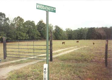
WHODATHOTIT!
I am sure a few more colorful names have been added to the area in Y2k..
Montgomery County, Arkansas will be getting a 911 system soon and the residences were
asked to give their driveways, lanes and roads physical address so the emergency vehicles can locate
the place. e.g. "Country View Rd" Hog Jaw. Today many community names and
ninety-three school districts are not found on maps but they tell
a part of the history of the area as well as the names of the Cogburn, Garrett, Howton,
Montgomery, Robbins, Waggoner, and Woodall cemeteries named after
Civil War veterans.
Centennial History of Arkansas By Dallas Tabor Herndon, pg 783 (1922)
MONTGOMERY COUNTY
Situated southwest of the center of the state is Montgomery County, which
was created by the act of December 9, 1842, from part of Hot Spring County.
It is supposed to have been named for Richard Montgomery, one of the
American generals in the Revolutionary war, who was killed at Quebec on
December 31. 1775. Its area is 784 square miles and its average elevation is
700 feet. On the north it is bounded by Scott and Yell counties ; on the
east by Garland and Hot Spring; on the south by Clark and Pike, and on the
west by Polk County. Farming and lumbering are the leading industries. When
the county was established the county seat was located where it is at
present, though the place was at first known as Montgomery. In July, 1850,
the county court ordered the name changed to Salem, but at the October term
the same year it was changed to Mount Ida. On October 26, 1921, the court
appropriated $40,000 for a new courthouse. Mount Ida was incorporated on
December 14, 1854, and in 1920 reported 'a population of 298. It is a
banking town, has a weekly newspaper, a flourmill, sawmills and woodworking
concerns, general stores, a public school, etc. Womble is the nearest
railroad station. Womble is an incorporated banking town about ten miles
south of Mount Ida. It is the terminus of a branch of the Missouri Pacific
railway system that connects with the main line at Gurdon, has a weekly
newspaper, large lumbering interests, general stores, etc., and a population
of 420. Black Springs, Caddo Gap, Oden and Washita are the principal
villages. The population of the county in 1920 was 11,112.
Montgomery is divided into the following townships: Big Fork, Caddo. Caney,
Center, Fir, Gap, Gaston, Hazel, Leverney, Mazarn, Missouri, Ouachita.
Parks, Polk, Rock Springs, Scott, Smith, South Fork, Sulphur Springs, Walnut
and Womble.
Alamo:
The
Alamo Community Reunion Picnic in mid October at the Alamo Missionary Baptist Church has
been an annual event since 1987.
Albert:
Now Albert Pike, a
recreational area nestled in the forested splendor of the Ouachita Mountains in the
southern portion of the Ouachita National
Forest. Visitors can hike, fish, camp, picnic or canoe on the Little Missouri River.
The Putman Cemetery 1885-1886 deep in the woods of the Ouachita National Forest
near Albert Pike and only 2 grave markers that were still legible. One was
Elijah Covington Putman. There were several other markers there most of which had
sunk into the ground or you could no longer read. 12 buried. Pike Co. ARGenWeb has an article on Gen.
Albert Pike.
Albert Pike was a lawyer and Masonic leader born in Boston, Mass. Dec.
29 1809, d. Washington, D.C. April 12 1891. He left New England Dec. in 1831 and
settling finally in Little Rock, AR where he rose to distinction as a lawyer. He was
a Calvary captain in the Mexican War (1846-1848) and a brigadier general in the CSA.
He published several volumes of poetry and the author of one of the standard versions of
the song "Dixie" which appeared in the Natchez Courier May 30 186? written with
a southern interest. His portrait is at the Albert Pike Memorial Temple, Little Rock. The
area was also known as Greasy Cove and moon shiners liked this isolated area.
Albert Pike's home in Montgomery County, Arkansas - The Record
(Garland County Historical Society) 1:18- & 3:18 Jan & Sept 1962
"Greasy Cove"... scene of beauty... and endless bootlegging. Arkansas
Democrat p.1, editorial section Sept 17, 1933
A Federal game refuge is maintained in the Muddy Creek area for the benefit
of hunters in the Ouachita National Forest. The Albert Pike camp on the
Blaylock and Albert Pike road near Norman is a recreational park where
swimming, boating and fishing where enjoyed by many visitors during the
summers. 1942 Montgomery County Mt Ida AR WPA History.
Avant see Buckville
Barnet
Bear City : May 1998 a black bear was shot
in Montgomery Co. Bear was annexed to Garland County in 1917.
Harington, Donald. Let Us Build Us a City: Eleven Lost Towns.
San Diego: Harcourt Brace Jovanovich, Publishers, 1986. Includes Bear City and Y City.
Big Fork: is in Polk
Co., was in Montgomery Co. prior to 1860, it was named for Big Fork Creek. Section 23 Twp
3S Range 28W. From Memdag to Norsk: A Historical Directory of Arkansas Post Offices
1832-1871 by Russell Pierce Baker.
Buckville
NW
Garland Co.
Black Springs:
Is probably the
oldest settlement on Montgomery County. In 1830 it was known as Caddo
Township. The census for that year recorded a population of 165 people,
classified as white and 24 classified as slaves. Located two miles E. of
Norman, nine miles SW of Mt. Ida on the Hot Springs and Dallas road near the Caddo River.
Merchants: F. Gross and Rowton Bros 1891. Population was 97 in 1990; housing units was 46 in 1990.
Cedar Glades - Harold
see Buckville
Caddo Gap:
Caddo Gap was first named Centerville. The area was first settled by Tula Indians
and there is a statue here built by the WPA in 1936 recalling the most westward point
DeSoto reached in the States in 1543. 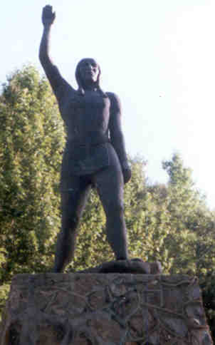 The
plaque on the base of the
statue reads
"DESOTO 1541 -A.D. Here Desoto reached his most westward point in the Untied
States. Here was the capitol of the warlike Tula tribe of Indians who fought Desoto
and his men. Relics found in this vicinity suggest the romance of past centuries
about which history will ever be meager and incomplete. Arkansas State Historical
Commission." The current bronze statute was erected in 1980. The original
copper statue had fallen during a storm earlier in the year.
The
plaque on the base of the
statue reads
"DESOTO 1541 -A.D. Here Desoto reached his most westward point in the Untied
States. Here was the capitol of the warlike Tula tribe of Indians who fought Desoto
and his men. Relics found in this vicinity suggest the romance of past centuries
about which history will ever be meager and incomplete. Arkansas State Historical
Commission." The current bronze statute was erected in 1980. The original
copper statue had fallen during a storm earlier in the year.
The actual "gap" for the Caddo River occurs just above the
Arkansas 240 bridge where the river passes through a narrow opening between the ridges,
and so does Arkansas 8 and the railroad. The Caddo River is a good
"family outing" float stream and the most popular float is the six-mile journey
from Caddo Gap to Glenwood. Another photo of
statue with
feather.
without
1968 Map Along
the west bank of the Caddo River (river right), in the area known as Caddo
Gap, thermal springs bubble up into the river at or just below the surface.
Naturally occurring thermal springs rise from the riverbed approximately 200
yards northwest of the old low water bridge. The hot springs average
ninety-five degrees Fahrenheit and can be felt as the thermal waters rise
from the depths into the river.
In 1851 Balaam Strawn built a grist mil at the lower narrows on the
Caddo River. Adjacent to this was a two story store, a trading store for furs, a
blacksmith, a Methodist church and the Centerville post office post. John Shipp was the
first postmaster. After the Civil War the name was changed and the post office was moved
one half mile west due to the possibility of flooding. Middleton Reynolds had a
grist mill here. David Bassinger built a log store, which was also a post office and
the New Hope Masonic Lodge No. 42 met on the second floor, beside his large two story
house. His daughter was Susan Shuffield and her daughters were Belle and Lue.
William A. Hopper moved into the county from TN in 1851 and settled near Buttermilk
Springs, later brought 160 acres in the Manfred community then a large bottom farm on the
South Fork, later know as Gibbs farm and then the Ira West farm. He built a large
house, a grist mill, cotton gin and a small store. After Bassinger died Hopper purchased
the store. Reference: Extracted from an article written by the late
Julia Biggers, a former teacher for the Caddo Gap School, for the Glenwood Herald,
Aug 19, 1971and includes a photo courtesy of late Clarence Hopper of the Bassinger store.
Today the pine log Bassinger store built about 1855 is still standing but was
moved to its present location in 1910.
Place names--Caddo Gap - Arkansas Gazette p.5F June 29, 1980
Towns vanish, memories cling: Caddo Gap, 1851 to 1906 by Biggers, Julia -
Record (Garland County Historical Society) 26:24-28a 1985 - history and
families
Caddo Gap to have a niche in history - Arkansas Gazette p.1C
June 5, 1966
Picturesque Caddo Gap by Osra Cobb - Arkansas Gazette Magazine p.1 ;
p.3 May 19, ; May 26, 1935
Highways and byways - Arkansas Democrat Magazine p.10 Sept 9, 1962
Caddo Gap, Ark.
Small-town basketball - Arkansas Democrat p.1E Dec 7, 1958 - Caddo
Gap
The toll bridge on the Caddo by Otto Ernest Rayburn. Arkansas
Historical Quarterly 13(2):160-163 Sum 1954. M. M. Chandler and the
Narrows; 1870-1884, Chandler built and ran toll bridge at Caddo Gap.
1851: Caddo Creek, of Arkansas, rises near the s. border of Montgomery Co.,
and flows through Clark Co. into the Washita River.
Caney
Chapmondville:
Was a village 10
miles from Hot Springs on the Mt. Ida Rd. Thomas Chapmond was a general merchant,
George Washington
Maddox had a cotton gin, saw and grist mill. Dr. A. J. Pole was a physician and
surgeon for the community.
Reference: The Goodspeed Biographical
and Historical Memoirs of Western Arkansas 1891
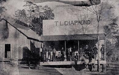
The General Store. It was probably taken between
1891 and 1900.
The 1900 Business Directory lists T.L. Chapmond as having a store at Washita
and a store at Story
Photo courtesy of Eunice KC who is researching
the Chapmond line.
Thomas Louis Chapmond
m. Allie Vanderslice 1873. Children were:
Alfred Berry Chapmond , Dora E. Chapmond and Louisa E. "Lura" Chapmond .
In 1883 he married Almeda M. Irons, children were:
Thomas Earl Chapmond, Eva Allie Chapmond, Oscar Louis Chapmond and Mary Delsie Chapmond.
Alfred B. Chapmond married #1 Sadie Josephine "Josie" Whittington in 1896 #2 Carrie Bell Shepard in 1903 .
Dora E. Chapmond married #1 Frank D. Cothern in 1897 #2 Gibson Witt Sr. in 1908.
Louisa E. "Lura" Chapmond married #1 Dr. Eugene Calton Tolleson #2 Louis Napoleon
"Poley" Burnett
Clagett
Crystal Springs: Now in Garland County.
Located half way between Hot Springs and Mt Ida and 4 miles from Bear.
Dilce: Located half way between
Silver and Mt. Ida.
Fancy Hill: Four
miles west of Hopper on Highway 240. Cemetery. Cogburn and Waggoner names dominate.
Fannie:
Gaston:
Church
Ghent
Glenwood: Population about 1,500 in Pike
County just over the county line. The town created in 1907 was first called Holly.
The A. L. Clark
lumber company built many
of the houses, a church and school. Downtown businesses support the farming area and
the sales barn is open to the public. In the fall there is the Sawmill Days festival.
Hickory Station: Cemetery. 33
miles SW from Hot Springs and 22 miles from Mt. Ida. G.A. Tackett merchant, and mill
man, George B. Willis, assessor resided here. Reference: The
Goodspeed Biographical and Historical Memoirs of Western Arkansas 1891.
Hog Jaw: Located on the south side of the
Ouachita River from Oden. A tramp who wandered through the area and as he went from
house to house, everyone fed him hog jowls, (the fatty part under the pig's jaw) so
he called that area Hog Jaw when he left. Another version:
The
origin of the name 'Hog Jaw' supposedly came from Sam Goodner. He was in charge of a
road crew in that area many years ago-and when lunch time came around, they ate lunch at
the nearest home. The meal always consisted of some kind of beans with hog jowl, and
he started calling the area Hog Jaw. (Another version by an older man, (Singleton),
was that a itinerant wheat thresher gave it the name for the same reason mentioned above.
Mount Olive Baptist Church is in the vicinity with the cemetery across the road.
Chat Lawrence Standridge from Pine Ridge b. Oct.. 28 1888 said her
father named two places. "When they was threshin' wheat-everywhere they'd thresh
wheat they'd eat their dinner. And they'd always have turnip greens and hog jowl cooked
for dinner. And they eat it too. And Pa called the community Hog Jowl. And everything Pa
put a name on, well, it just wore.... They's a bunch of little hills between Pine Ridge
and Mena -there's seven of 'em. Now then they're graded down till you can drive right on.
But in those days when we'd get to them it was a dead pull-over the top, and over the top,
and over the top. Elevation is 786 feet.
Hopper:
Just over 300 headstones in the
Hopper Cemetery. Coffman, Davis, Golden, Hollifield, Hopper, Putman, Shields, Thomas,
Tollerson, Tweedle, Walker names dominate. William (Jack) Hopper had a general store
in the area and mail was left here so the community took on the name Hopper.
Huddleston
Hurricane Grove: 4 miles east of Mt Ida
toward Silver on Highway 270. Here the soil "is black as the bible".
A tornado struck the Ouachita Mountains on May 8, 1882, wiping out a section
of what is today the Ouachita National Forest giving Hurricane Grove its name.
The path of the storm was about one-half mile wide by approximately 14 miles
long through a stand of virgin shortleaf pine.
Joplin:
On Highway 270 12 miles east of Mt.
Ida. Cemetery.
Liberty:
SE of Norman. Liberty Church and
cemetery here. Collier, Dutton, West,. Wilson dominate.
Love:
Post office was formed in
1873 with Josiah H. Demby as postmaster.
It
was 8 miles west of Mt Ida on the main road to Hot Springs. In 1879 Silver
City was 2.5 miles N.E. and Mt. Ida was 9 miles west. In July 1879 John W.
Brady became postmaster of Silver City. Later changed its
name to Silver.
Lucky: In the SW corner of Montgomery
County on the Memphis-Dallas & Gulf railroad line 25 miles from Mt. Ida and 25 miles
from Hot Springs. Had a steam saw, grist-mill with cotton gin owned by Short &
Montgomery as well as a Post Office and a "pin-hook" store. Reference: The Goodspeed Biographical and Historical Memoirs of Western Arkansas 1891.
Mauldin
:
Existed from about 1922 to1933 and was once a thriving little company town with a company
store, office, church and school an about one hundred and fifty people. The Caddo
River Lumber Company had acquired much of the land in western and northern Montgomery
county so built a railroad from Norman to the future town of Mauldin. The economy was built
on the forestry industry and men of the town earned their living cutting down the trees
and taking them to the hardwood sawmill in Mauldin.
Mazarn:
In SE Montgomery County.
Mount Ida
: County seat. Population: 924.
Alt 663ft. In 1923 the building of a new stone courthouse, in the town square, commenced and is now listed on
the National Register of Historic Places. 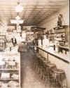 County records remain intact from July 1845 to present.
"The county seat was established on its present site in 1842, the year the county was
created and to the place (now Mount Ida) was given the name Montgomery courthouse in 1850,
the name of the town was changed to Salem but in the same year was changed back to Mt Ida.
Transcribed from plaque placed by Arkansas Centennial Commission 1886-1996 in front of the
courthouse. Granville Whittington established the first post office in the county in
1842. He had opened a store in the area in 1832. It was named Mount
Ida after a hill near his former home in Massachusetts. 1890 there were two hotels,
Watkins Hotel and the Smith House and Methodist and Christian churches. 1907 Andy J. Smith
was a merchant and Thomas P. Saudlin a blacksmith, G. H. Speer, Jr was county
clerk. 1913 C.J. Watkins was a hotel proprietor and W.A. Brakefield a merchant and T.P.
Saudlin deputy clerk.
Mt Idy is a local pronunciation.
County records remain intact from July 1845 to present.
"The county seat was established on its present site in 1842, the year the county was
created and to the place (now Mount Ida) was given the name Montgomery courthouse in 1850,
the name of the town was changed to Salem but in the same year was changed back to Mt Ida.
Transcribed from plaque placed by Arkansas Centennial Commission 1886-1996 in front of the
courthouse. Granville Whittington established the first post office in the county in
1842. He had opened a store in the area in 1832. It was named Mount
Ida after a hill near his former home in Massachusetts. 1890 there were two hotels,
Watkins Hotel and the Smith House and Methodist and Christian churches. 1907 Andy J. Smith
was a merchant and Thomas P. Saudlin a blacksmith, G. H. Speer, Jr was county
clerk. 1913 C.J. Watkins was a hotel proprietor and W.A. Brakefield a merchant and T.P.
Saudlin deputy clerk.
Mt Idy is a local pronunciation.
Watkins Bros., and Mrs. G.W. Golden, dealers in dry goods, groceries
etc.,
C.A. Abernathy, dealer in lumber, lath and shingles, and also in flour.
Watkins and Witt, attorneys at law
R.C. Roberts, physician and surgeon
N.B. Riffe, general blacksmith and woodworker
Prof. W.G. Fail and daughter Annie, directs Mount Ida High School
Sheriff Golden. Reference: The Goodspeed Biographical and Historical Memoirs of Western Arkansas. 1891
Twenty the 20% of the 64 street names in Mount Ida are named
after trees but some are probably named to honor early settler families:
Abernathy, Featherston, George, Golden, Graham, Guinn, Hall, Irons, Jackson,
Powell, Ray, Scott, Simpson, Smith, Van Buren, Watkins, West,
Whittington
Mimosa
New
Norman:
Population under 400. Womble was
formed in 1907 and prospered as the railroad terminated there. Businesses were relocated
from nearby Black Springs to Womble about the same time as the new railroad.
First called Womble after brothers who lived in Black Springs and owned the 'Womble Timber
and Land Co.' The name was changed in 1925. A man with the last
name Norman provided money for the town at a time when it was badly needed, and
many feel that is why the town changed its name. The Presbyterian Church in Norman
celebrated its 90th year in 1998 and there are detailed articles in the Montgomery County
News August, 1998. Dr. John Tilman Barr was a circuit pastor for 51 years.
The library and town square are listed on
National Register of Historic Places.
The Caddo Valley Academy an old school building is currently being restored.
Next door is the remains of an old dormitory that house students who lived to
far to walk. The Caddo River,
canoeable, runs behind the town and has caused flooding in the past. Melba's Cafe
was a meeting place
with "home" cooking, but now closed. Big 4 Cafe
Norman to Lake Ouachita
postcard
Annual Report of the United States Civil Service
Commissions - Page 141. 1916
INVESTIGATIONS OF ALLEGED VIOLATIONS OF THE CIVIL-SERVICE LAW AND RULES.
Womble, case of Water B. Womble, fourth-class postmaster.
Charge: Undue activity in political affairs.
Date of charge: November, 1915.
Result: Upon investigation by a post-office inspector, it appeared that Mr.
Womble, with his brothers, started the village which bears their name, and
had been very active in the advancement of the village ever since its
founding. He was appointed postmaster, elected mayor, justice of the peace,
and school director, and was at one time chairman of the county central
committee of his political party. It was also found that he was active in
the interests of his brother's candidacy for a county office by soliciting
votes on election day in March, 1914, and that he was very active in several
attempts to have the county seat removed from Mount Ida to Womble, he having
participated in the political campaigns before two special elections called
for the purpose of voting upon the proposition, and that he secured and paid
for the printing of campaign circulars. Mr. Womble claimed that he did not
consider himself in the competitive classified service until after he had
passed an examination and been accepted by the Post Office Department, in
May, 1914. However, the political activity restrictions of the civil-service
rules applied to this postmaster from October 15, 1912, on which date his
position was made competitive, regardless of the date on which the incumbent
was given a classified status. The commission recommended that he be
reprimanded and warned, and this action was taken.
Oakwood :
Once
a small community with about 100 people in 1900 with a post office established 1894 and
discontinued in 1914. Near the present Montgomery / Garland Co. line six miles east of
Story on Hwy 298. First left after Irons Fork Creek, and go 1� miles. There was a
"creek" and the school, a church and some other buildings there. The Odd Fellows
Lodge #362 members met at the
Mt Zion Baptist Church. The creek kind of divided up the "town" and was usually
no problem to cross but it could separate the town during heavy rain or flooding. The
first school was near the cemetery which today has approximately 100 graves. Lat 344145N
Long. 0932352W Twp1N R23W Sec25. NW� of
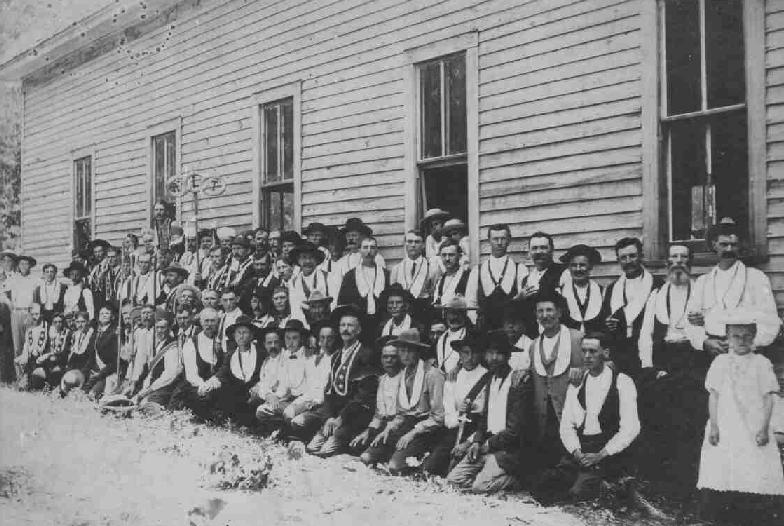
NE� Here is another photo
of an Odd Fellow group in Montgomery County.
Oden :
Alt 771ft. The general store, old rock bank
and many barns make good photographic subjects. Picturesque Brushy Recreational Area is a good place for a family reunion but
bring water for drinking purposes. There is a good hiking trail, part of the
Ouachita trail, (marked with blue paint) from old Forester Road down to the recreational
area. Brushy Cemetery and the Brushy Creek Missionary
Baptist Church are located three miles north of Oden and Foster, Hickey, Hill, Singleton,
Vincent and Wilhite names dominate. 1891 merchants were H.S. Goodner, Philpot & Sims and James Allen.
In the 1920s store owners were A.J. Plemons, S.N. Hickey, A.C. McKay and I.C.
Chapman. Taylor Town in Oden was named after C.C. Taylor who built a few economical homes in the
1960s & 1970s.
Elevation is 761 feet.
Population was 126 in 1990
Housing units was 66 in 1990
US Postal
Service Zip Code is 71961
Biggest employer: The local Oden School.
In the 1970s the Oden store 'Rusert's Grocery', was run by Paul Rusert.
The house next door heading east toward Pencil Bluff was Carl Willhite's and next to him
was Elder M. Norman home and his workshop out back were he engraved tombstones. The old
bank closed down many years ago after it had been robbed. Across the road where the new
Post Office now stands was a vacant lot where an old house had burnt down. Across the road
west of the PO today was Frank Elder's service station with the Post Office in the back
room and Frank Smith, Postmaster. One door west was a hardware store, then a variety store
and a gas station. On the north side of the road was C.C.Taylor's appliance store and
Irvine Sickafus barber's shop. Opposite the bank on the road to Brushy was Granville
Mullenix house with a little hair saloon. Further north Carl Willhite's small store,
Tarten's Garage. and Willis Willhite's house. Willis and Carl were cousins.
Oden is a tiny village on the banks of the Ouachita River, in Montgomery
County. Incorporated seventy five years ago in 1929. It is impossible to get lost there. The entire county retains its friendly atmosphere and
rural past. It's safe to say that any of the town's 200 residents would be willing to give directions provided visitors lose their way.
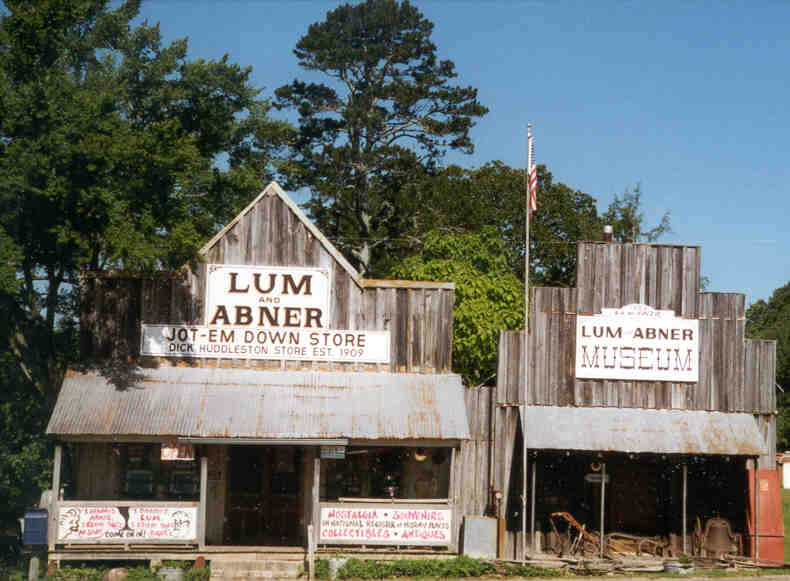
In Montgomery County, Ark. the biggest tourist attraction is the Lum and Abner
Museum at Pine Ridge another nine miles east down the road is Oden and
Oden, is about eight miles west of Mt Ida. Churches outnumber gas stations, 2-1. There is no police department.
The village is covered by the Montgomery County Sheriff's Department and an all-volunteer fire department with about a dozen
fire-fighters. And by far, the biggest building in town is the elementary school. This is a community where I would say everyone looks out for each other.
It's a quiet neighborhood, really.
At the Deli towards Pencil Bluff some men mostly of retirement age, gather, drink coffee and catch up on the local goings-on. for an early
morning cup of coffee and a common conversation topic is the weather. You hear a lot about everything. They love to talk about the weather.
People get to be people out here.
Ophir
Pencil Bluff
: Named after the nearby slate
bluff overlooking the Ouachita River. Formerly called Sock
City. Residents did not like the undesirable name of Sock City
because of its gambling-related origin. They began to push for a name change
which eventually did happen. Called "Sock City" in 1940 and it was called
"Pencil Bluff" by 1948. The name changed when the first post office opened,
which was in 1949.
Pine Ridge: Formerly Waters until April 26, 1936.
Alt. 8840ft Located in western Montgomery County is
only slightly smaller now than it was in the early 1900s and it is small. If you blink you
will miss it. There was a saw mill, general store, grist mill,
blacksmith shop, and the other services necessary to a farming community where change
occurs slowly. Dick Huddleston built his store in 1909 and it became the hub of activity
in the community. The county local newspaper is still published every Thursday and way
back in the1930s Dick would read aloud to the group of locals huddled around the stove.
Dick purchased groceries from a wholesaler named Mr. Goff. Tuffy Goff, his son, got the
inspiration for the radio comdey hour from the day to day scenes, dialects and
customers observed at the store. Tuffy was "Abner" the one with the little white
beard. Lum and Abner Jot em Down Store and museum is located here. The museum has a 1897
school district script receipt book, 1869 tax notices, 1894-1900 ledger for A.J.
Risenhoover's store and post office, 1923-24 school record book, displays on local history
and Lum and Abner and more. Postcards
of Pine Ridge years ago are for sale as well as postcards
of local characters from the Lum and Abner era. US Postal Service Zip Code is 71966 for
Pine Ridge. Maps and books are available and the Post Office inside the store is still
active. Some of the local residents who collected mail from the postmaster, Ashel J.
Risenhoover, in 1908 were: A.A. Bates, R. Bullue, William Clayton, Bob Cranford,
C.L. Fountain, B. Gamble, John W. Gilliam, J.C. Guinn, Marion F. Hill, James R.
Huddleston., J. E. Johnston, J.B. Mckinzie, Fannie Morris, Wallace Morris, James J.
Mullenix, William New, W.M. Rigley, Lena Risenhoover, Maggie
Vincent, G.A. Willhite, L.D. Willhite and W. Williams. The cemetery is located
� mile
down a gravel road, the "Old Waters Highway," between the outhouse
and the museum and near the Pine Ridge Baptist
Church and Union Baptist Church.
and museum is located here. The museum has a 1897
school district script receipt book, 1869 tax notices, 1894-1900 ledger for A.J.
Risenhoover's store and post office, 1923-24 school record book, displays on local history
and Lum and Abner and more. Postcards
of Pine Ridge years ago are for sale as well as postcards
of local characters from the Lum and Abner era. US Postal Service Zip Code is 71966 for
Pine Ridge. Maps and books are available and the Post Office inside the store is still
active. Some of the local residents who collected mail from the postmaster, Ashel J.
Risenhoover, in 1908 were: A.A. Bates, R. Bullue, William Clayton, Bob Cranford,
C.L. Fountain, B. Gamble, John W. Gilliam, J.C. Guinn, Marion F. Hill, James R.
Huddleston., J. E. Johnston, J.B. Mckinzie, Fannie Morris, Wallace Morris, James J.
Mullenix, William New, W.M. Rigley, Lena Risenhoover, Maggie
Vincent, G.A. Willhite, L.D. Willhite and W. Williams. The cemetery is located
� mile
down a gravel road, the "Old Waters Highway," between the outhouse
and the museum and near the Pine Ridge Baptist
Church and Union Baptist Church.
Red Bird
Rocky
formerly
Gibbs.
Approximately 4 miles east of Sims
on Hwy 88. "Presently, the community seems just a continuation of the communities of
Sims to the west and Washita to the east. The old schoolhouse has rotted and the site
cleaned up. I do not know why there has always been a conflict of opinion on what the
community should be named. It seems that folks related to Gibbs want to call it Gibbs.
Everyone else wants to call it Rocky. Greenberry Gibbs and G.W. Gibbs were
some of the first people to live in the Rocky/Gibbs community. I believed that
they were related. We believe the
community got its name (Gibbs) because Greenberry had the Post Office in his house. Sallie
H. West was the first appointed Postmaster there. Greenberry's first wife, Sarah Ann
(Jones) Gibbs, helped him run a cotton gin, grist mill, and large farm with orchards. They
had the following children: Louana "Lewaney", Martha, Green Berry, Roland, Sally
and Telithia." On information courtesy of Doug
Anderson.
Rubie
Silver City: During the late 1880s there were
several large silver mines in the area. The 1880 census showed
Central Township had 48 miners and only 27 farmers and the population of the
county had risen to 5,743, residents, including 408 African-Americans and
this was due to the silver boom that occurred in the 1880s.
About 1915 the silver ore started playing
out so people left There were grist and saw mills that were powered by water from
Murphy Creek, that flows through the area. Where homesteads use to stand there may be
water wells over 100' deep and private silver mine shafts 200' covered in vines or
caved in. Today people dig in the area looking for quartz. A lot of cotton was
grown in the hills and now no cotton is grown in Montgomery County.
newspaper clipping
Silver City is 8
and a half miles east of Mt. Ida and 32 miles west of Hot
Springs., 10 years ago there was a mining camp of considerable magnitude but now
practically abandoned. Ores of this district consist of galena, gray copper, chlorides,
etc. Mines included: The Waterloo, Silver King, Montezuma (patented), Mammoth, Walnut,
Diamond Jo, and several others. About 1 mile from Silver City is situated Elnora City, where the Elnora mine is located. Reference:
The Goodspeed Biographical and Historical Memoirs of Western
Arkansas. 1891
Sims
Slate City
Slatington:
A company mining town
early 1900's. Slatington, an extinct town deep in the mountains of Montgomery
County, is evidence of a futile effort to operate a commercial slate quarry
Snow
Story: From "Montgomery
County, Our Heritage", there are some comprehensive biographies about
JAMES STORY and his wife CALIFORNIA STORY who came to Arkansas from West
Plains, Missouri in 1870. Other biographies include Claude Roy Story
(b.1899), Lewis Clark Story (1872-1956), and William Fern Story (1914-1976),
all of them lived at one time in Story, AR. The writings also include a
history of Story School District, and the Story Church of God.
On August 27, 1886, James Story received a permit to
establish a post office at Story which was named Story, Montgomery County,
with Nellie Story appointed postmistress. It has remained Story since that
time. There were sawmills, gins, and gristmills since the 1870s. General
stores were owned by Jim Logan Blakely, Columbus (Lum) Story, and several
others, including an Owen Story. (The complete article was submitted by
Jewell Story Phillips.)
The book also has a few paragraphs and photograph of the Story School. The
first school was a one-room structure located two miles north of Story on
land donated by Franklin Lamb. Several years later this school was replaced
by a one-room frame schoolhouse which was built east of Story near the
present locations of the churches. The Story School was established before
1885, consolidated with Mount Ida November 23, 1929, but remained as a wing
school until 1965. Teachers in the school including Jewell Story and Jewell
Smith Story.
The book has several pages of biographies of Story families. The earliest
Story to arrive in the area was James and California Story who came to Yell
County near Rover, Arkansas, in 1870. They came in covered wagons from West
Plains, Missouri. They immediately moved to Montgomery County, Arkansas
where Story is now located. They acquired some land, 160 acres, under the
Homestead Act. James served in the Confederate Army. They had five children:
Isabelle, Dora, William Henry, Sidney Columbus (Lum) and Eddie. After
California died in 1883, James married Nellie Myers Neese in 1884. There was
no post office there so on August 27, 1886, the post office at Story was
established under the name of Story. Nellie Story became the first
postmistress.
Sulphur Springs:
17 miles west of Norman.
There use to be a school here. Names in the cemetery include Edwards, Hoyle, Hughes,
Hutchinson, Rainwater, Wigger.
Tackett : Near Hickory Station
Washita:
At intersection of Hwy 88 and
27. In the 1920s Washita was a thriving community with two hotels, a
cotton gin,
bakery, general store, two doctors Dr. Steely and Dr. Sullivan. Ouachita means good
hunting /good fishing grounds. Game here includes deer, 'possum, mink,
squirrel, red and gray fox, bobcat, wild coon, duck, quail, dove, wild
turkey. Buried at the West Washita Cemetery is George Washington Giffin a Union veteran (IN. I Co. 81st Reg. Vol. Inf.). A CSA veteran A.Y. Hays (4th
AR Inf. Montgomery Co. Hunters) is buried here.
The East Washita Cemetery is on Corps of Engineers land, at the boat dock at Washita, and
is in terrible shape. "We do not want this cemetery to be lost in
time." There are four graves with headstones in this abandoned cemetery
including Drew Allen Wallace (Co. D. 4th Reg. AR Calvary). Drew's
wife, Patience is also buried there. Elevation is 582 feet. Washita P.O.
closed 30 September 1955.
Welsh:
Located in the
SW corner of Montgomery County on Highway 70 between Glenwood and Hot Springs.
White Plains see Buckville
White Town: Between Oden and Pencil Bluff, nearly in Pencil
Bluff. There use to be a general store here.
Montgomery -
There are
eighteen Montgomery Counties in the USA.
In keeping with the tradition of naming townships after military and
political leaders Montgomery County, Arkansas was named in honor of a Revolutionary War
(1775-1783) hero, General Richard Montgomery (1738-1775). Born in Swords, County Dublin,
Ireland. The 2nd New York marched with General Montgomery's army on the successful
drive through the Champlaign Valley to Fort Saint John. There they laid siege to that
British outpost which surrendered after two months of steady rains, floods, and sickness.
In November, Montgomery pushed the army forward with the promise of provisions and
quarters. Montreal fell with little resistance and they arrived with 300 troops to
join Colonel Benedict Arnold's forces from Maine and closed on Quebec. Arnold's
forces attacked the strongly fortified city, only to have the assault end in disaster. A
hundred Americans were killed, including Montgomery while leading an assault on Quebec's
defenses in a blinding snowstorm, 4 AM on 31 December 1775. Four hundred were
captured; and many were wounded, including Arnold, who fell as he stormed over a
barricade, a ball through his leg.
"Follow the saw with the
plow" Was a truism in the early days of
Montgomery and Polk County. Farmers would prepare the land they homesteaded
and plant cotton. Today there isn't any cotton grown in Montgomery County. During
the depression many of the farmers moved to California after they sold their farms to the
national forest service. Now Montgomery County is now 63% national forest
land. There use to be about 83 school districts in the county when the children had
to walk to school and the population was greater. The three school districts today are
Caddo Hills, Mount Ida and Ouachita Rivers School District. [Ouachita River
School District - Area schools in attendance included: Acorn, Cossatot River,
Mena, Oden and Umpire with over 300 students in attendance.]
Montgomery Co. ARGenWeb Project
Timeline
TOP
If you know any history on any other communities and
towns and the origins of their names, please let me know and I'll add them.
USGENWEB NOTICE: In keeping with our policy of providing free information on the
Internet, data may be freely used by non-commercial entities, as long as this
message remains on all copied material. These electronic pages cannot be reproduced in any format for profit or other presentation.
 Arkansas Place Names by Ernie Deane.
"From Apt to Zink, by way of Oil Trough, Toad Suck, Smackover and
Ink." Ernie began collecting Arkansas place names in the 1950s. Tells
how and why places got their names. A good source of information for the
researcher who wants to know about that Arkansas town with the funny
name.
Arkansas Place Names by Ernie Deane.
"From Apt to Zink, by way of Oil Trough, Toad Suck, Smackover and
Ink." Ernie began collecting Arkansas place names in the 1950s. Tells
how and why places got their names. A good source of information for the
researcher who wants to know about that Arkansas town with the funny
name.
What's in our name? Arkansan? Arkansawyer?
Arkansian? Arkansasan?
STORIES BY ELLIS WIDNER
The Arkansas Democrat Gazette 27 December 2007
Who are we? We know where we live - Arkansas. We know how to pronounce it -
Ark-an-saw. The state's General Assembly made that pronunciation and the
current spelling a matter of law in 1881 after an 1880 report from a joint
committee appointed by the Arkansas Historical Society and the Eclectic
Society, whose members included Judge U.M. Rose. So what should we call
ourselves? That's where things get complicated. The word Arkansas is based
on a French interpretation and spelling of an American Indian word (probably
from the Quapaw); it is spelled differently than it is pronounced. When the
Legislature settled on the state's spelling, it ruled out other versions
that included Arkansaw, Arkensaw, Alkansas and Akansea. No wonder there are
several words to identify residents and natives of the Natural State.
We pronounce it Ark-an-saw; the standard way in English is to add `an.' To
get to a word like Ar-kansan, it changes into a mispronunciation of the
state itself ... and that becomes offensive to some people." The words
Arkansan, Arkansawyer and Arkie are in common use. Each term has its
partisans and its detractors. Other names have surfaced, such as Arkansasan
(Ark-an-saw-an) and Arkansian, each presented with what supporters say is
historical or linguistic logic and precedent.
"Through the 200 years of our state's history people haven't understood the
evolution of the word Arkansas, so we end up with works like Arkansian,
Arkie, Arkansan, Arkansawyer," Westbrook says. "We don't know what to call
ourselves." Westbrook says that following the official pronunciation of our
state, Ark-an-saw - with the final "s" silent - "tradition is that you add
`an' to the `ah' or `aw' sound. So, if we add it to the Arkansaw
pronunciation, you would call it Ark-an-saw-an, spelled Arkansasan."
WHAT'D YOU JUST CALL ME?
You'd be well-advised not to use the word Arkie around Bill Bowen of Little
Rock. "It's offensive," says the former lawyer, banker, chief of staff for
Gov. Bill Clinton in 1991-'92 and law school dean for whom the University of
Arkansas at Little Rock's law school is named. "Arkie is derogatory, it goes
back to Depression era, Arkies and Okies fleeing poverty and the Dust Bowl
to pursue the harvest ... the picture it painted is one of illiteracy and
broken-down cars heading west," he says. "I favor discontinuing the use of
negative terms." That negativity, Bowen says, was also fueled by
Greenwoodborn radio comic Bob Burns, who spun tales about people and life in
Arkansas in the 1930s and '40s. "He brought us the worst kind of notoriety,"
Bowen says. He recalls that during his time in the Air Force, when other
airmen found out he was from Arkansas, "they would say `You are? But you
have shoes on.'" Westbrook agrees, adding Lum and Abner and H.L. Mencken to
the list. Writer Donald Harington says that "all literate Arkansawyers for
many years have preferred calling themselves that," citing noted Arkansas
writers John Gould Fletcher, Vance Randolph, Ernie Deane and Neil Compton.
"Arkansan is not only wishywashy and P.C., but also makes one sound like
some kind of artificial Kansan. Arkansawyer is the only proper name for us,"
says Harington, whose books include The Architecture of the Ozarks and Let
Us Build a City. He is a distinguished professor of art history at the
University of Arkansas at Fayetteville.
A REGIONLESS PEOPLE?
"There was a newspaper in the 1850s in Fayetteville called The Arkansian,"
he says. The earliest reference Dillard knows of for Arkansawyer was
uncovered by Wintory, who found a reference to "the Argenta Arkansawyer" in
a Nov. 25, 1882, article in the Arkansas Democrat. Dillard says Arkansawyer
"may be an informal, colloquial thing more commonly used in the Ozarks. It
seems a purposeful rejection of a name that has historical precedent ...
Arkansian and Arkansan. I think Arkansawyer is a reaction to Kansas; Kansas
wasn't popular here because of the pre-Civil War violence in Kansas and the
fact Kansas troops fought in Arkansas during the Civil War. The `ian' ending
and Arkansawyer may be a conscious rejection of association with Kansas."
The fact that we are still asking the question, Dillard says, "may be
related to the fact that Arkansas people are neither Southern nor Western
and it doesn't have a strong unified history like Texas." As a result, he
says, the people of Arkansas are unable to define themselves and are
unwilling "to delve into our very mixed heritage." Our legislators have
tried to pin down a name for us, too. In 1959, Rep. W.H. Thompson of
Poinsett County sponsored a resolution to make Arkansan the official name.
It was approved by both houses but vetoed by Gov. Orval Faubus, who
reportedly favored Arkansawyer, according to a March 12, 1965, story in the
Arkansas Gazette. On Jan. 18, 1965, the Arkansas Senate adopted Prescott
Sen. Olen Hendrix's measure to have our inhabitants known as Arkansawyers,
but the resolution never came up for a vote in the House. For the time
being, at least, Arkansan seems to have the upper hand. It's used by many
newspapers and radio and television stations. That, Wintory says, could be
as much the product of a reaction to negative images of the state evoked by
Arkie and Arkansawyer. Wintory says he is bothered by words such as Arkansan
that change the pronunciation of the state's name, but says, "ultimately,
it's a social consensus." For now, at least, that seems to point toward
Arkansan.
REMEMBERING ARKANSAS History of state's post
offices is a social history, too by
Tom W. Dillard
The Arkansas Democrat Gazette 16 July 2006
Arkansas Post Offices, From Memdag to Norsk, the book, was
compiled by Russell P. Baker of the Arkansas History Commission in Little
Rock. The copy I bought is a revised edition, published in 2003 by the
Arkansas Genealogical Society (P.O. Box 17653, Little Rock, Ark. 72222).
Other than a brief introduction and illustrated explanation of how the book
was compiled from a variety of sources (since there is no reliable
encompassing government list), this truly is an alphabetical listing of
every known post office ever established in Arkansas.
More than 6,500 Arkansas towns have had post offices at one time or another.
Many of these turned out to be short lived. Accident, in southern Montgomery
County, had a post office from 1888 to 1890, but that short duration might
have been because of the unfortunate choice of name. The settlement of Ada
in Stone County (not the ones by the same name in Conway, Montgomery or
Washington counties) had an even shorter life; it was born and died in the
same year, 1907.
The postal system has changed a great deal over the years. Until well into
the 20th century, politics played a major role in naming local postmasters.
Indeed, dispensing federal jobs - especially postmasterships in larger towns
- became the glue that held together the Arkansas Republican Party during
its lean years after 1874 when the "Redeemer" Democrats regained power and
ended Reconstruction. "Post Office Republicans" became their unfortunate
nickname. Smaller post offices, which is to say the great majority, were not
considered political plums - and the income from such postmasterships was
minimal. A general store owner often doubled as the postmaster, and the mail
was distributed along with groceries. Having a post office in a store meant
that people often gathered there, with older men hugging the potbellied
stove in the winter and whittling away at sticks on the front porch during
the warm months. Many of the small post offices were named after the first
postmaster. Scobey, in Cleveland County, was named for John P. Scobey.
Harbour in Calhoun County, which existed from 1886 to 1904, was the namesake
of Postmaster John H.S. Harbour. Post office names changed frequently.
Rohwer, the Desha County community that became a large relocation camp for
interned Japanese-Americans during World War II, was originally named
Harding.
The book does not address how Ink in Polk County got its name
- which has been a source of speculation for years. The story, which seems
too good to be true, is that the person completing the paperwork for a post
office took literally the form's direction that the line reserved for the
name be filled in with ink. Records do not address that probable bit of
rural mythology, but they do record that the Ink post office was established
in 1887 and closed in 1967. Interestingly, the original plan was to name the
post office Melon, but the authorities rejected that name. I have always
wondered how Eros, in Marion County, got its name. Baker tells us the post
office was intended to be named Sweet Water. In my mind I can see the
disappointed locals getting together in 1880 and deciding to one-up the
postal authorities by giving the town a name that might have raised eyebrows
among the upright Victorians. Possibly the most famous post office in
Arkansas today is at Romance, in rural White County, which does a booming
business each year leading up to Valentine's Day. The name was chosen in
1884 when the original suggestion, Clifty, was rejected. The post office at
Vimy Ridge in Saline County was originally named Germania, reflecting the
large number of German immigrants who settled in the area. During World War
I anti-German sentiment resulted in a petition to change the name of the
post office. To add insult to the injury, the post office was renamed in
honor of a recent battle in which the Allies defeated the Germans.
Montgomery County - Arkansas Gazette
p.9B Sept 16, 1945 Names, Geographical
Otago Daily Times 13 February 1941 ARKANSAS FARMER
FLIES TO MARKET
Caddo Gap, Ark. When Parks Shields of the Hopper community wants to market
a basket of eggs, can of cream, or other products from his garden and farm,
he doesn't straddle a mule or crank the family flivver as his neighbors do.
He merely goes to his private airplane hanger, back of the barn, swings open
the doors, steps on the starter of his small plane, taxies across the
meadow, and within less than 30 minutes is in Hot Springs 40 miles away.
Time was when travel from the Hopper community was exceedingly slow. It took
two or three days for the older member of the Shields family to make the
round trip in a linchpin wagon. But now the rough topography of the Ouachita
hills is no barrier. Wings have replaced wheels and even Little Rock is only
an hour away.
Parks Shields is a young, air-minded farmer of the hill country. His boyhood
ambition was to own and fly his own plane. He took flying lessons at the air
field in Hot Springs and obtained a pilot's license. Then he obtained a
plane, for his private use and built a shed hangar and landing field on his
farm. He visits local fairs and picnics in the surrounding country and adds
substantially to his farm income. Neighbors ride for a look at their hill
farms from the air. Wings have conquered the Ouachitas.
Montgomery County Our Heritage pg 430
Parks Shields of Hopper brought his single engine plane to the 1924
picnic. He was doing well taking passengers for flights, but when he
returned from a trip of aerial acrobatics, he hit a wire, flipped his plane,
and wrecked it. He took the pieces to the H. Burchell blacksmith, and flew
out of Womble in a few weeks.
Parks Shields, age 20, in 1930 census with a wife Elva, living in Parks Twp.
He was 18 when he married and Elva was 16. Parks Twp is below Caddo Gap.
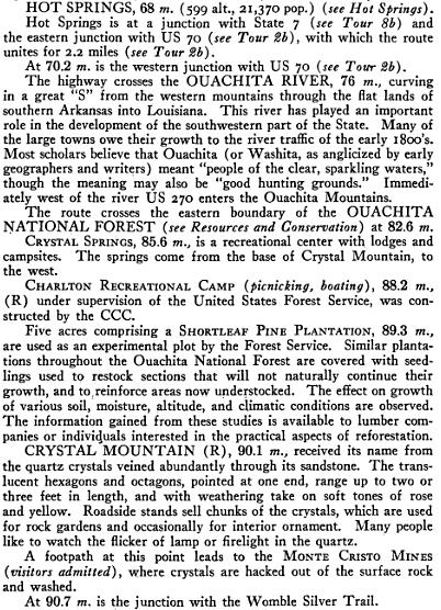
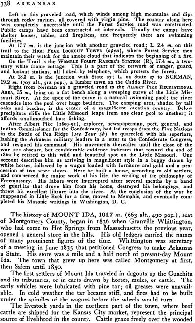
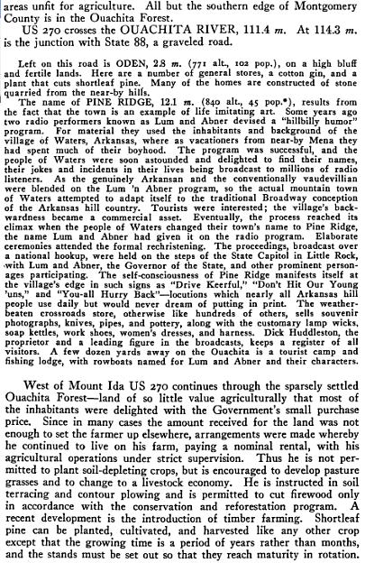
Arkansas -A Guide to the State
Compiled by Workers of the Writers' Program
of the Work Projects Administration in the State of Arkansas
First published in 1941
"In 1932 whenever a comment was made that the stock
market was going down, many of us in Mount Ida thought they were referring to the price of
cattle and hogs."
Ralph J. Smith Montgomery County News Feb. 4, 1988
The Great Depression took its toll on Montgomery County. In
1935 there were 1,601 farms in the county, comprising of 138,951 acres. In
1945, there were only 1,118 farms, with 124,767 acres. Sesquicentennial
Committee - pg 325.
Montgomery County PO
Garland County PO.
