Ouachita Headwaters Watershed
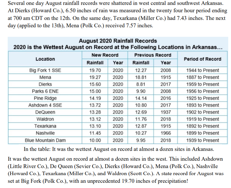
August 2020 will be remembered for much rain and flooding in western Arkansas and below average temperatures, by nearly 2 degrees, mild more often than not. This is the 5th year in a row that August has recorded above-average rainfall. Rainfall increased when the tropics stirred up. Parts of western Arkansas got over four times the normal monthly rainfall. Mount Ida, Arkansas gets 55 inches of rain, on average, per year. The US average is 38 inches of rain per year. Usually July and August is are uncomfortable months in Montgomery County, Ark. due to heat, humidity, chiggers and ticks. August is the hottest month for Mount Ida with an average high temperature of 91.3°. Usually May is the wettest month. Normal for May is 6.12in. and August the driest month averaging 2.7" rain. The rainiest season is summer when it rains 28% of the time and the driest is autumn with only a 23% chance of a rainy day.
Ouachita
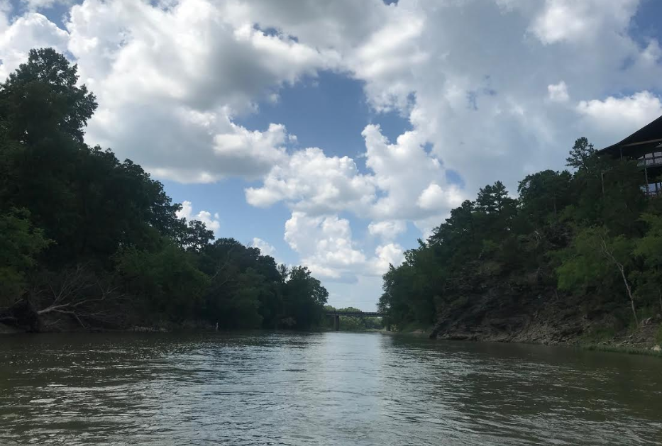
River gauge, Rocky Shoals -
a good put in for kayaks, west of Mt. Ida, opposite Camp
Ozark.
Gage
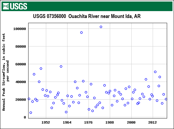
Drainage area 414 square miles
Entergy Arkansas
Outage map
I Drive Arkansas Road Closures
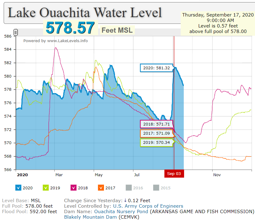
Ouachita River @ Blakely Mountain Dam, AR - Pool
Level
Longitude: 93 41'51" Latitude: 34 36'36"
Gage height Oct. 10 2022 2.27ft.
| Monday | 3rd August 2020 | .5" |
| Wednesday | 7th | 1.7" + .2 |
| Tuesday | 11th | Rain |
| Wednesday | 12th | 1.9" |
| Friday | 14th | 2.6" |
| Thursday | 27th | 1.7" |
| Sunday | 30th | 3" |
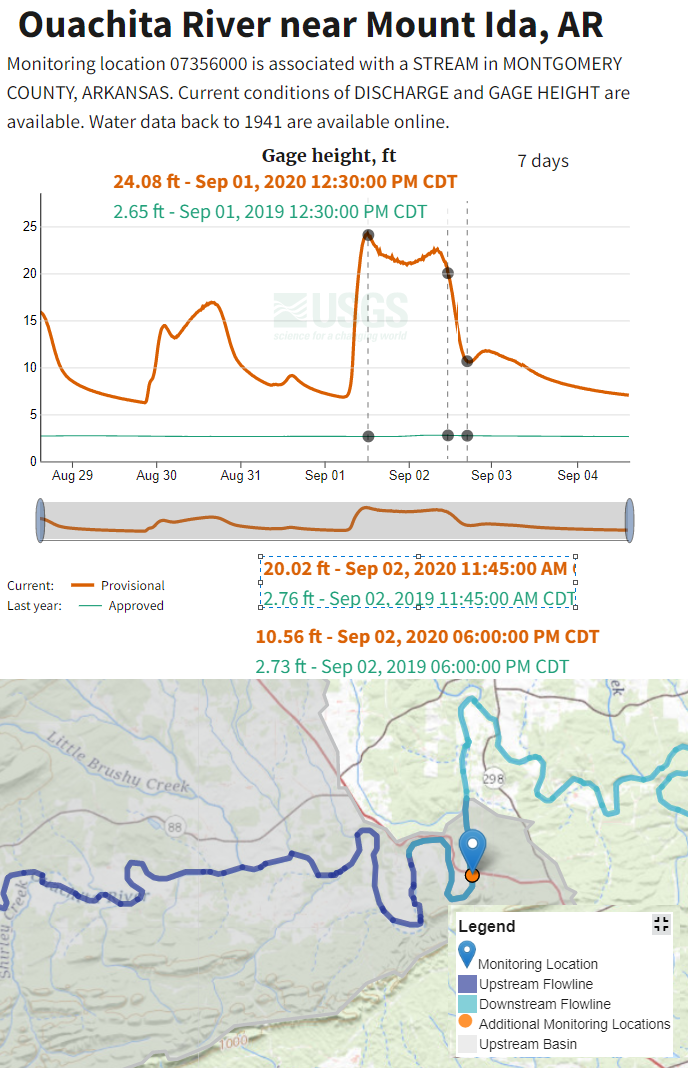
| Tuesday | 1st Sept. 2020 | 5" rain gauge running over + .7 |
| total 19.8 inches. |
Then at least another 6" rain at Oden, AR on Monday night 1st Sept. 2020.
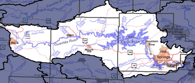
Carter's Creek, Iron Fork, Kates Creek, Brushy Creek, Fiddler's Creek,
South Fork, Muddy Creek, Iron's Fork, Blakely Creek, Little Mazarn Creek, Mazarn Creek, Ouachita River
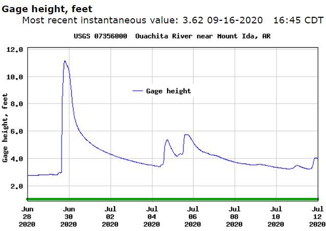
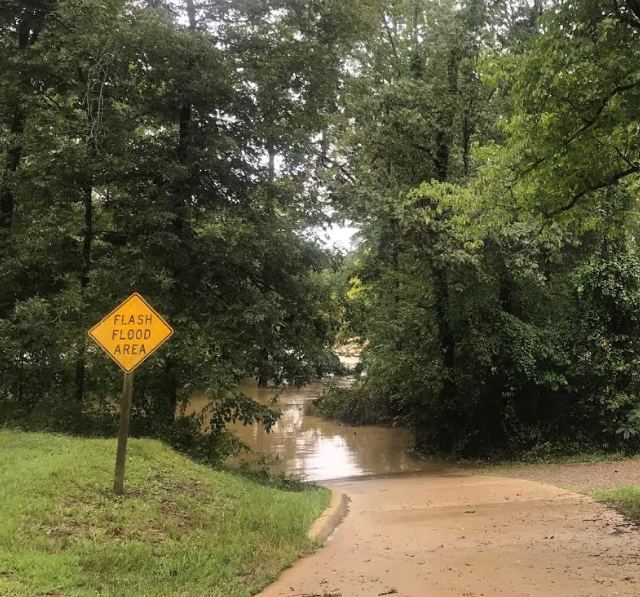
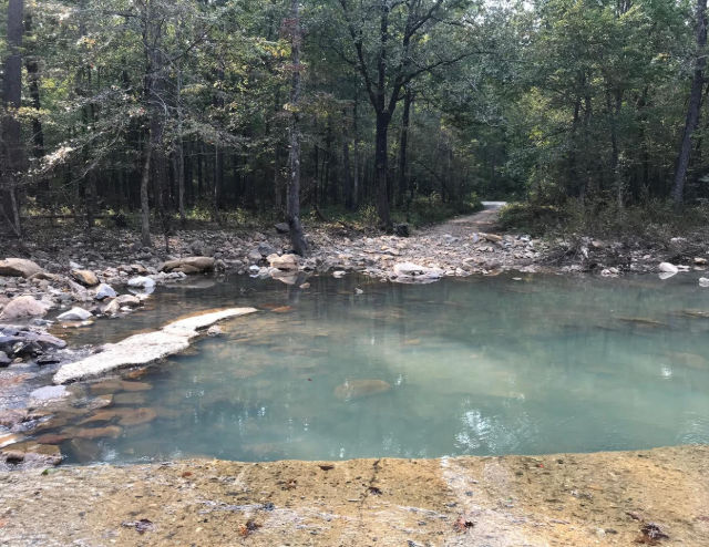
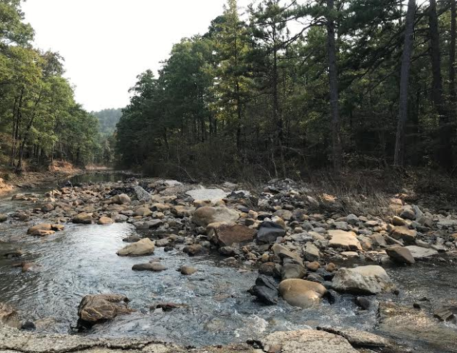
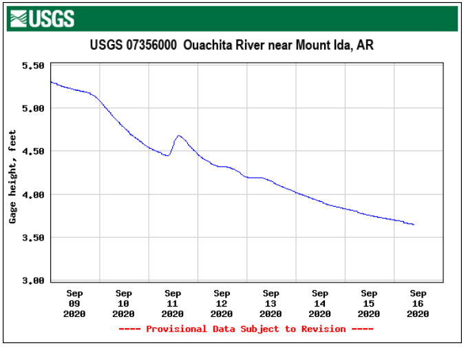
Rocky Shoals canoe put-in closed end of August 2020 for a few days due to high water in the Ouachita River. Ideal to float from Rocky Shoals to the low water bridge at Sims is 300 cu. ft /sec. The water is clear and you don't ground on the shoals. The river gauge is just above the bridge at Hwy 88 and Rocky Shoals.
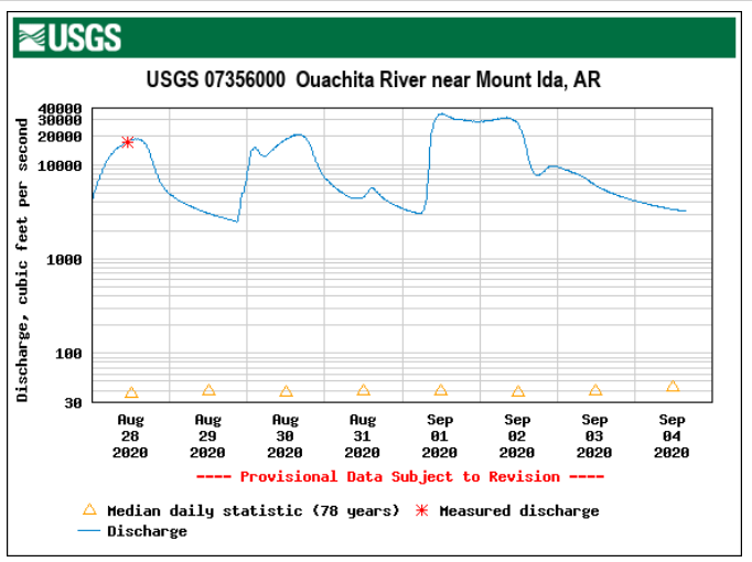
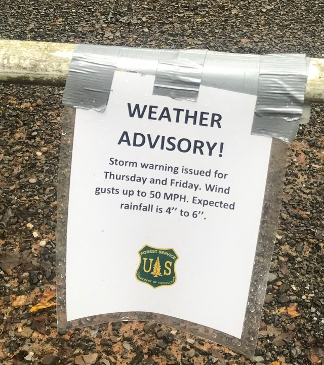
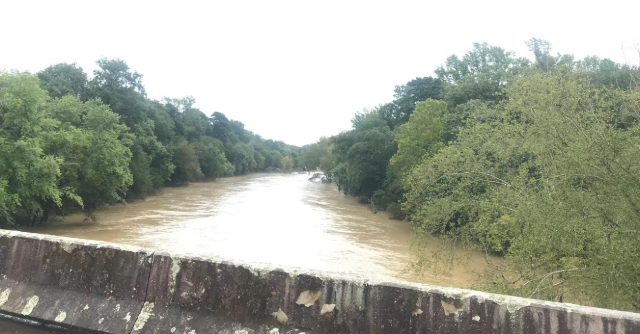
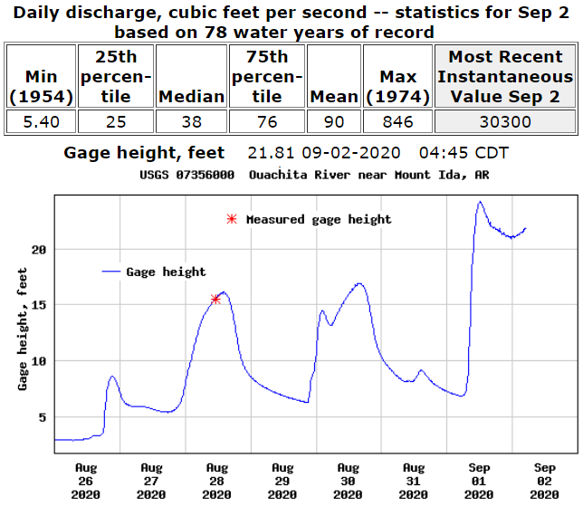
Photo taken on Wednesday 2nd Sept. 2020 at 1130 am. The river
was at 20ft. We usually put in here when the river is about 3ft.
Rocky Shoals Bridge at 3pm 2nd Sept. 2020.
Oden bridge, looking downstream, 2nd July 2020, 2 pm.
During the night of June 10–11, 2010 a flash flood along Little Missouri River
(Arkansas) killed at least 20 people in the campgrounds of the Albert Pike
Recreational Area near Caddo Gap. In a matter of less than four hours, water
rose from three feet to over 23 feet on the Little Missouri.
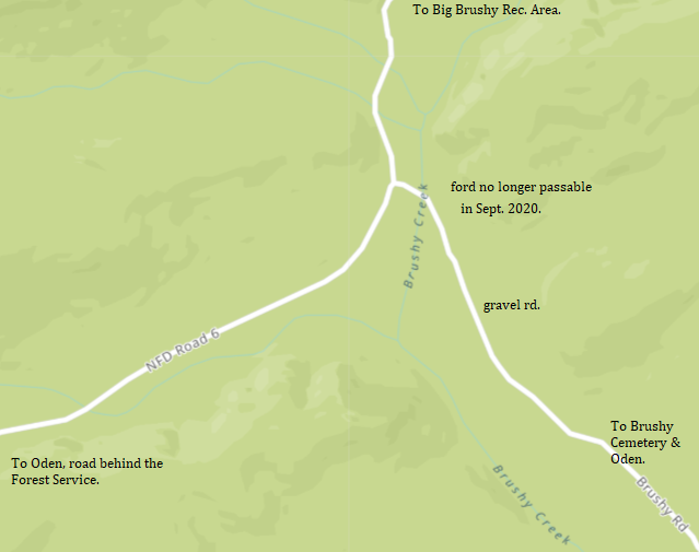
Little Brushy and Brushy Creek merge to become Brushy Creek. Brushy Creek
and Polk Creek run
into the Ouachita River. During the 1975 flood it was not the creeks that
closed Hwy 88 here but the river over flowing and backing up to the road.
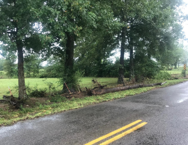
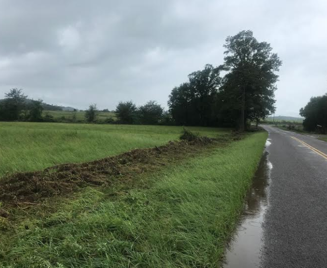
Hwy 88 gets flood water on the west of Big Brushy. Polk Creek is to the east of
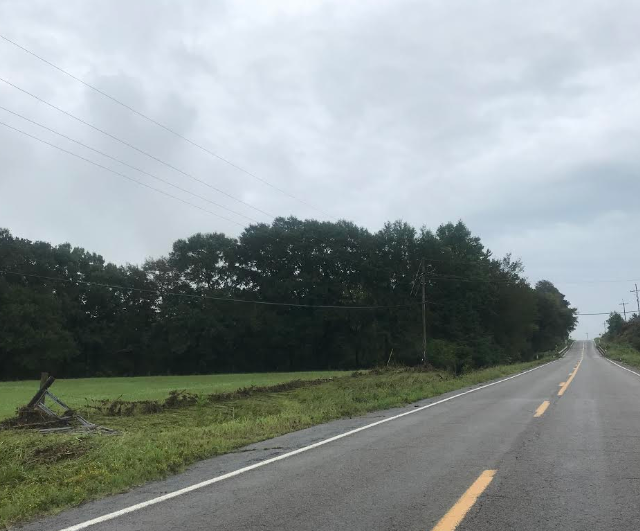
Big Brushy also flooded. The fences on both sides of the highway were flatten and the gate
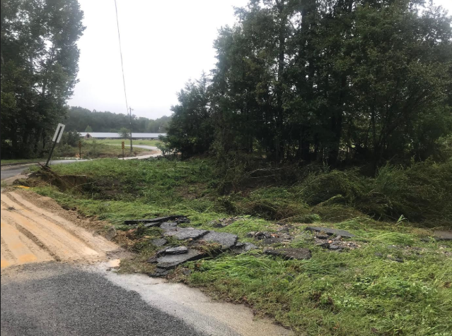
down during the 1 Sept. 2020 flood by the waters from Brushy Creek. There
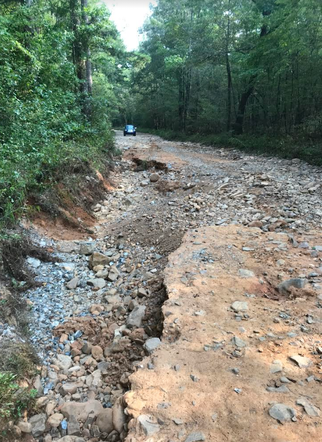
was also a washout due to flooding eastbound on Hwy 88 pass Macedonia Cemetery
and another washout towards Pine Ridge due to flooding at a bridge. Tuesday
morning I passed 3 + 2 dump trucks with gravel heading that way. A quarter mile
of highway was closed, 11 miles west of Pencil Bluff.
![]()
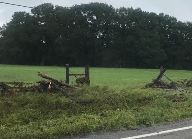
The force of the water took the gate down. Upstream on Little Brushy fencing
panels were wrapped around trees.
Brushy Rd has washed in a flash flood May 2013. The
force of water stripped the pavement from this road just west of the Brushy
Bridge on Brushy Rd. Repaired by 1300hrs 2nd Sept. 2020. Brushy Creek bridge in the
background.
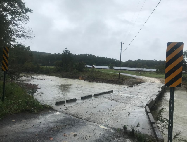
Big
Brushy Creek at 1300hrs 2 Sept. 2020. The water was over the bridge. Five hours
earlier it was 12 ft higher. Creeks drop faster than the river.
Further upstream the old ford has been washed away. Only time in the last 55
years. Photo taken Sept. 18th 2020.
Brushy Creek appears to be wider at the ford. Note the concrete from the ford
downstream a little way. All culverts are now blocked with stones. Photo taken
Friday 18th September. 17 days after the flood.
Brushy Rd, a county road, has been scoured out, just before the ford. Photo 18th
Sept. 2020.
Water was also over the Whitetown Rd at Ouachita Hyland. Photo 2 Sept. 1300hrs.
Water was also over the Whitetown Rd at Ouachita Hyland. Photo 2 Sept. 1300hrs.
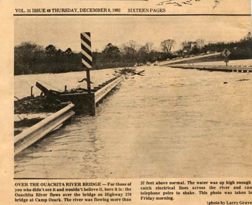
December 1982
The storm December 2-7 was related to a deep low pressure trough aloft over
Texas and the Southwest. The resulting flow pattern fed warm, wet air over the
lower Mississippi River basin and created atmospheric disturbances over the Gulf
of Mexico and southeast Texas that encouraged development of the storm systems.
Subsequent slow movement of these systems toward the northeast produced
tornadoes, severe thunderstorms, and intense rainfall for extended time periods.
Additional moderate but spotty rains in December served to maintain a high soil
moisture content, thereby
contributing to high runoff and extreme floods.
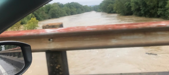
The Ouachita River over Hwy 270 at Camp Ozark, where the river gage is located. The photo was taken from the Camp Ozark side of the bridge 3rd December 1982. Lake Ouachita reached its highest elevation of 591.2 mean sea level. In Arkansas the Ouachita River was expected to crest 13 feet above flood stage at Camden. Gage height is often used interchangeably with the general term "stage," although gage height is more appropriate when used with a reading on gage.
There was a big flood in 1975 and below the Methodist Church
in Oden, there is a maker, marking the water level.
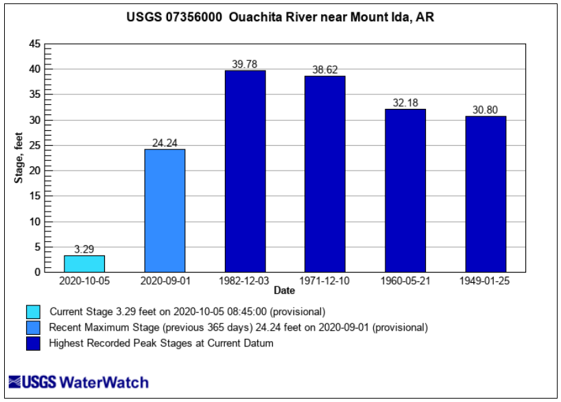
Ideal level to float is between 3 and 4 feet. Three feet the water is clearer and good for fishing. Four feet, a faster trip, and no grounding.
3rd July 2020 Just above Rocky Shoals, Camp Ozark on the right. River gage
on the right.
. Oden bridge to Rocky Shoals, ten miles in a canoe, in three hours, water level
4ft at gage, making for a fast trip, passed 21 kayaks and four canoes with one
from Riverview abandoned in the middle of the river, caught on a rock.