Smoke map -some roads don't exit
2010 Oden map.
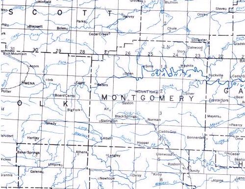
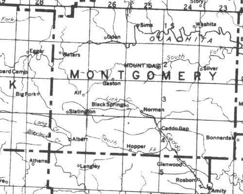
Topo Map
2022 Oden
ONF map
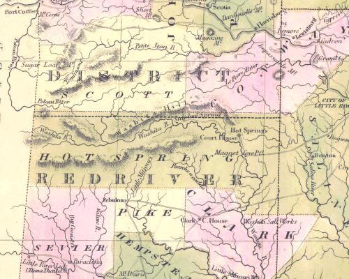
Caddo area
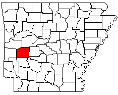
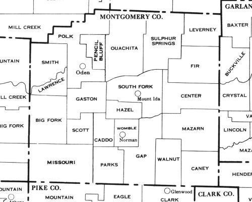
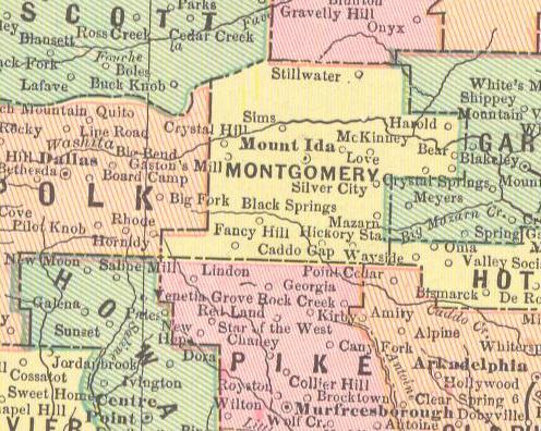
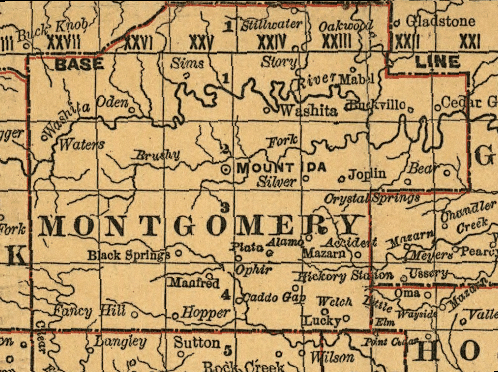
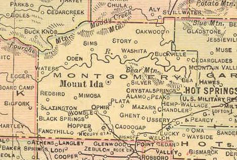
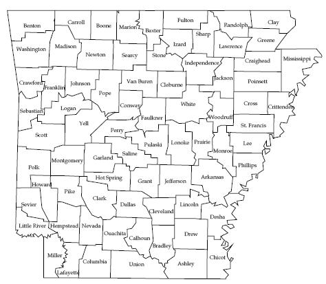
Montgomery Co. township map.
Understanding the county's township boundaries makes it easier to locate an
ancestor on census returns.
1960 Arkansas Minor Civil Divisions-Townships (1960 census)

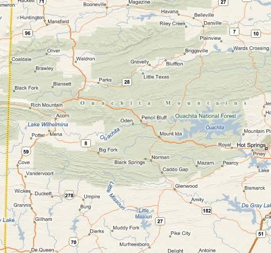
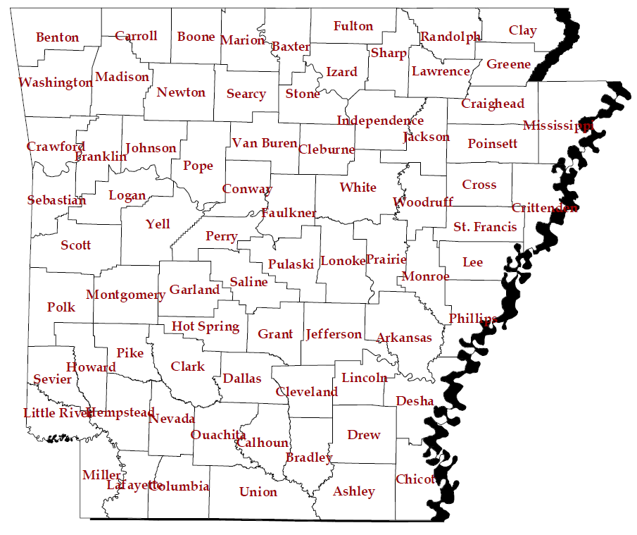
Index to U.S. Geological Survey Topographic Maps, Montgomery Co. area. The Ranger District Offices sells the actual maps.
| Buck Knob | Brushy Ck Mtn | Sims | Story | Fannie | Avant |
| Pine Ridge | Oden | Mt Ida | Reed Mtn | McGraw Mtn | Crystal Springs |
| Big Fork | Polk Ck Mtn | Norman | Caddo Gap | Bonnerville | Pearcy |
| Athens | Langley | Lodi | Glenwood |
Amity |
1853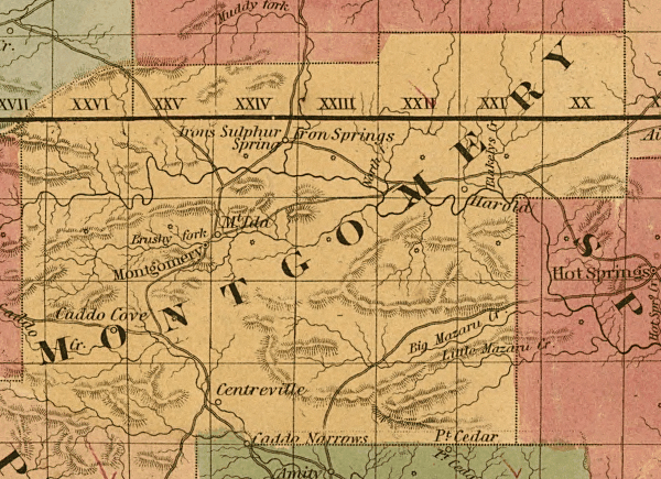 Map Created/published New York, 1854. Colton's railroad & township map of
Arkansas complied from the U.S. Surveys and other authentic sources.
Map Created/published New York, 1854. Colton's railroad & township map of
Arkansas complied from the U.S. Surveys and other authentic sources.
(opens in a new window)
1863 Map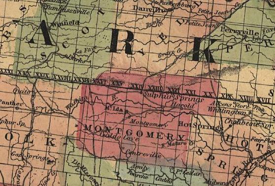 (opens in a new window)
1835
Tanner's work in the early 1840s.
1891 Harold later became known as Cedar Glades.
1898 Map with townships marked (not census
townships)
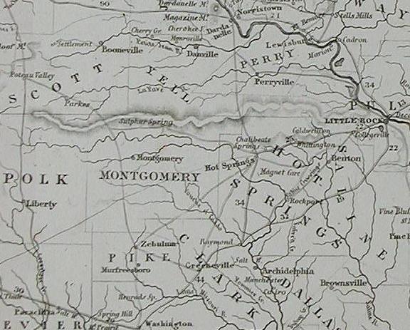
1915 Railways map
1928
U.S. Geological Survey, 1935
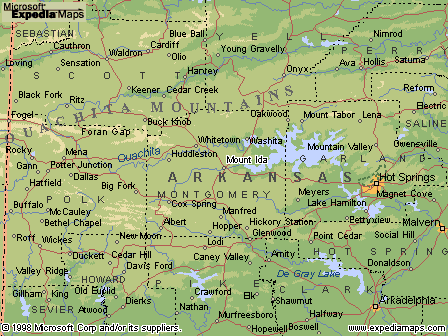
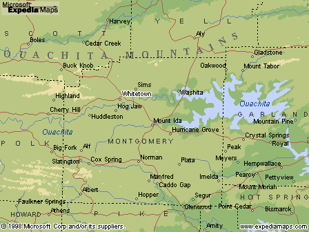
1998 map
![]()
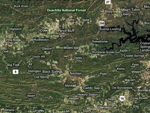
The red circle is the location of Cedar Glades now under Lake Ouachita.
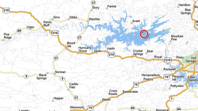
2008 2009 Microsoft Virtual Earth -aerial
2009
Remembering Arkansas - Interstate highways put
state on road to change by
Tom W. Dillard
The Arkansas Democrat Gazette 2 April 2006
This year marks the 50th birthday of the American interstate highway system. The
construction of interstate highways in Arkansas profoundly changed the state,
opening new opportunities for development, but at the same time spawning massive
urban sprawl. Having now lived in the Fayetteville area for more than a year, I
can fully comprehend how, for example, the construction of Interstate 540 from
the Fort Smith area to Bentonville has made it possible for Northwest Arkansas
to capitalize on its opportunities.
I can recall a trip my family took in the pre-interstate days of the late 1950s
from our farm in rural Montgomery County to Benton in Saline County. I do not
recall much about what was then a long trip - about three hours to cover the 80
miles or so, most of it on a route that has been known as the Mount Ida Road for
more than 150 years, but that the Arkansas Highway and Transportation Commission
designates as Arkansas 5. Sadly for me, the most memorable scene on the trip for
this elementary school country boy was that of two men engaged in a fierce
fistfight. They were fighting in the front yard of an aging white farmhouse,
somewhere deep in the Ouachita Mountains. My second memory of that trip was of
my older cousin driving me out to see the new "freeway" (Interstate 30) as it
was being constructed through Benton. I could not comprehend so much red clay
earth, which to a child seemed endless, cutting through pine-covered hills that
had only months before sheltered deer, and foxes, and little boys playing in
home-made forts. While I mourn the loss of green space to the interstates - and
while it is sad to think of how wrong we got the whole issue of rural land use -
I do appreciate the convenience of the ribbons of concrete highways that allowed
me recently to glide through Benton at 70 mph and to make the drive from Hot
Springs to Little Rock in less than an hour.
President Dwight D. Eisenhower signed the legislation creating the interstate
highway system on June 29, 1956. The same legislation created a highways trust
fund that enabled the federal government to pick up 90 percent of the costs.
While Eisenhower does deserve credit for helping make the interstate system
happen, the idea for such a national system of roadways goes back long before
World War II. Beginning in 1931, federal teams plotted the first plan for such
an interstate system, which provided for three north south superhighways as well
as three running east-west. With the passage of the 1956 legislation, federal
taxes on gasoline and other travel-related items were dedicated to the Highway
Trust Fund, which provided a steady stream of income and enabled a pay-as-you-go
approach. Since 1958, a hefty $129 billion has been spent on the interstate
system, with the national government providing $114 billion of that. The states
were expected to absorb most of the costs involved in preliminary engineering
and right-of way acquisition. The national government was pleased with the pace
of construction in Arkansas. In May 1962 the U.S. Bureau of Public Roads
announced that Arkansas was leading the nation in building its share of the
interstate system. Arkansas ended up with two major interstate routes, I-40
running east west from Memphis to Fort Smith, and I-30 from Fort Worth, which
terminates at its junction with I-40 in North Little Rock. Additionally,
Arkansas is home to several small interstates of more recent origin. The first
of these to be completed was I-630 in Little Rock. The road started out in the
1960s as an effort to speed up the commute from the western suburbs of Little
Rock to downtown. The completion of the interstate system was one of the great
public works accomplishments of humanity. Of course, it has had its downside,
including helping encourage suburban sprawl - not to mention helping put our
railways out of the passenger business.