![]()

Marion Co TOC
Homepage
Awards
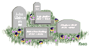
Cemeteries
Census Records
Courthouse Info
Family Genealogies
Heritage Society
Society's Newsletters
History + more
Marion History-book
Maps
Marion Co Timeline
Marriages
Mt Meadow Massacre
Newspapers
Obits
Photo Gallery
Post Office History
Townships
Transcribed Records
Helpful Links
Contact -
Jeana
Graphics by Rhio

CHAPTER FIVE
Cemeteries
By: Marian Burnes
Pages: 30-39
![]()
(This chapter includes many references to Townships & Ranges and mention of cemeteries moved when Bull Shoals was built. Use the Cemeteries link on the left for a map of cemetery locations and names of graves moved when Bull Shoals was built.)
(Page 30) From earliest recorded history, burial grounds have been considered hallowed ground. The 23rd chapter of Genesis gives an account of the death and burial of Abraham's beloved wife, Sarah. He was in a strange land. The 3rd verse of Genesis 23 gives the following account of his desire of a burial ground, and his request to the sons of Heth who inhabited that land: "I am a stranger and soourner with you: give me a possession of a burying place with you, that I may bury my dead out of my sight." The chapter goes on to record that he would not accept it as a gift, but desired the cave of Machpelah, and paid Ephron, the owner, the full purchase price as a sure possession for the cave and field, and all the trees that were in the field and in the borders round about it.
Early Marion County historians have recorded finding Indian burial grounds with spears, arrows, etc., buried with the Indians, thus insuring them a good life in the "happy hunting grounds" where they had gone.
The cemeteries of Marion County, and in fact of any area, are of invaluable aid to family historians as well as those doing research on the history of the County.
Early cemeteries were located on ground usually donated by owners. Several facts were taken into consideration in establishing cemeteries. Roads were poor, so proximity to homes was of great importance. Undertakers as such were unknown, so burials took place soon after death. Creek crossing was difficult, so many small cemeteries were begun when creeks were up and impossible to ford. Many were begun on the owners' own farms as a burial place for their family dead. Usually these continued to exist under that name.
I will give the cemeteries alphabetically and then a few unknown ones last.
In pioneer days there was no perpetual paid care, as is the case in several cemeteries today. Neighbors had a working each spring, cleaned off the brush and old decorations and got them ready for the annual decoration. These occurred, as some still do, on the same Sunday each year. They were somewhat in the nature of a homecoming. Old settlers came from far and near for the annual decoration-to decorate graves, weep over their dead and greet family and friends. Each family decorated its own graves, and, especially in the early days, spared a few flowers for the neglected graves which had no family to care for them. Today the cemeteries in use are usually kept mowed by a committee who solicit donations to pay for the work. Most (Page 31 Top) used cemeteries are kept in better condition today-mowed, well fenced, etc. But alas, the old abandoned cemeteries are being fast lost to history as they grow up in brush, the tombstones decaying and falling down.
Adams Cemetery is located on Greasy Creek, about 6 miles south of Yellville and is no longer in use. It was established as a family cemetery by the Pioneer Adams family on the farm they then owned. Most of the grave markers are of people who are related to the family. The earliest marker is of George Adams who died in 1854. One of the latest ones is of E. V. Wade, who died in 1938, whose mother was Louisa Adams Wade, known as Aunt "Sis" Wade.
Anderson Flat Cemetery is in the southwest part of the county in the NW1/4 of Section 19, Township 17, Range 17. It is a large well-kept cemetery and is in use now. It is about one mile off State Road 235. This cemetery has few grave stones with dates earlier than 1900, though there are a few in the 1890's of the Anderson family from whom the cemetery and community got its name. For several years the Mennonites had a community there and used it. In the 1960's they all left this area and moved to South America.
Barb Cemetery is very near White River in a field now owned by Lyle Wood. It is no longer used and was established there by the Barb family who originally owned the farm. Most early graves are of members of that family. The latest grave is that of Lt. Albert G. Cravens, who died in 1931. He was a veteran of the Civil War, having been a Lieutenant in the 27th Arkansas Infantry. Later he became a steamboat captain on the White River. Before his death at 91 years of age, "Daddy" Cravens, as he was known, requested that he be buried there in sight of the White River. An inscription on his stone reads, "Pioneer, Soldier, Patriot."
Beckham Cemetery is located in the extreme southwest corner of Marion County in the SW1/4 of Section 14, Township 17, Range 18. It is an old, well kept cemetery and is still in use. It was established early and one of the earliest markers is of Sarah Tomblen, who was born in 1804 and died in 1882. Many graves have dates in the 1880's. Those buried there include the families of Shults, Slover, Swafford, Taylor, Tramwell, Trueblood, Willis and many others.
Berry or Cowdrey Cemetery is about 4 miles below Yellville on the Jefferson farm. It has not been used in years, but was a family cemetery used by Berry, Cowdrey and Wilson, who were all related. Only a few markers are now left standing, and the earliest burial date that can be read is 1855, the latest 1893.
Bruno Cemetery is one of the larger cemeteries in the county, and is also an old one. It is about one mile from Bruno, in Section 3, Township 17, Range 17, is well kept, well fenced, and used often. One of the older marked graves is that of Joseph G. McEntire, 1842-1875. Many families arc buried there, among them Adkins, Angels, Blankenship, Brown, Burnes, Campbell, Cooper, Dodd, Depriest, Elam, Elton, Glenn, Gray, Heath, Keeter, Kyles, Lowrey, Massey, Milligan, McEntire, Ogden, Pyle, Roberts, Stovall, Taylor and many others with one to four or five graves.
Burch Cemetery is a family cemetery near Flippin, Arkansas, located in the SW1/4 of Section 20, Township 19, Range 15. The oldest marked grave is of St. Francis Burch, daughter of pioneer Henry Burch, who died in 1869 at the age of 9 years. This cemetery is seldom, if ever, used now.
(Page 32 Top) Burnes Cemetery is located about 8 miles south of Yellville on Water Creek. It is named for the pioneer Burnes family who homesteaded near there in the 1850's. It is in the NW1/4 of Section 20, Township 17, Range 16. Two of the older markers are William H. Taylor, who died in 1871, and Susan Burnes Glenn, who died in 1872, aged 27 years. This cemetery is still used today.
Caney Cemetery, a fairly new cemetery, began in recent years adjacent to Caney Church of Christ near lower Water Creek
Cedar Creek Cemetery is located on the bank of the Buffalo River at the mouth of Cabin Creek. It is now accessible only by jeep, walking, or by the river. It is no longer in use. Most burials there are of the Lafoon family who owned the farm across the river. The oldest marked grave is of F. T. Lafoon, who was born in 1833 and died in 1878.
Concord Cemetery is on the right side of Crooked Creek, several miles below Yellville. It has not been used in years and is very grown up. It is near the site of Old Concord School. There are very few graves with markers.
Cowan Cemetery is one of the older cemeteries of the county. It was so named for the families of Si Cowan and his son John Wesley Cowan who settled there in the 1830's. It is located in the SE1/4 of Section 26, Township 18, Range 16. It is a large, well kept cemetery. Two of the older markers are of John and Charity Adams, with a single stone dated 1865 with the inscription "Killed by Jayhawkers." John Wesley Cowan was buried there, who was born in 1816 and died in 1862. This cemetery is much in use today. Many names are found there-Cowans, Adams, Mears and Bridges, to name a few.
Derryberry Cemetery is not in use, is unfenced and most stones are down. It is located in the west part of the country in the NW1/4 of Section 23, Township 20, Range 18. It is named for the Derryberry family. Dr. Derryberry practiced medicine early in Marion and Boone Counties. An early historian says the Lead Hill Post Office was first established there. The oldest marker yet standing is of Caroline Akin with the inscription, "born in Tennessee 1821, married J. H. Akin 1843, died in 1879." Her husband J. H. Akin, a Civil War veteran, is also buried there, but no dates are given. It is sad, but few, if any, Civil War markers give dates, only name, rank, company and state.
DeSoto cemetery is between Mull and Rush in Township 17, Range 15. It is slightly off of the road with a private road leading to it. It is in use and has an annual decoration each year in May. Many families are buried there, among them J. F. and Elizabeth Smith Dillard and their descendants. The Dillards were long time residents of the area, and raised a large family. Others there include members of many other old families of the area, including Fletchers, Davenports, Smiths, Langstons, etc.
Dodd City cemetery is about 12 miles north of Yellville and one mile west of State Highway 14, in the NIE1/4 of Section 4, Township 19, Range 17. It has a poor access road. According to data given in the "Reminiscent History of the Ozark Region", Dodd City post office was established about 1872 by Dr. Hiempsal S. Dodd and was named by him "Doddville", later changed to Dodd City. He served as first postmaster. He came to the pine lands of the Ozark Mountains seeking a climate better suited to his physical condition. He built a gristmill and sawmill there, then as there were but two post offices in the county, he petitioned for one there, and it was granted. He has a brother, Samuel T. Dodd, buried in the Dodd City Cemetery, but Dr. (Page 33 Top) Dodd and his wife are buried on the hill just above Dodd City. The Dodd City Cemetery is an old cemetery, and many graves are there with no markers. There are now 22 which can be read. It is no longer in use and is located in a fenced woodland. This cemetery was started right after the Civil War when bushwhackers hanged three men down below the present site of Dodd City. After they were gone, the women cut them down, dug shallow graves and buried them, thus starting Dodd City Cemetery. This cemetery has 4 Civil War tombs, one Kansas veteran, one Mississippi veteran, and 2 Ohio veterans, which is unusual for a small cemetery.
Dodson Cemetery is a small family cemetery on Crooked Creek about 3 miles east of Yellville in a field on the Jefferson farm. Eli Dodson once owned that farm. He had 3 wives and 21 children, and buried 2 wives and several children there. Most stones are down and it has not been used for years. Eli Dodson was a pioneer settler and for a decade was prominent in politics in Marion and later Boone counties.
Elm Springs is a small old cemetery in southeast Marion County, in the NW1/4 of Section 31, Township 17, Range 14. It is grown up and no longer used, has many native rocks, but only two markers. One of them is J. J. Jones, who died in 1898.
Fairview Cemetery is about 4 miles north of Flippin on State Road 178, in the SE1/4 of Section 31, Township 20, Range 15. It consists in part of Wildcat Cemetery, which was moved when the Bull Shoals Dam was built. Wildcat Cemetery was on Jimmies Creek, near Kingdon Springs in the area that was covered by the lake. This is a large, well kept cemetery and is much used.
Flippin Cemetery is one of the older, larger cemeteries in the county. It is about one-half mile north of Flippin near the airport. It was named for the Flippin family who settled there in the 1830's. Members of that family are some of the earlier burials. It is in a beautiful setting and well kept.
Fee Cemetery is an old cemetery on the Fee farm, a farm now owned by Dr. L. A. Kelley. At the time it was established, Henderson Fee, a pioneer settler and Civil War veteran, owned the farm and began to use it as a burial place for his family. Few stones yet remain, and those are all of that family. This cemetery has not been used for many years.
George's Creek Cemetery is another large well kept cemetery on George's Creek, just off U. S. Highway 62, about 6 miles west of Yellville. It is located in the NW1/4 of Section 36, Township 19, Range 17. Dates there go back into the 1870's. Most numerous burials include families of Briggs, Brooksher, Burleson, Davenport, Dobbs, Hudson, Johnson, Keeter, Lewis, Pierce and Pangle, as well as many others with a few burials.
Hand Valley or Elbow Cemetery is on State Road 101 below Rea Valley, it is in the NW1/4 of Section 17, Township 18, Range 14. The oldest grave with a date that can be read is that of Gunilday Cox, wife of G. W. Cox, who died in 1878.
Hurst Cemetery is just off U. S. Highway 62 between Yellville and Flippin. Located in the SW1/4 of Section 30, Township 19, Range 15, this cemetery was evidently begun after 1900. Buried there are Burch, Hall, Holland and Wood, as well as others.
Jaybird Cemetery is a small cemetery adjacent to Jaybird old one-room school in the northwest part of Marion County; it is still used very occasionally.
(Page 34 Top) Jefferson Cemetery is located just west of the corporate limits of Yellville, on what was then the Jefferson farm. It was begun by pioneer Col. Thomas Jefferson as a burial ground for his family and slaves. It is down in a field and has not been used for many, many years. Many tombs were made of native stone with names and dates cut into them. Almost all the tombstones that can be read are dated before the Civil War and are of members of the old Col. Jefferson family.
Jefferson Hall Cemetery is an old cemetery about 7 or 8 miles south of Yellville in the NE1/4 of Section 21, Township 18, Range 17. It is on the hill above Hampton Creek and has not been used much in years. Burial dates there go back to the 1870's. Most numerous burials with markers are Blankenship, Dodd, Honeycutt and Patterson. The access is poor. A one-room school was near there, and for years was used as school and church. It has been torn down for many years.
Jenkins Cemetery is an old family cemetery, established in the NW1/4 of Section 8, Township 19, Range 15, for the pioneer Jenkins family and their relatives. It has not been used in late years.
Keesee Cemetery is a large well kept cemetery on State Highway 14, 15 miles north of Yellville. it is located in East Sugar Loaf Valley, which was an early settled part of the county. It has a long history. Abner Cantrell and his wife Mary are two old, old graves. Abner-born 1793, died 1890; Mary- born 1803, died 1872. The stones read like an early census of the area. Anderson, Austin, Campbell, Chappelle, Markle and Owen have the largest number of burials per family. This cemetery is adjacent to Keesee Church and community building which is now in constant use.
Lee's Mountain Cemetery is on Lee's Mountain, off State Highway 14, about 11/2 miles north of Summit in the SW1/4 of Section 29, Township 19, Range 16. All of the stones that can be read are dated after 1900.
Locust Cemetery is on the Locust road between Lead Hill and Peel on Locust Creek. It is a lovely old cemetery. The oldest marker is Lucinda Smith, wife of T. W., 1825-1874. Several burials were before 1900.
Moccasin Cemetery is on Moccasin Creek about one mile above the Jimmies Creek road to Flippin. It is in the NW1/4 of Section 3, Township 19, Range 16, and is near the site of the old Kingdon Springs. Most dates are from 1900 to 1920, which leads me to believe it was used mostly during the mining boom at Kingdom Springs. No burials have been made there in late years.
Mountain View Cemetery is one of the prettiest old cemeteries in the area. it is about half-way between Flippin and Yellville on the Fallen Ash Road. One of the earliest markers is that of Fletcher C. Noe, 18284878. This cemetery has also been called Fallen Ash Cemetery. Most marked graves are dated since 1900.
Nanney Cemetery is on State Highway 235, south of Yellville. It is a large old cemetery, well kept and in use. The oldest graves with dates go back to 1873. Many are dated since 1900. Families with most numerous burials include Keeter, McKinney, and Wolf. Many other families have several buried there.
Newton Flat Cemetery is on Newton Flat, near the present thriving little city of Bull Shoals. it was started when this area was known as "Newton Flat" for the Newton family, who were early settlers here.
(Page 35 Top) Norton Cemetery is an old cemetery on the hill across Crooked Creek out of Pyatt, Arkansas. It is near the mouth of Sugar Orchard Creek. In 1962, it had no access except by walking over very rough terrain. There are few graves, and the oldest marker is of H. J. Brady, a pioneer settler from Georgia, and ancestor of the Bradys of Marion County today. The stone reads H. J. Brady, 1811-1883.
Oakland Cemetery is on Highway 5. Since Bull Shoals was built, this cemetery has been moved and is now in Baxter County, near the Missouri line. It is mostly Marion County people buried there, having been originally located under the present Bull Shoals Lake. After the lake was built, this cemetery, along with the Anglin, Hogan and Yocum graveyards, were moved to this site. Unfortunately, many names and dates were lost in the move. There is one old stone I was not able to read the name-born 1770, died 1812. In January, 1925, when White River was at flood stage, a heavily loaded boat overturned at Gar Shoals, drowning several. Among them were Tessie Billings, aged 13, buried there; her uncle Rush Shew, born 1894, drowned January 1925. Others would have suffered the same fate had it not been for the courage of Alva Johnson. This incident is covered in another chapter. Many old time names are found here. Among the most numerous burials are Hogans, Newtons and Yochams.
Old Hurst Cemetery is about 6 miles east of Yellville, down Crooked Creek on the farm now owned by Lester Jefferson. It is one of the older cemeteries of the area, but is fast deteriorating. I have been told that is was the original Hurst cemetery, located on the farm then owned by John Hurst. When Crooked Creek was at flood stage, the other Hurst cemetery across the creek near U.S. Hwy. 62, was begun due to their inability to ford Crooked Creek. Many of the markers here are of native stone with names and dates chiseled on them. Buried here are many pioneer settlers and I'm sure many with no markers. One old grave has this inscription: L. B. Horn, 1820-1861 "was murdered". As this was the outbreak of the Civil War, I can only surmise he was probably killed by bushwhackers in the early days of the war. Several graves here have dates of death during the Civil War. Families with 5 or more markers include Halls, Horns and Rea.
Old Buffalo Cemetery is on White River near the mouth of the Buffalo River. It is on the Baxter Hurst farm and is rather grown up now. The oldest marker I could read was one with the inscription: "Sacred to the memory" of William Kendall Hogan, 1820-1855. He was operating a store at Old Buffalo City in 1849 and boarding with a Mr. Morland. Buffalo City at that time was near that site, later was moved across White River into Baxter County. For many years the remains of houses, old cisterns, etc., could be seen in the pasture surrounding this old cemetery. The ruins bore mute testimony to the fact that this was once a thriving town. Now white faced cattle roam the fields.
Ott Cemetery is atop Hall Mountain near the old Bearden School, on the road from Rea Valley to Ware's Chapel. It was evidently established around 1900, although there may have been earlier burials with no markers. It is located on the farm of Sherman B. Ott. Most numerous markers are of the Ott and Hall families. It is a well kept cemetery and in use today.
Patton Cemetery is one of the larger, older cemeteries of the county. It is located on Crooked Creek at the mouth of Clear Creek. This was the site (Page 36 Top) of Upper Shawneetown, an Indian village. Tradition says many Indians are buried here. The pioneer James Magness family, who came to the county in the 1830's, settled near Yellville. Later they moved to near Upper Shawneetown on Clear Creek. This family is prominently represented here, having at least 20 marked graves. Many were buried in the 1850's. Many of these graves are covered with large, flat native stones, with names and dates very hard to read. Other families with many burials include Davis, Foster, Ledford, Gieek, McEntire, Milum, Melton, Patton, Parnell, Ply, Roark, Smith, Stonecipher, Sullivan, Tabor, Underwood and Young. Many of these families intermarried. They have an annual decoration there on the 3rd Sunday in May and this tradition has been carried on for many, many years. There are several veterans buried here, also some Masons.
Pea Ridge Cemetery is located on Bruno and Maumee Road, about 5 miles east of Bruno. It is a small cemetery next to Pea Ridge one-room school which is yet standing. All dates that can be read are after 1900.
Peel Cemetery is near the old town of Peel, just off State Road 125 North, that leads to the free ferry across Bull Shoals Lake. There is a dividing line, one part being composed of cemeteries which were moved there when Bull Shoals Lake was built. Dial Bend, Friend Bend, Trimble, and one from near Old Arkansas school were moved there, probably a few graves from others, also. It has but few marked graves, most having only a white wooden slat, that in most cases has fallen down. Several old pioneers are buried here, among them are the names Keesee, Trimble, Copelin and Anderson. The original Peel Cemetery adjoins this part on the north. It is a large well kept cemetery and is much used. The oldest grave I found here was that of Andre Jaques Lankford dated 1814-1894. Other families with many graves include Benton, Cagle, Fee, Jones, King, Merriman, Weaver, Yocham and Wilkinson.
Packard Cemetery is a small cemetery in the north part of the county near Bull Shoals Lake. It is located in the SW1/4 of Section 15, Township 21, Range 18. In 1963, it had only 13 stones with names and dates, the oldest Eul Pickard buried there in 1904.
Pleasant Ridge Cemetery is about 6 miles south of Yellville, and it ranks in size and age with Yellville, Flippin, Cowan and Patton cemeteries. It is adjacent to Pleasant Ridge Church, a well kept Methodist church which is in use. A long time tradition has been their annual decoration and homecoming held each year on the first Sunday in June. Many states are represented there on that day as they come from far and near. The basket dinner spread there that day is a gourmet's dream. For many years that was the day to serve the first new green peas and new potatoes. The burial list reads like an early census of that area. Numerous ones are Cantrell, Callahan, Cheek, Doshier, Firestone, Johnson, Keeter, Matlock, Melton, Morrow, Phillips, Summers, Setzer, Watts, Simms, etc.
Price Place is in Section 20, Township 21, Range 15, North of White River in North Fork Township, and not far south of the Missouri line. It is a large plot, but has few graves, and it is well kept. The oldest burial marker is 1892. The cemetery is enclosed with Price Place church where services are held each Sunday.
Promised Land Cemetery is also in the northern part of Marion County, north of White River, hand not far from the Missouri border. It is a large, well kept cemetery in two parts-the original Promised Land Cemetery and the (Page 37 Top) Noe Cemetery which was moved here when they were building Bull Shoals Lake. Many pioneers are buried here, many with no stones except native rock with no dates. Martha Jane Hollingsworth is buried here and her dates are 1861-1892. S. C. Tumbo gave this account of her death: "Lemuel Hollingsworth married a daughter of James Pasco. One da between 11 and 12 Noon, she was bitten on the hand by a 2 foot copperhead snake. When her husband came to lunch, they had given her 2 pints of whiskey. She never regained consciousness." In that day and time, whiskey was supposed to be an antidote to the poison.
Riddle and McCord Cemetery is north of Bull Shoals Lake near the Missouri line. It was named for two pioneer families. The two cemeteries were moved to that location to get them out of the area to be flooded when Bull Shoals Lake was built. It is in Keesee township and by road is 92 miles from Yellville. There are a few graves with names and dates. The parents of S.C. Turnbo, the early historian, are buried here: J. C. Turnbo, 1820-1870, and Eliza Onstótt Turnbo, 1823-1868. Also some of his brothers and sisters are buried here. Most numerous burials with markers include families of Jones, Riddle, Ridenger and Turnbo.
Stanley Cemetery is located between Pyatt and Eros, not far off State Road 125. It was evidently named for the pioneer Stanley family who have many graves there. Other families include Casey, Lancaster, Pigg, and McClean.
Tutt or Tutt Hill Cemetery is located in the east part of the city limits of Yellville. At one time it was a large cemetery, but the land was cultivated and many stones torn down and destroyed, leaving only 7 marked graves now. It was first established on the land owned by the infamous "Hamp" Tutt and quite likely several Tutts who were killed in the "Tutt and Everett" feud lie there in unmarked graves. It has not been used in many years.
Tomahawk Cemetery is an old, small abandoned cemetery on Upper Tomahawk. It is not used today. Apparently it was begun about 1900 and abandoned about 1916.
Upshaw Cemetery is near Bull Shoals Lake in the north part of the county. It is located in the NW1/2 of Section 26, Township 21, Range 18, south of White River. It has only 4 marked graves, two of whom are Civil War veterans with no dates given. It seems to be no longer used.
Vanzant Cemetery is about 5 miles south of Yellville. It has a lovely setting in a large grove of trees and is now no longer used. Its name came from Samuel Vanzant and his wife who are both buried there. They owned that farm and the grist mill and cotton gin near there on Mill Creek. Buried there that can now be identified are Callahans,Clark, Reed and Vanzant. One stone is of J. H. Reed, died 12 March 1865, aged 42 years, 3 months and 24 days. I have been told he was killed near the end of the war by "bushwhackers", and that his wile and other neighbor women hauled him there on an ox wagon and buried him.
Wickersham Cemetery is located about one mile south of Yellville on a hill near Mill Creek. The largest number of burials are of the Wickersham family. Daniel Wickersham, who came here from Kentucky, ran a water mill there on Mill Creek. He was a prosperous man and during the Civil War, Bushwackers tortured and shot him, trying to make him tell where he kept his money. He refused, escaped from them, and crawled to a neighbor's house. This was in 1863, and he died as a result. His first wife, Susannah, (Page 38 Top) 1783-1854, is buried in the main cemetery. He remarried after her death, to Elizabeth Doshier. She and pioneer Daniel are buried down near the mouth of the creek, This cemetery is well kept and still in use.
Williams Cemetery is an abandoned cemetery down in the Bearden settlement near the head of Blue John. It has few markers, some of those are of the pioneer Williams family, from which it took its name.
Yellville Cemetery or Layton Cemetery has a long history. It was first established on the Mike Mathis farm and known as the Mathis Cemetery. In 1899, the late A. S. Layton donated the Mathis Cemetery to the town of Yellville, and sold them the surrounding area for $500.00, according to the Mountain Echo of that year. The town then charged $1.00 per burial for a time to recover the cost. It is one of the largest cemeteries in the county. It is well kept and is in a lovely setting. Many veterans are buried here, including Dennis Estes, W.W.I., for which the Yellville Legion Post is named, being the Dennis Estes Post.
Yocham Bend Cemetery is on Lakeway to Yocham Bend Road. It is another cemetery that was moved due to the construction of Bull Shoals Dam. It has many wooden slabs but few graves with names and dates. The citizens of that area, including many newcomer retirees, cleared it off, made a new sign and did much to improve it a few years ago. It is used occasionally yet.
All over the county there are a few graves here and there, many such places have no names, or if so, have been forgotten. The Page family cemetery is just off State Hwy. 235 on Greasy Creek Near Cow Creek on the Buffalo River about 5 miles above old Buffalo City is a cemetery. It has several native rocks but only one stone with name and date. This is M. D. Yocham, 1846-1920.
On the Paul Jones farm, across Crooked Creek from the mouth of Georges Creek, there are a few old, old graves. These are covered with big native rocks that form a covering for the grave.
The Old Wood Cemetery is about 3 miles east of Yellville, near Crooked Creek. It is entirely grown up in timber and is impossible to find unless you know where it is, or happen to come across it accidentally. It, at one time, was a large cemetery, mostly native rock markers. Most graves are pre-Civil War. Buried here among others is William Hasten, by him is Mary Hasten Dodson. William was killed in a skirmish here in Yellville during the Civil War. His widow later married Eli Dodson, and when she died, he took her there and buried her by her first husband. Also buried here is John Wickersham, the son of old pioneer Daniel Wickersham. According to S. C. Turnbo, John Wickersham ran a store here in Yellville long before the Civil War. He died in 1859. Old citizens have told me that this cemetery was originally an Indian cemetery. The pioneer Woods family originally owned the farm, hence the name. William M. Hasten was killed here November 16, 1864, at the age of 29 years. His wife died in 1874.
The Long cemetery is located in Section 31, Township 20 N, Range 15 West about four miles north of Flippin and one half mile west of the Fairview church building. Few markers are readable but among the graves there are those of the Long family who died in the early part of the 20th Century; some members of the Rea family and some members of the Robert Sanders family of the same era. One grave is that of a soldier who drowned in White (Page 39 Top) River near Oakland and whose body was recovered some two months later near Dew's Ford and was buried in this cemetery. Graves of those who have been buried here in the past fifty years include a Mr. Coots, members of the Smith and Flippin families and perhaps, some of the Pate King family.
A small cemetery located on the Music Farm near the mouth of Jimmie's Creek was the burial place of some of the early members of the Music and Fee families. This cemetery was moved by the U. S. Corps of Engineers during the construction of the Bull Shoals Dam and relocated at Fairview.
Lack of space, knowledge and remembrance do not permit me to list all the small scattered burial grounds over the county. I can only wish they were all well marked and well kept. I regret very much seeing this historical record of our forefathers being lost to coming generations.
![]()
![]()
Top of Page
Return to The History Of Marion Co Index Page
Return to Marion Co Home Page