![]()

Marion Co TOC
Homepage
Awards
Cemeteries
Census Records
Courthouse Info
Family Genealogies
Heritage Society
Society's Newsletters
History + more
Marion History-book
Maps
Marion Co Timeline
Marriages
Mt Meadow Massacre
Newspapers
Obits
Photo Gallery
Post Office History
Townships
Transcribed Records
Helpful Links
Contact -
Jeana
Graphics by Rhio

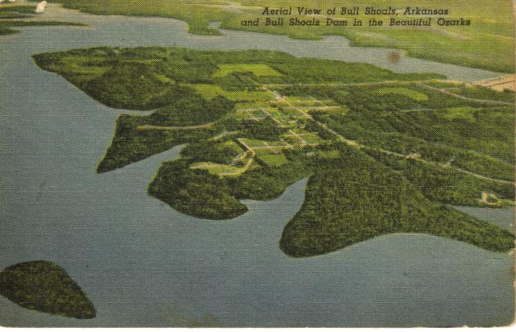
AERIAL VIEW OF BULL SHOALS Submitted by: Jeana (Parker) Houghton (houghtonjeana@gmail.com)
![]()
My Mamaw, Ann (Miller) Mears, loved keeping post cards of places she had been. I thought this would be a great place to share these post cards relating to Marion Co.
Bull Shoals Dam - built by the Corp of Engineers, US Army, Little Rock, Ark. Dist is located 14 miles northwest of Mountain Home and at the new towns of Bull Shoals and Lake view; also 45 miles east of Harrison, Arkansas. It impounds a lake 87 miles long, with a shoreline of 1,050 miles. Its location in the beautiful Ozarks of Arkansas and Missouri makes this one of the great recreation areas in the United States. This dam (you have to look close at the right side of the photo) is located on White River, long famous for bass fishing. Length of dam 2,256 feet; Height of dam 283 feet; Area of lake 71,20 acres.
Previous Next
Return to Groups & Places Photos Index
Return to Photo Gallery Index
Return to Marion Co Home Page