| |
| Home |
| Site Map |
| Site Index |
| SUBMIT
RECORDS to this Site |
| Crawford
County Today |
Genealogy
Societies, Libraries, and
State / National Archives |
| CrawCo
Interactive Map |
| Cities
& Towns in Crawford |
|
County of Crawford |
| Arkansas,
The State of |
| Crawford
County Indexes |
| Biographies
Index |
| Catch
All Index |
| Cemetery
Index |
| Church
Index |
| Disaster
/ Epidemic Index |
| Family
Group Sheets Index |
| Family
Website Index |
| Map
Index |
| Newspaper
Article Index |
| Obituary
Index |
| Photography
Gallery Index |
| Surname
Index |
| Wills
& Probate Index |
SUBMIT:
Bios, Cems, Articles,
Sites, Obits, and Photos |
|
Vital Records Index |
| Birth |
| Marriage |
| Divorce |
| Death |
| Where
to Obtain Official Records |
| SUBMIT:
Birth, Marriage, Divorce, and Death Records |
| Censuses
and Archives |
| Census
Records |
US
Federal Mortality Schedules
Crawford County, Arkansas |
Bureau
of Land Management (BLM):
Arkansas Land |
| BLM:
Crawford County thru 1908 |
| Nat'l
Register of Historic Places: Crawford County,
Arkansas |
| SUBMIT:
Records, Sites & Maps |
| Verterans'
Service Records |
| American
Revolution 1775-1783 |
| Mexican
American War 1846-1847 |
| Civil
War 1860-1880 |
| World
War I |
| World
War II: Navy, Marines, Coast Guard |
| World
War II: Army & Air Force |
| Korean
War 1950-1957 |
| Vietnam
War 1954-1975 |
| Gulf
War / Desert Storm 1990-1991 |
| Images:
Draft Registration |
| SUBMIT:
Records, Stories & Images |
| Genealogy
Assistance |
| Post
& Read QUERIES |
| List
of LOOK-UP Volunteers |
| JOIN
the Crawford e-Mailing List |
| Books
and Resources |
| Crawford
County Calendar |
| Family
Reunions |
| Favorite
Sites - Users' Choice |
| SUBMIT:
Tips & Sites |
| Historical
Archives |
Arkansas
History Commission and
State Archives |
| Bureau
of Land Management |
| The
National Archives |
| National
Register of Historic Places |
| Contact
Us |
| |
|
| Name |
Date of Map Detail |
Publication, Date Published |
Crawford County, Arkansas, 2007 |
Sept 2007 |
Custom generated Google
- Crawford County, Arkansas map using GPS Coordinates
to show historical and current: cities, towns, communities,
townships, and cemeteries. This map works in conjunction
with the "Crawford County
Cemetery Index".
Future updates will include using GPS Coordinates to
show churches, the Crawford County Genealogical and
Crawford County Historical society buildings, and the
Crawford County Courthouse. These enhancements will
work in conjunction with the "Crawford
County Church Index" and "Crawford's
Cities / Towns". This is a work in progress
with enhancements scheduled for later releases. |
 |
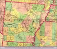
2001 |
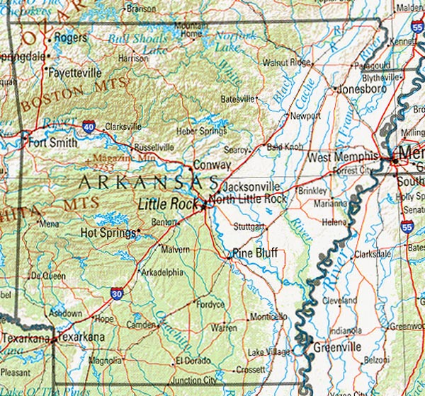
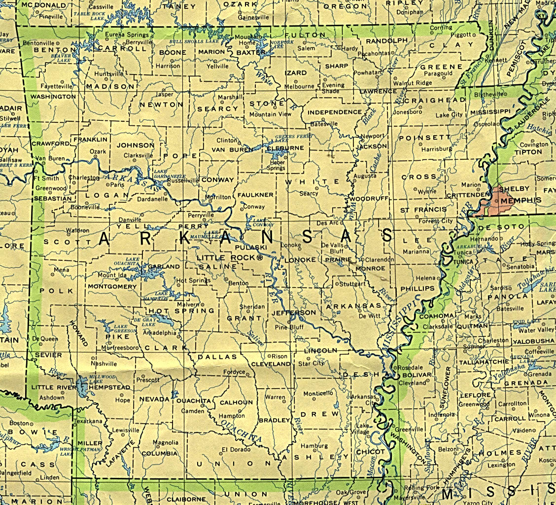
Arkansas Reference Map, 2001
Shaded relief map with state boundaries, forest cover,
place names, major highways. Portion of "The National
Atlas of the United States of America. General Reference",
compiled by U.S. Geological Survey 2001, printed 2002
University of Texas at Austin
Perry-Castañeda Library
Map Collection |
 |
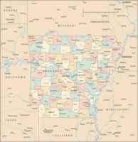
2000 |
2000 Present-day Arkansas
with County Detail
Sheila
Farrell Brannon |
| |
|
|
|
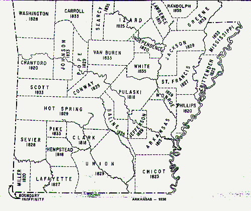
Counties of the State of Arkansas,
1989 |
1989 |
1989 Cadastral Map
Modern Map of the State of Arkansas
with County Detail.
Towns and Townships shown in Crawford
County: Van Buren |
 |
1990 |
U.S. Bureau of the Census,
1990
Arkansas county boundaries and names
University of Texas at Austin
Perry-Castañeda Library
Map Collection |
|
 |
1972 |
1972 Arkansas Boundary
Map
University of Texas at Austin
Perry-Castañeda Library
Map Collection
Towns and Townships shown in Crawford County:
Van Buren |
| |
|
|
|
| |
|
|
| |
|
|
|
 |
1904 |
1904 Map Showing Northwestern
Arkansas
Towns and Townships shown in Crawford
County:
Judy
Tate |
 |
1909 |
1909 Arkansas Map detailing
the Boston Mountains.
Towns and Townships shown in Crawford
County: Chester, Rudy, Alma, Dyer
Judy
Tate |
 |
1910 |
1910 Arkansas County Map
Counties shown include: Benton, Boone, Carroll, Crawford,
Franklin, Johnson, Madison, Newton, Pope, Washington
Atlas of the World 1910-1914 Maps
Towns and Townships shown in Crawford
County: Armada, Chester, Mountainburg, Stop,
Frisco, Locke, Lancaster, Rudy, Dyer, Cropy, Shibley,
Alma, Vanburen.
Janie
Edwards |
| |
|
|
|
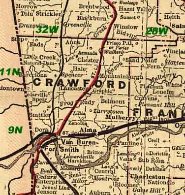 |
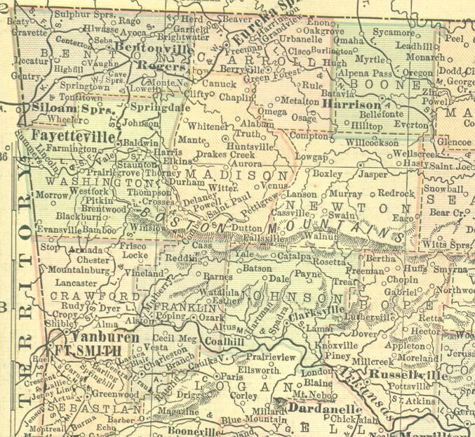
1895 |
Cram's 1895 Crawford County,
Arkansas Atlas Map
Crawford County,
Arkansas, 1895
Towns and Townships shown in Crawford
County: Lee's Creek, Natural Dam, Stop, Ends(?),
Barcelona, Uniontown, Graphic, Lancaster, Mulberry, Dyer,
Armada, Anna, Hale, Spencer, Cedarville, Dora, Van Buren,
Zenolia (?), Lillie, Belmont, Larrytown, Rudy, Mountainburg,
Frog Bayou, Frisco or Peter Walker (?), Speir, St. Louis
(?), Briton, Leonardsville, Haroldton, Stattler, Uniontown,
Sand Point. |
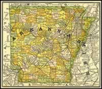 |
1881 |
1881 Arkansas Map with
detailed counties
Towns and Townships shown in Crawford
County: Alma
Judy
Tate |
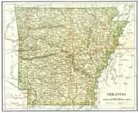 |
1892 |
1892 International Cyclopaedia
Vol I
State of Arkansas, 1892
Dodd Mead & Company
Towns and Townships shown in Crawford
County: Chester, Mountainburg, Cedarville, Belmont,
Alma, Van Buren, Sand Point. |
| |
|
|
|
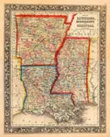 |
1860 |
Samuel Augustus Mitchell,
c. 1860, Louisiana, Mississippi and Arkansas.
A detailed map showing counties, rivers, mountains, cities,
and rail. Mitchell's maps from this series are some of
the more attractive maps from this period. |
 |
1850 |
1856
Arkansas Map with County Detail
Courtesy of Desmond Walls Allen
Arkansas Research
P. O. Box 303
Conway, AR 72033
Sheila
Farrell Brannon |
| |
|
|
|
 |
1832 |
1832 Arkansas Territory
Towns and Townships shown in Crawford
County: Van Buren |
 |
1836 |
1836
Arkansas Map with County Detail
Courtesy of Desmond Walls Allen
Arkansas Research
P. O. Box 303
Conway, AR 72033
Sheila
Farrell Brannon |
| |
|
|
|
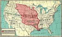 |
1803 |
Frank Bond, 1912, Louisiana
and the Louisiana
Purchase
The Louisiana Purchase was the acquisition by the United
States of approximately 530 million acres (828,000 sq
mi or 2,100,000 km²) of French territory in 1803,
at the cost of about 3¢ per acre (7¢ per ha);
totaling $15 million or 80 million French francs. Including
interest, America finally paid $23,213,568 for the Louisiana
territory.[1] The land purchased contained all of present-day
Arkansas, Missouri, Iowa, Oklahoma, Kansas, Nebraska,
Minnesota south of Mississippi River, much of North Dakota,
nearly all of South Dakota, northeastern New Mexico, northern
Texas, the portions of Montana, Wyoming, and Colorado
east of the Continental Divide, and Louisiana on both
sides of the Mississippi River, including the city of
New Orleans. (The Oklahoma Panhandle, and southwestern
portions of Kansas and Louisiana were still claimed by
Spain at the time of the Purchase.) In addition, the Purchase
contained small portions of land that would eventually
become part of the Canadian provinces of Alberta and Saskatchewan.
The land included in the purchase comprises around 23%
of the territory of the modern United States.[1] The purchase
was an important moment in the presidency of Thomas Jefferson.
At the time, it faced domestic opposition as being possibly
unconstitutional. Although he felt that the Constitution
did not contain any provisions for acquiring territory,
Jefferson decided to purchase Louisiana because he felt
uneasy about France and Spain having the power to block
American traders' access to the port of New Orleans. |
 |
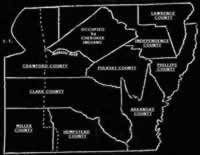
1819 |
1819 Arkansas Territory
Towns and Townships shown in upcoming
Crawford County: Mulberry (shown
in Lawrence County)
Sheila
Farrell Brannon |
 |
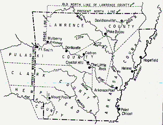
1821 |
1821 Arkansas Territory
and Cherokee Settlement Map
By early 1830, the Cherokee were removed from their
above location in Arkansas Territory and forced to relocate
into Indian Territory (I.T.). The land previously occupied
by the Cherokee was made available to white settlers,
which resulted in population growth that allowed a portion
of Arkansas Territory to become a state on June 15,
1836.
Judy
Tate |
| |
1822 |
Geographical, Statistical
and Historical Map of Arkansas Territory
by Major Stephen H. Long, Topographical Engineers
from the Carey and Lea’s Atlas of 1822 |
| |
|
|
|


